 https://maltaclouds.net/wp-content/uploads/2019/09/Sc-volotus.jpg?v=1569918565
2001
3769
admin
http://maltaclouds.net/wp-content/uploads/2018/10/logo-1-300x138.png
admin2019-07-14 17:25:422019-10-02 17:50:59Sc volotus
https://maltaclouds.net/wp-content/uploads/2019/09/Sc-volotus.jpg?v=1569918565
2001
3769
admin
http://maltaclouds.net/wp-content/uploads/2018/10/logo-1-300x138.png
admin2019-07-14 17:25:422019-10-02 17:50:59Sc volotus https://maltaclouds.net/wp-content/uploads/2019/05/Sc-cumulogenitus1.jpg?v=1569919532
1087
1881
admin
http://maltaclouds.net/wp-content/uploads/2018/10/logo-1-300x138.png
admin2019-06-04 18:41:332019-06-04 18:45:38Sc cumulogenitus
https://maltaclouds.net/wp-content/uploads/2019/05/Sc-cumulogenitus1.jpg?v=1569919532
1087
1881
admin
http://maltaclouds.net/wp-content/uploads/2018/10/logo-1-300x138.png
admin2019-06-04 18:41:332019-06-04 18:45:38Sc cumulogenitus https://maltaclouds.net/wp-content/uploads/2019/09/Sc-radiatus6.jpg?v=1569918566
1365
2048
admin
http://maltaclouds.net/wp-content/uploads/2018/10/logo-1-300x138.png
admin2019-05-26 17:20:062019-09-03 16:04:14Sc radiatus
https://maltaclouds.net/wp-content/uploads/2019/09/Sc-radiatus6.jpg?v=1569918566
1365
2048
admin
http://maltaclouds.net/wp-content/uploads/2018/10/logo-1-300x138.png
admin2019-05-26 17:20:062019-09-03 16:04:14Sc radiatus https://maltaclouds.net/wp-content/uploads/2019/05/ScstratiformisCumediocris.jpg?v=1569919533
1840
4688
admin
http://maltaclouds.net/wp-content/uploads/2018/10/logo-1-300x138.png
admin2019-02-05 15:36:262019-06-06 20:31:17Sc stratiformis Cumediocris
https://maltaclouds.net/wp-content/uploads/2019/05/ScstratiformisCumediocris.jpg?v=1569919533
1840
4688
admin
http://maltaclouds.net/wp-content/uploads/2018/10/logo-1-300x138.png
admin2019-02-05 15:36:262019-06-06 20:31:17Sc stratiformis Cumediocris https://maltaclouds.net/wp-content/uploads/2019/05/Sc-opacus12.jpg?v=1569919528
2448
3264
admin
http://maltaclouds.net/wp-content/uploads/2018/10/logo-1-300x138.png
admin2019-01-28 13:00:282019-06-04 18:35:59Sc opacus
https://maltaclouds.net/wp-content/uploads/2019/05/Sc-opacus12.jpg?v=1569919528
2448
3264
admin
http://maltaclouds.net/wp-content/uploads/2018/10/logo-1-300x138.png
admin2019-01-28 13:00:282019-06-04 18:35:59Sc opacus https://maltaclouds.net/wp-content/uploads/2019/05/Sc-cumulogenitus.jpg?v=1569919525
1365
2048
admin
http://maltaclouds.net/wp-content/uploads/2018/10/logo-1-300x138.png
admin2019-01-24 18:29:382019-06-04 18:32:54Sc cumulogenitus
https://maltaclouds.net/wp-content/uploads/2019/05/Sc-cumulogenitus.jpg?v=1569919525
1365
2048
admin
http://maltaclouds.net/wp-content/uploads/2018/10/logo-1-300x138.png
admin2019-01-24 18:29:382019-06-04 18:32:54Sc cumulogenitus https://maltaclouds.net/wp-content/uploads/2019/05/Sc-stratiformis10.jpg?v=1569919521
3631
5073
admin
http://maltaclouds.net/wp-content/uploads/2018/10/logo-1-300x138.png
admin2019-01-03 18:26:162019-06-04 18:29:09Sc stratiformis
https://maltaclouds.net/wp-content/uploads/2019/05/Sc-stratiformis10.jpg?v=1569919521
3631
5073
admin
http://maltaclouds.net/wp-content/uploads/2018/10/logo-1-300x138.png
admin2019-01-03 18:26:162019-06-04 18:29:09Sc stratiformis https://maltaclouds.net/wp-content/uploads/2019/05/Sc-opacus11.jpg?v=1569919519
1365
2048
admin
http://maltaclouds.net/wp-content/uploads/2018/10/logo-1-300x138.png
admin2018-12-25 18:23:222019-06-04 18:25:45Sc opacus
https://maltaclouds.net/wp-content/uploads/2019/05/Sc-opacus11.jpg?v=1569919519
1365
2048
admin
http://maltaclouds.net/wp-content/uploads/2018/10/logo-1-300x138.png
admin2018-12-25 18:23:222019-06-04 18:25:45Sc opacus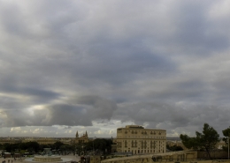 https://maltaclouds.net/wp-content/uploads/2019/05/Sc-stratiformis9.jpg?v=1569919517
1888
4624
admin
http://maltaclouds.net/wp-content/uploads/2018/10/logo-1-300x138.png
admin2018-12-11 18:19:082019-06-04 18:22:59Sc stratiformis
https://maltaclouds.net/wp-content/uploads/2019/05/Sc-stratiformis9.jpg?v=1569919517
1888
4624
admin
http://maltaclouds.net/wp-content/uploads/2018/10/logo-1-300x138.png
admin2018-12-11 18:19:082019-06-04 18:22:59Sc stratiformis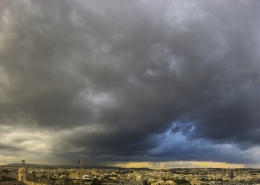 https://maltaclouds.net/wp-content/uploads/2019/05/Sc-stratiformis8.jpg?v=1569919509
2795
5171
admin
http://maltaclouds.net/wp-content/uploads/2018/10/logo-1-300x138.png
admin2018-11-16 18:15:232019-06-04 18:17:32Sc stratiformis
https://maltaclouds.net/wp-content/uploads/2019/05/Sc-stratiformis8.jpg?v=1569919509
2795
5171
admin
http://maltaclouds.net/wp-content/uploads/2018/10/logo-1-300x138.png
admin2018-11-16 18:15:232019-06-04 18:17:32Sc stratiformis https://maltaclouds.net/wp-content/uploads/2019/05/Sc-opacus10.jpg?v=1569919497
1365
2048
admin
http://maltaclouds.net/wp-content/uploads/2018/10/logo-1-300x138.png
admin2018-10-18 18:12:412019-06-04 18:14:58Sc opacus
https://maltaclouds.net/wp-content/uploads/2019/05/Sc-opacus10.jpg?v=1569919497
1365
2048
admin
http://maltaclouds.net/wp-content/uploads/2018/10/logo-1-300x138.png
admin2018-10-18 18:12:412019-06-04 18:14:58Sc opacus https://maltaclouds.net/wp-content/uploads/2019/05/Sc-stratiformis7.jpg?v=1569919489
1365
2048
admin
http://maltaclouds.net/wp-content/uploads/2018/10/logo-1-300x138.png
admin2018-09-26 18:06:552019-06-04 18:12:03Sc stratiformis
https://maltaclouds.net/wp-content/uploads/2019/05/Sc-stratiformis7.jpg?v=1569919489
1365
2048
admin
http://maltaclouds.net/wp-content/uploads/2018/10/logo-1-300x138.png
admin2018-09-26 18:06:552019-06-04 18:12:03Sc stratiformis https://maltaclouds.net/wp-content/uploads/2019/05/Sc-floccus2.jpg?v=1569919489
3044
5590
admin
http://maltaclouds.net/wp-content/uploads/2018/10/logo-1-300x138.png
admin2018-09-25 18:38:492019-06-03 18:41:27Sc floccus
https://maltaclouds.net/wp-content/uploads/2019/05/Sc-floccus2.jpg?v=1569919489
3044
5590
admin
http://maltaclouds.net/wp-content/uploads/2018/10/logo-1-300x138.png
admin2018-09-25 18:38:492019-06-03 18:41:27Sc floccus https://maltaclouds.net/wp-content/uploads/2019/05/Sc-lacunosus4.jpg?v=1569919488
1365
2048
admin
http://maltaclouds.net/wp-content/uploads/2018/10/logo-1-300x138.png
admin2018-09-21 18:27:252019-06-03 18:34:51Sc lacunosus
https://maltaclouds.net/wp-content/uploads/2019/05/Sc-lacunosus4.jpg?v=1569919488
1365
2048
admin
http://maltaclouds.net/wp-content/uploads/2018/10/logo-1-300x138.png
admin2018-09-21 18:27:252019-06-03 18:34:51Sc lacunosus https://maltaclouds.net/wp-content/uploads/2019/05/Sc-stratiformis6.jpg?v=1569919462
3136
6266
admin
http://maltaclouds.net/wp-content/uploads/2018/10/logo-1-300x138.png
admin2018-05-03 18:24:222019-06-03 18:26:57Sc stratiformis
https://maltaclouds.net/wp-content/uploads/2019/05/Sc-stratiformis6.jpg?v=1569919462
3136
6266
admin
http://maltaclouds.net/wp-content/uploads/2018/10/logo-1-300x138.png
admin2018-05-03 18:24:222019-06-03 18:26:57Sc stratiformis https://maltaclouds.net/wp-content/uploads/2019/05/Sc-undulatus8.jpg?v=1569919446
3066
5968
admin
http://maltaclouds.net/wp-content/uploads/2018/10/logo-1-300x138.png
admin2018-02-09 18:21:152019-06-03 18:23:38Sc undulatus
https://maltaclouds.net/wp-content/uploads/2019/05/Sc-undulatus8.jpg?v=1569919446
3066
5968
admin
http://maltaclouds.net/wp-content/uploads/2018/10/logo-1-300x138.png
admin2018-02-09 18:21:152019-06-03 18:23:38Sc undulatus https://maltaclouds.net/wp-content/uploads/2019/05/Sc-stratiformis-perlucidus.jpg?v=1569919442
3152
6232
admin
http://maltaclouds.net/wp-content/uploads/2018/10/logo-1-300x138.png
admin2018-01-25 13:33:492019-06-02 13:38:00Sc stratiformis perlucidus
https://maltaclouds.net/wp-content/uploads/2019/05/Sc-stratiformis-perlucidus.jpg?v=1569919442
3152
6232
admin
http://maltaclouds.net/wp-content/uploads/2018/10/logo-1-300x138.png
admin2018-01-25 13:33:492019-06-02 13:38:00Sc stratiformis perlucidus https://maltaclouds.net/wp-content/uploads/2019/05/Sc-floccus1.jpg?v=1569919431
2149
3668
admin
http://maltaclouds.net/wp-content/uploads/2018/10/logo-1-300x138.png
admin2017-12-19 18:15:442019-06-03 18:20:40Sc floccus
https://maltaclouds.net/wp-content/uploads/2019/05/Sc-floccus1.jpg?v=1569919431
2149
3668
admin
http://maltaclouds.net/wp-content/uploads/2018/10/logo-1-300x138.png
admin2017-12-19 18:15:442019-06-03 18:20:40Sc floccus https://maltaclouds.net/wp-content/uploads/2019/05/Sc-stratiformis-radiatus.jpg?v=1569919427
2048
3072
admin
http://maltaclouds.net/wp-content/uploads/2018/10/logo-1-300x138.png
admin2017-12-03 18:11:472019-06-03 18:15:03Sc stratiformis radiatus
https://maltaclouds.net/wp-content/uploads/2019/05/Sc-stratiformis-radiatus.jpg?v=1569919427
2048
3072
admin
http://maltaclouds.net/wp-content/uploads/2018/10/logo-1-300x138.png
admin2017-12-03 18:11:472019-06-03 18:15:03Sc stratiformis radiatus https://maltaclouds.net/wp-content/uploads/2019/05/Sc-stratiformis-opacus2.jpg?v=1569919424
3016
6116
admin
http://maltaclouds.net/wp-content/uploads/2018/10/logo-1-300x138.png
admin2017-11-27 18:07:502019-06-03 18:11:02Sc stratiformis opacus
https://maltaclouds.net/wp-content/uploads/2019/05/Sc-stratiformis-opacus2.jpg?v=1569919424
3016
6116
admin
http://maltaclouds.net/wp-content/uploads/2018/10/logo-1-300x138.png
admin2017-11-27 18:07:502019-06-03 18:11:02Sc stratiformis opacus https://maltaclouds.net/wp-content/uploads/2019/05/Sc-velum.jpg?v=1569919424
1312
3050
admin
http://maltaclouds.net/wp-content/uploads/2018/10/logo-1-300x138.png
admin2017-11-24 18:05:382019-06-03 18:07:26Sc velum
https://maltaclouds.net/wp-content/uploads/2019/05/Sc-velum.jpg?v=1569919424
1312
3050
admin
http://maltaclouds.net/wp-content/uploads/2018/10/logo-1-300x138.png
admin2017-11-24 18:05:382019-06-03 18:07:26Sc velum https://maltaclouds.net/wp-content/uploads/2018/09/Sc-stratiformis-undulatus.jpg?v=1569919650
3140
4968
admin
http://maltaclouds.net/wp-content/uploads/2018/10/logo-1-300x138.png
admin2017-11-07 18:02:412019-06-03 18:05:06Sc stratiformis undulatus
https://maltaclouds.net/wp-content/uploads/2018/09/Sc-stratiformis-undulatus.jpg?v=1569919650
3140
4968
admin
http://maltaclouds.net/wp-content/uploads/2018/10/logo-1-300x138.png
admin2017-11-07 18:02:412019-06-03 18:05:06Sc stratiformis undulatus https://maltaclouds.net/wp-content/uploads/2019/05/Sc-stratiformis-opacus1.jpg?v=1569919553
2048
3072
admin
http://maltaclouds.net/wp-content/uploads/2018/10/logo-1-300x138.png
admin2017-10-28 17:59:492019-06-03 18:02:15Sc stratiformis opacus
https://maltaclouds.net/wp-content/uploads/2019/05/Sc-stratiformis-opacus1.jpg?v=1569919553
2048
3072
admin
http://maltaclouds.net/wp-content/uploads/2018/10/logo-1-300x138.png
admin2017-10-28 17:59:492019-06-03 18:02:15Sc stratiformis opacus https://maltaclouds.net/wp-content/uploads/2018/09/Sc-floccus.jpg?v=1569919853
3128
5148
admin
http://maltaclouds.net/wp-content/uploads/2018/10/logo-1-300x138.png
admin2017-04-21 17:08:052018-11-11 17:10:23Sc floccus
https://maltaclouds.net/wp-content/uploads/2018/09/Sc-floccus.jpg?v=1569919853
3128
5148
admin
http://maltaclouds.net/wp-content/uploads/2018/10/logo-1-300x138.png
admin2017-04-21 17:08:052018-11-11 17:10:23Sc floccus https://maltaclouds.net/wp-content/uploads/2018/09/Sc-stratiformis-opacus.jpg?v=1569919829
1971
3072
admin
http://maltaclouds.net/wp-content/uploads/2018/10/logo-1-300x138.png
admin2017-04-20 17:11:152018-11-11 17:19:14Sc stratiformis
https://maltaclouds.net/wp-content/uploads/2018/09/Sc-stratiformis-opacus.jpg?v=1569919829
1971
3072
admin
http://maltaclouds.net/wp-content/uploads/2018/10/logo-1-300x138.png
admin2017-04-20 17:11:152018-11-11 17:19:14Sc stratiformis https://maltaclouds.net/wp-content/uploads/2018/09/Sc-mammatus2.jpg?v=1569919849
3028
6036
admin
http://maltaclouds.net/wp-content/uploads/2018/10/logo-1-300x138.png
admin2017-02-11 17:16:552018-11-11 17:49:16Sc mammatus
https://maltaclouds.net/wp-content/uploads/2018/09/Sc-mammatus2.jpg?v=1569919849
3028
6036
admin
http://maltaclouds.net/wp-content/uploads/2018/10/logo-1-300x138.png
admin2017-02-11 17:16:552018-11-11 17:49:16Sc mammatus https://maltaclouds.net/wp-content/uploads/2018/09/Sc-praecipitatio4.jpg?v=1569919832
1365
2048
admin
http://maltaclouds.net/wp-content/uploads/2018/10/logo-1-300x138.png
admin2017-01-22 17:21:082018-11-11 17:23:26Sc praecipitatio
https://maltaclouds.net/wp-content/uploads/2018/09/Sc-praecipitatio4.jpg?v=1569919832
1365
2048
admin
http://maltaclouds.net/wp-content/uploads/2018/10/logo-1-300x138.png
admin2017-01-22 17:21:082018-11-11 17:23:26Sc praecipitatio https://maltaclouds.net/wp-content/uploads/2018/09/Sc-stratiformis5.jpg?v=1569919826
1612
3072
admin
http://maltaclouds.net/wp-content/uploads/2018/10/logo-1-300x138.png
admin2017-01-12 17:23:572018-11-11 17:26:08Sc stratiformis
https://maltaclouds.net/wp-content/uploads/2018/09/Sc-stratiformis5.jpg?v=1569919826
1612
3072
admin
http://maltaclouds.net/wp-content/uploads/2018/10/logo-1-300x138.png
admin2017-01-12 17:23:572018-11-11 17:26:08Sc stratiformis https://maltaclouds.net/wp-content/uploads/2018/09/Sc-perlucidus14.jpg?v=1569919836
1365
2048
admin
http://maltaclouds.net/wp-content/uploads/2018/10/logo-1-300x138.png
admin2016-12-30 17:26:382018-11-11 17:31:56Sc perlucidus
https://maltaclouds.net/wp-content/uploads/2018/09/Sc-perlucidus14.jpg?v=1569919836
1365
2048
admin
http://maltaclouds.net/wp-content/uploads/2018/10/logo-1-300x138.png
admin2016-12-30 17:26:382018-11-11 17:31:56Sc perlucidus https://maltaclouds.net/wp-content/uploads/2018/09/Sc-perlucidus13.jpg?v=1569919836
2448
3264
admin
http://maltaclouds.net/wp-content/uploads/2018/10/logo-1-300x138.png
admin2016-12-22 17:34:082018-11-11 17:35:11Sc perlucidus
https://maltaclouds.net/wp-content/uploads/2018/09/Sc-perlucidus13.jpg?v=1569919836
2448
3264
admin
http://maltaclouds.net/wp-content/uploads/2018/10/logo-1-300x138.png
admin2016-12-22 17:34:082018-11-11 17:35:11Sc perlucidus https://maltaclouds.net/wp-content/uploads/2018/09/Sc-praecipitatio3.jpg?v=1569919833
1900
3072
admin
http://maltaclouds.net/wp-content/uploads/2018/10/logo-1-300x138.png
admin2016-12-08 17:35:592018-11-11 17:39:46Sc praecipitatio
https://maltaclouds.net/wp-content/uploads/2018/09/Sc-praecipitatio3.jpg?v=1569919833
1900
3072
admin
http://maltaclouds.net/wp-content/uploads/2018/10/logo-1-300x138.png
admin2016-12-08 17:35:592018-11-11 17:39:46Sc praecipitatio https://maltaclouds.net/wp-content/uploads/2018/09/Sc-perlucidus12.jpg?v=1569919837
3072
5376
admin
http://maltaclouds.net/wp-content/uploads/2018/10/logo-1-300x138.png
admin2016-11-30 17:40:322018-11-11 17:43:01Sc perlucidus
https://maltaclouds.net/wp-content/uploads/2018/09/Sc-perlucidus12.jpg?v=1569919837
3072
5376
admin
http://maltaclouds.net/wp-content/uploads/2018/10/logo-1-300x138.png
admin2016-11-30 17:40:322018-11-11 17:43:01Sc perlucidus https://maltaclouds.net/wp-content/uploads/2018/09/Sc-opacus8.jpg?v=1569919845
3012
6432
admin
http://maltaclouds.net/wp-content/uploads/2018/10/logo-1-300x138.png
admin2016-10-28 17:43:352018-11-11 17:45:45Sc opacus
https://maltaclouds.net/wp-content/uploads/2018/09/Sc-opacus8.jpg?v=1569919845
3012
6432
admin
http://maltaclouds.net/wp-content/uploads/2018/10/logo-1-300x138.png
admin2016-10-28 17:43:352018-11-11 17:45:45Sc opacus https://maltaclouds.net/wp-content/uploads/2018/09/Sc-castellanus.jpg?v=1569919854
2448
3264
admin
http://maltaclouds.net/wp-content/uploads/2018/10/logo-1-300x138.png
admin2016-05-04 17:50:402018-11-11 17:53:46Sc castellanus
https://maltaclouds.net/wp-content/uploads/2018/09/Sc-castellanus.jpg?v=1569919854
2448
3264
admin
http://maltaclouds.net/wp-content/uploads/2018/10/logo-1-300x138.png
admin2016-05-04 17:50:402018-11-11 17:53:46Sc castellanus https://maltaclouds.net/wp-content/uploads/2018/09/Sc-perlucidus11.jpg?v=1569919838
2448
3264
admin
http://maltaclouds.net/wp-content/uploads/2018/10/logo-1-300x138.png
admin2016-03-23 17:55:172018-11-11 17:57:37Sc perlucidus
https://maltaclouds.net/wp-content/uploads/2018/09/Sc-perlucidus11.jpg?v=1569919838
2448
3264
admin
http://maltaclouds.net/wp-content/uploads/2018/10/logo-1-300x138.png
admin2016-03-23 17:55:172018-11-11 17:57:37Sc perlucidus https://maltaclouds.net/wp-content/uploads/2018/09/Sc-undulatus6.jpg?v=1569919823
2000
3264
admin
http://maltaclouds.net/wp-content/uploads/2018/10/logo-1-300x138.png
admin2016-01-06 17:58:582018-11-11 18:01:09Sc undulatus
https://maltaclouds.net/wp-content/uploads/2018/09/Sc-undulatus6.jpg?v=1569919823
2000
3264
admin
http://maltaclouds.net/wp-content/uploads/2018/10/logo-1-300x138.png
admin2016-01-06 17:58:582018-11-11 18:01:09Sc undulatus https://maltaclouds.net/wp-content/uploads/2018/09/Sc-stratiformis4.jpg?v=1569919827
2448
3264
admin
http://maltaclouds.net/wp-content/uploads/2018/10/logo-1-300x138.png
admin2015-12-13 18:01:392018-11-11 18:03:35Sc stratiformis
https://maltaclouds.net/wp-content/uploads/2018/09/Sc-stratiformis4.jpg?v=1569919827
2448
3264
admin
http://maltaclouds.net/wp-content/uploads/2018/10/logo-1-300x138.png
admin2015-12-13 18:01:392018-11-11 18:03:35Sc stratiformis https://maltaclouds.net/wp-content/uploads/2018/09/Sc-perlucidus10.jpg?v=1569919839
2448
3264
admin
http://maltaclouds.net/wp-content/uploads/2018/10/logo-1-300x138.png
admin2015-12-01 18:04:192018-11-11 18:06:19Sc perlucidus
https://maltaclouds.net/wp-content/uploads/2018/09/Sc-perlucidus10.jpg?v=1569919839
2448
3264
admin
http://maltaclouds.net/wp-content/uploads/2018/10/logo-1-300x138.png
admin2015-12-01 18:04:192018-11-11 18:06:19Sc perlucidus https://maltaclouds.net/wp-content/uploads/2018/09/Sc-radiatus5.jpg?v=1569919830
1365
2048
admin
http://maltaclouds.net/wp-content/uploads/2018/10/logo-1-300x138.png
admin2015-11-23 18:06:492018-11-11 18:09:45Sc radiatus
https://maltaclouds.net/wp-content/uploads/2018/09/Sc-radiatus5.jpg?v=1569919830
1365
2048
admin
http://maltaclouds.net/wp-content/uploads/2018/10/logo-1-300x138.png
admin2015-11-23 18:06:492018-11-11 18:09:45Sc radiatus https://maltaclouds.net/wp-content/uploads/2018/09/Sc-mammatus.jpg?v=1569919850
1388
3152
admin
http://maltaclouds.net/wp-content/uploads/2018/10/logo-1-300x138.png
admin2015-11-19 18:10:152018-11-11 18:12:17Sc mammatus
https://maltaclouds.net/wp-content/uploads/2018/09/Sc-mammatus.jpg?v=1569919850
1388
3152
admin
http://maltaclouds.net/wp-content/uploads/2018/10/logo-1-300x138.png
admin2015-11-19 18:10:152018-11-11 18:12:17Sc mammatus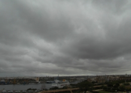 https://maltaclouds.net/wp-content/uploads/2018/09/Sc-radiatus4-1.jpg?v=1569919831
1944
2592
admin
http://maltaclouds.net/wp-content/uploads/2018/10/logo-1-300x138.png
admin2015-05-18 18:15:182018-11-11 18:19:48Sc radiatus
https://maltaclouds.net/wp-content/uploads/2018/09/Sc-radiatus4-1.jpg?v=1569919831
1944
2592
admin
http://maltaclouds.net/wp-content/uploads/2018/10/logo-1-300x138.png
admin2015-05-18 18:15:182018-11-11 18:19:48Sc radiatus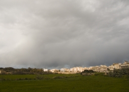 https://maltaclouds.net/wp-content/uploads/2018/09/Sc-praecipitatio2-1.jpg?v=1569919834
1536
2048
admin
http://maltaclouds.net/wp-content/uploads/2018/10/logo-1-300x138.png
admin2015-02-09 18:20:572018-11-11 18:26:07Sc praecipitatio
https://maltaclouds.net/wp-content/uploads/2018/09/Sc-praecipitatio2-1.jpg?v=1569919834
1536
2048
admin
http://maltaclouds.net/wp-content/uploads/2018/10/logo-1-300x138.png
admin2015-02-09 18:20:572018-11-11 18:26:07Sc praecipitatio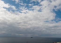 https://maltaclouds.net/wp-content/uploads/2018/09/Sc-praecipitatio1-1.jpg?v=1569919835
1536
2048
admin
http://maltaclouds.net/wp-content/uploads/2018/10/logo-1-300x138.png
admin2015-02-07 18:26:402018-11-11 18:41:25Sc praecipitatio
https://maltaclouds.net/wp-content/uploads/2018/09/Sc-praecipitatio1-1.jpg?v=1569919835
1536
2048
admin
http://maltaclouds.net/wp-content/uploads/2018/10/logo-1-300x138.png
admin2015-02-07 18:26:402018-11-11 18:41:25Sc praecipitatio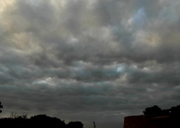 https://maltaclouds.net/wp-content/uploads/2018/09/Sc-radiatus3-1.jpg?v=1569919832
1944
2592
admin
http://maltaclouds.net/wp-content/uploads/2018/10/logo-1-300x138.png
admin2015-01-30 18:15:012018-11-15 18:17:22Sc radiatus
https://maltaclouds.net/wp-content/uploads/2018/09/Sc-radiatus3-1.jpg?v=1569919832
1944
2592
admin
http://maltaclouds.net/wp-content/uploads/2018/10/logo-1-300x138.png
admin2015-01-30 18:15:012018-11-15 18:17:22Sc radiatus https://maltaclouds.net/wp-content/uploads/2018/09/Sc-stratiformis2-1.jpg?v=1569919828
1944
2592
admin
http://maltaclouds.net/wp-content/uploads/2018/10/logo-1-300x138.png
admin2014-10-27 18:19:512018-11-15 18:21:41Sc stratiformis
https://maltaclouds.net/wp-content/uploads/2018/09/Sc-stratiformis2-1.jpg?v=1569919828
1944
2592
admin
http://maltaclouds.net/wp-content/uploads/2018/10/logo-1-300x138.png
admin2014-10-27 18:19:512018-11-15 18:21:41Sc stratiformis https://maltaclouds.net/wp-content/uploads/2018/09/Sc-opacus7-1.jpg?v=1569919845
1944
2592
admin
http://maltaclouds.net/wp-content/uploads/2018/10/logo-1-300x138.png
admin2014-10-23 18:22:352018-11-15 18:24:45Sc opacus
https://maltaclouds.net/wp-content/uploads/2018/09/Sc-opacus7-1.jpg?v=1569919845
1944
2592
admin
http://maltaclouds.net/wp-content/uploads/2018/10/logo-1-300x138.png
admin2014-10-23 18:22:352018-11-15 18:24:45Sc opacus https://maltaclouds.net/wp-content/uploads/2018/09/Sc-lacunosus3-1.jpg?v=1569919599
1536
2048
admin
http://maltaclouds.net/wp-content/uploads/2018/10/logo-1-300x138.png
admin2014-10-04 18:25:532018-11-15 18:29:19Sc lacunosus
https://maltaclouds.net/wp-content/uploads/2018/09/Sc-lacunosus3-1.jpg?v=1569919599
1536
2048
admin
http://maltaclouds.net/wp-content/uploads/2018/10/logo-1-300x138.png
admin2014-10-04 18:25:532018-11-15 18:29:19Sc lacunosus https://maltaclouds.net/wp-content/uploads/2018/09/Sc-opacus6-1.jpg?v=1569919596
1536
2048
admin
http://maltaclouds.net/wp-content/uploads/2018/10/logo-1-300x138.png
admin2014-09-28 18:29:442018-11-15 18:32:18Sc opacus
https://maltaclouds.net/wp-content/uploads/2018/09/Sc-opacus6-1.jpg?v=1569919596
1536
2048
admin
http://maltaclouds.net/wp-content/uploads/2018/10/logo-1-300x138.png
admin2014-09-28 18:29:442018-11-15 18:32:18Sc opacus https://maltaclouds.net/wp-content/uploads/2018/09/Sc-perlucidus9-1.jpg?v=1569919840
1536
2048
admin
http://maltaclouds.net/wp-content/uploads/2018/10/logo-1-300x138.png
admin2014-09-27 18:32:432018-11-15 18:37:29Sc perlucidus
https://maltaclouds.net/wp-content/uploads/2018/09/Sc-perlucidus9-1.jpg?v=1569919840
1536
2048
admin
http://maltaclouds.net/wp-content/uploads/2018/10/logo-1-300x138.png
admin2014-09-27 18:32:432018-11-15 18:37:29Sc perlucidus https://maltaclouds.net/wp-content/uploads/2018/09/Sc-opacus4-1.jpg?v=1569919598
1536
2048
admin
http://maltaclouds.net/wp-content/uploads/2018/10/logo-1-300x138.png
admin2014-04-27 17:57:152019-06-03 17:59:22Sc opacus
https://maltaclouds.net/wp-content/uploads/2018/09/Sc-opacus4-1.jpg?v=1569919598
1536
2048
admin
http://maltaclouds.net/wp-content/uploads/2018/10/logo-1-300x138.png
admin2014-04-27 17:57:152019-06-03 17:59:22Sc opacus https://maltaclouds.net/wp-content/uploads/2018/09/Sc-perlucidus8-1.jpg?v=1569919841
1536
2048
admin
http://maltaclouds.net/wp-content/uploads/2018/10/logo-1-300x138.png
admin2014-04-17 19:17:262018-11-15 19:18:56Sc perlucidus
https://maltaclouds.net/wp-content/uploads/2018/09/Sc-perlucidus8-1.jpg?v=1569919841
1536
2048
admin
http://maltaclouds.net/wp-content/uploads/2018/10/logo-1-300x138.png
admin2014-04-17 19:17:262018-11-15 19:18:56Sc perlucidus https://maltaclouds.net/wp-content/uploads/2018/09/Sc-lacunosus2-1.jpg?v=1569919851
1536
2048
admin
http://maltaclouds.net/wp-content/uploads/2018/10/logo-1-300x138.png
admin2014-04-13 19:21:232018-11-15 19:21:53Sc lacunosus
https://maltaclouds.net/wp-content/uploads/2018/09/Sc-lacunosus2-1.jpg?v=1569919851
1536
2048
admin
http://maltaclouds.net/wp-content/uploads/2018/10/logo-1-300x138.png
admin2014-04-13 19:21:232018-11-15 19:21:53Sc lacunosus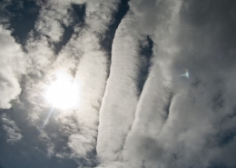 https://maltaclouds.net/wp-content/uploads/2018/09/Sc-undulatus5-1.jpg?v=1569919824
1536
2048
admin
http://maltaclouds.net/wp-content/uploads/2018/10/logo-1-300x138.png
admin2014-04-05 19:22:432018-11-15 19:25:14Sc undulatus
https://maltaclouds.net/wp-content/uploads/2018/09/Sc-undulatus5-1.jpg?v=1569919824
1536
2048
admin
http://maltaclouds.net/wp-content/uploads/2018/10/logo-1-300x138.png
admin2014-04-05 19:22:432018-11-15 19:25:14Sc undulatus https://maltaclouds.net/wp-content/uploads/2018/09/Sc-perlucidus7-1.jpg?v=1569919841
1536
2048
admin
http://maltaclouds.net/wp-content/uploads/2018/10/logo-1-300x138.png
admin2014-03-15 19:26:202018-11-15 19:28:24Sc perlucidus
https://maltaclouds.net/wp-content/uploads/2018/09/Sc-perlucidus7-1.jpg?v=1569919841
1536
2048
admin
http://maltaclouds.net/wp-content/uploads/2018/10/logo-1-300x138.png
admin2014-03-15 19:26:202018-11-15 19:28:24Sc perlucidus https://maltaclouds.net/wp-content/uploads/2018/09/Sc-undulatus4-1.jpg?v=1569919825
1536
2048
admin
http://maltaclouds.net/wp-content/uploads/2018/10/logo-1-300x138.png
admin2014-03-04 19:29:032018-11-15 19:31:31Sc undulatus
https://maltaclouds.net/wp-content/uploads/2018/09/Sc-undulatus4-1.jpg?v=1569919825
1536
2048
admin
http://maltaclouds.net/wp-content/uploads/2018/10/logo-1-300x138.png
admin2014-03-04 19:29:032018-11-15 19:31:31Sc undulatus https://maltaclouds.net/wp-content/uploads/2018/09/Stratocumulus2-1.jpg?v=1569919822
1536
2048
admin
http://maltaclouds.net/wp-content/uploads/2018/10/logo-1-300x138.png
admin2014-01-26 19:33:282018-11-15 19:35:41Sc opacus??
https://maltaclouds.net/wp-content/uploads/2018/09/Stratocumulus2-1.jpg?v=1569919822
1536
2048
admin
http://maltaclouds.net/wp-content/uploads/2018/10/logo-1-300x138.png
admin2014-01-26 19:33:282018-11-15 19:35:41Sc opacus?? https://maltaclouds.net/wp-content/uploads/2018/09/Sc-perlucidus5-1.jpg?v=1569919842
1536
2048
admin
http://maltaclouds.net/wp-content/uploads/2018/10/logo-1-300x138.png
admin2013-12-21 19:36:102018-11-15 19:37:48Sc perlucidus
https://maltaclouds.net/wp-content/uploads/2018/09/Sc-perlucidus5-1.jpg?v=1569919842
1536
2048
admin
http://maltaclouds.net/wp-content/uploads/2018/10/logo-1-300x138.png
admin2013-12-21 19:36:102018-11-15 19:37:48Sc perlucidus https://maltaclouds.net/wp-content/uploads/2018/09/Sc-opacus3-1.jpg?v=1569919846
1536
2048
admin
http://maltaclouds.net/wp-content/uploads/2018/10/logo-1-300x138.png
admin2013-12-15 19:38:082018-11-15 19:39:35Sc opacus
https://maltaclouds.net/wp-content/uploads/2018/09/Sc-opacus3-1.jpg?v=1569919846
1536
2048
admin
http://maltaclouds.net/wp-content/uploads/2018/10/logo-1-300x138.png
admin2013-12-15 19:38:082018-11-15 19:39:35Sc opacus https://maltaclouds.net/wp-content/uploads/2018/09/Sc-perlucidus4-1.jpg?v=1569919843
1498
2048
admin
http://maltaclouds.net/wp-content/uploads/2018/10/logo-1-300x138.png
admin2013-12-07 19:39:532018-11-15 19:42:03Sc perlucidus
https://maltaclouds.net/wp-content/uploads/2018/09/Sc-perlucidus4-1.jpg?v=1569919843
1498
2048
admin
http://maltaclouds.net/wp-content/uploads/2018/10/logo-1-300x138.png
admin2013-12-07 19:39:532018-11-15 19:42:03Sc perlucidus https://maltaclouds.net/wp-content/uploads/2018/09/Sc-lacunosus1-1.jpg?v=1569919851
1536
2048
admin
http://maltaclouds.net/wp-content/uploads/2018/10/logo-1-300x138.png
admin2013-11-10 19:42:232018-11-15 19:43:52Sc lacunosus
https://maltaclouds.net/wp-content/uploads/2018/09/Sc-lacunosus1-1.jpg?v=1569919851
1536
2048
admin
http://maltaclouds.net/wp-content/uploads/2018/10/logo-1-300x138.png
admin2013-11-10 19:42:232018-11-15 19:43:52Sc lacunosus https://maltaclouds.net/wp-content/uploads/2018/09/Sc-stratiformis1-1.jpg?v=1569919829
2448
3264
admin
http://maltaclouds.net/wp-content/uploads/2018/10/logo-1-300x138.png
admin2013-02-18 19:44:072018-11-15 19:45:57Sc stratiformis
https://maltaclouds.net/wp-content/uploads/2018/09/Sc-stratiformis1-1.jpg?v=1569919829
2448
3264
admin
http://maltaclouds.net/wp-content/uploads/2018/10/logo-1-300x138.png
admin2013-02-18 19:44:072018-11-15 19:45:57Sc stratiformis https://maltaclouds.net/wp-content/uploads/2018/09/Sc-opacus2-1.jpg?v=1569919847
1536
2048
admin
http://maltaclouds.net/wp-content/uploads/2018/10/logo-1-300x138.png
admin2012-12-01 19:46:302018-11-15 19:48:01Sc opacus
https://maltaclouds.net/wp-content/uploads/2018/09/Sc-opacus2-1.jpg?v=1569919847
1536
2048
admin
http://maltaclouds.net/wp-content/uploads/2018/10/logo-1-300x138.png
admin2012-12-01 19:46:302018-11-15 19:48:01Sc opacus https://maltaclouds.net/wp-content/uploads/2018/09/Sc-lacunosus.jpg?v=1569920643
1536
2048
admin
http://maltaclouds.net/wp-content/uploads/2018/10/logo-1-300x138.png
admin2012-05-14 19:48:162018-11-15 19:50:17Sc lacunosus
https://maltaclouds.net/wp-content/uploads/2018/09/Sc-lacunosus.jpg?v=1569920643
1536
2048
admin
http://maltaclouds.net/wp-content/uploads/2018/10/logo-1-300x138.png
admin2012-05-14 19:48:162018-11-15 19:50:17Sc lacunosus https://maltaclouds.net/wp-content/uploads/2018/09/Sc-opacus1-1.jpg?v=1569919848
1536
2048
admin
http://maltaclouds.net/wp-content/uploads/2018/10/logo-1-300x138.png
admin2012-02-19 19:50:462018-11-15 19:55:37Sc opacus
https://maltaclouds.net/wp-content/uploads/2018/09/Sc-opacus1-1.jpg?v=1569919848
1536
2048
admin
http://maltaclouds.net/wp-content/uploads/2018/10/logo-1-300x138.png
admin2012-02-19 19:50:462018-11-15 19:55:37Sc opacus https://maltaclouds.net/wp-content/uploads/2018/09/Sc-opacus-1.jpg?v=1569919848
1536
2048
admin
http://maltaclouds.net/wp-content/uploads/2018/10/logo-1-300x138.png
admin2012-01-22 19:55:532018-11-15 19:57:44Sc opacus
https://maltaclouds.net/wp-content/uploads/2018/09/Sc-opacus-1.jpg?v=1569919848
1536
2048
admin
http://maltaclouds.net/wp-content/uploads/2018/10/logo-1-300x138.png
admin2012-01-22 19:55:532018-11-15 19:57:44Sc opacus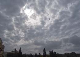 https://maltaclouds.net/wp-content/uploads/2018/09/Sc-perlucidus3-1.jpg?v=1569919844
1536
2048
admin
http://maltaclouds.net/wp-content/uploads/2018/10/logo-1-300x138.png
admin2011-11-05 19:58:042018-11-15 20:00:41Sc perlucidus
https://maltaclouds.net/wp-content/uploads/2018/09/Sc-perlucidus3-1.jpg?v=1569919844
1536
2048
admin
http://maltaclouds.net/wp-content/uploads/2018/10/logo-1-300x138.png
admin2011-11-05 19:58:042018-11-15 20:00:41Sc perlucidusSc perlucidus
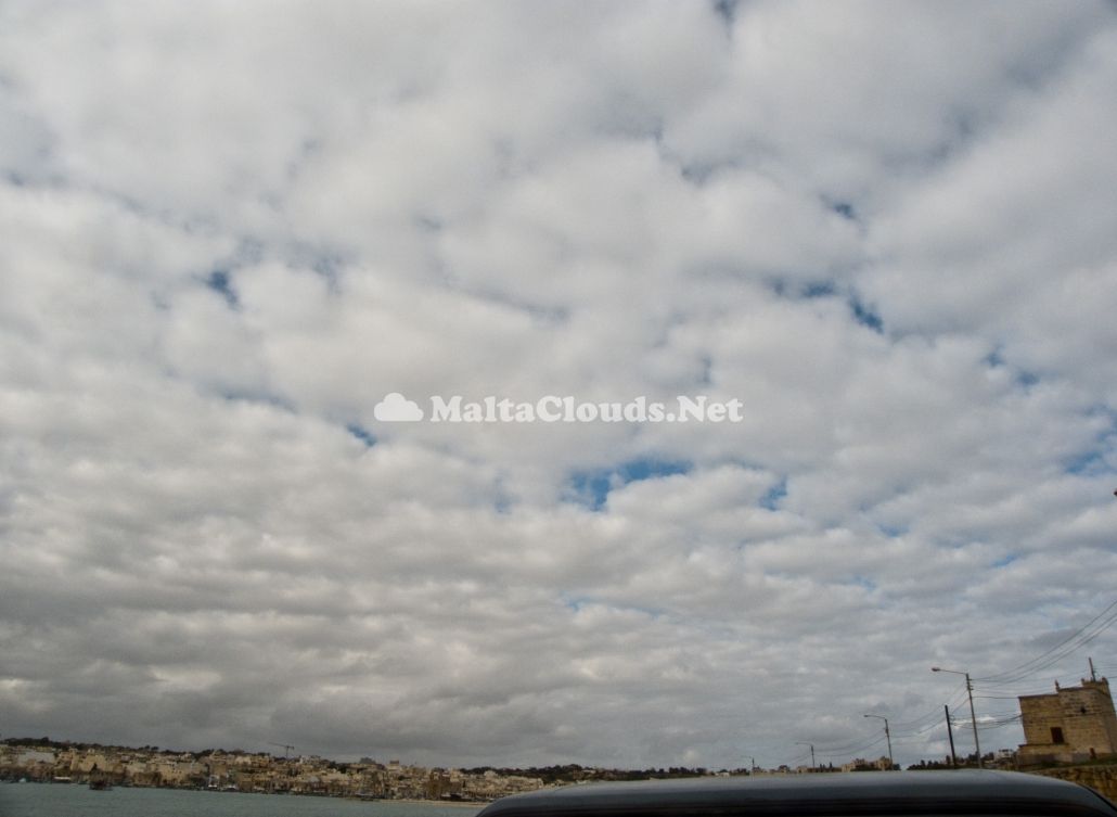
This cloud formation is very typical after a cold spell in the Maltese Islands (as happened in this case) or the sudden arrival of a warm airmass. This have caused the lingering cold and moist air (from previous cold spells) to get trapped close to the ground as surface pressure rose. This weather situation led to widespread formation of stratocumulus clouds. The first thumbnail shows a cumulus cloud that stops rising once it reached the 2.2km altitude and spread out. In fact, the weather sounding depicts the perfect scenario for such clouds formation. If wind shear was also present, the clouds would have formed wave-like feautures possibly making for some dramatic scenery in the area.


Leave a Reply
Want to join the discussion?Feel free to contribute!