 https://maltaclouds.net/wp-content/uploads/2019/05/Cs-fibratus10.jpg?v=1569919549
1365
2048
admin
http://maltaclouds.net/wp-content/uploads/2018/10/logo-1-300x138.png
admin2019-04-30 15:26:262019-06-01 15:29:02Cs fibratus
https://maltaclouds.net/wp-content/uploads/2019/05/Cs-fibratus10.jpg?v=1569919549
1365
2048
admin
http://maltaclouds.net/wp-content/uploads/2018/10/logo-1-300x138.png
admin2019-04-30 15:26:262019-06-01 15:29:02Cs fibratus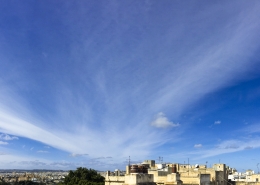 https://maltaclouds.net/wp-content/uploads/2019/05/Cs-fibratus9.jpg?v=1569919530
2900
5528
admin
http://maltaclouds.net/wp-content/uploads/2018/10/logo-1-300x138.png
admin2019-01-31 15:04:412019-06-09 15:11:40Cs fibratus
https://maltaclouds.net/wp-content/uploads/2019/05/Cs-fibratus9.jpg?v=1569919530
2900
5528
admin
http://maltaclouds.net/wp-content/uploads/2018/10/logo-1-300x138.png
admin2019-01-31 15:04:412019-06-09 15:11:40Cs fibratus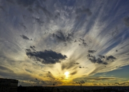 https://maltaclouds.net/wp-content/uploads/2019/05/Cs-fibratus8.jpg?v=1569919432
2448
3264
admin
http://maltaclouds.net/wp-content/uploads/2018/10/logo-1-300x138.png
admin2017-12-19 15:01:022019-06-01 15:04:21Cs fibratus
https://maltaclouds.net/wp-content/uploads/2019/05/Cs-fibratus8.jpg?v=1569919432
2448
3264
admin
http://maltaclouds.net/wp-content/uploads/2018/10/logo-1-300x138.png
admin2017-12-19 15:01:022019-06-01 15:04:21Cs fibratus https://maltaclouds.net/wp-content/uploads/2018/09/Cs-nebulosus3.jpg?v=1569920090
1288
2048
admin
http://maltaclouds.net/wp-content/uploads/2018/10/logo-1-300x138.png
admin2017-01-13 11:22:302018-10-24 11:23:59Cs nebulosus
https://maltaclouds.net/wp-content/uploads/2018/09/Cs-nebulosus3.jpg?v=1569920090
1288
2048
admin
http://maltaclouds.net/wp-content/uploads/2018/10/logo-1-300x138.png
admin2017-01-13 11:22:302018-10-24 11:23:59Cs nebulosus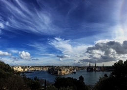 https://maltaclouds.net/wp-content/uploads/2018/09/Cs-fibratus7.jpg?v=1569920092
3160
5664
admin
http://maltaclouds.net/wp-content/uploads/2018/10/logo-1-300x138.png
admin2016-01-20 12:44:292018-10-24 12:47:05Cs fibratus
https://maltaclouds.net/wp-content/uploads/2018/09/Cs-fibratus7.jpg?v=1569920092
3160
5664
admin
http://maltaclouds.net/wp-content/uploads/2018/10/logo-1-300x138.png
admin2016-01-20 12:44:292018-10-24 12:47:05Cs fibratus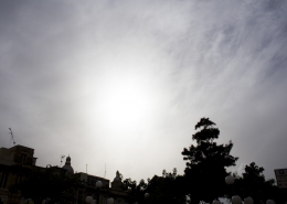 https://maltaclouds.net/wp-content/uploads/2018/09/Cs-fibratus6.jpg?v=1569920093
1365
2048
admin
http://maltaclouds.net/wp-content/uploads/2018/10/logo-1-300x138.png
admin2015-10-10 12:48:012018-10-24 12:51:04Cs fibratus
https://maltaclouds.net/wp-content/uploads/2018/09/Cs-fibratus6.jpg?v=1569920093
1365
2048
admin
http://maltaclouds.net/wp-content/uploads/2018/10/logo-1-300x138.png
admin2015-10-10 12:48:012018-10-24 12:51:04Cs fibratus https://maltaclouds.net/wp-content/uploads/2018/09/Cs-fibratus5-1.jpg?v=1569920094
1536
2048
admin
http://maltaclouds.net/wp-content/uploads/2018/10/logo-1-300x138.png
admin2014-09-26 12:52:142018-10-24 12:56:07Cs fibratus
https://maltaclouds.net/wp-content/uploads/2018/09/Cs-fibratus5-1.jpg?v=1569920094
1536
2048
admin
http://maltaclouds.net/wp-content/uploads/2018/10/logo-1-300x138.png
admin2014-09-26 12:52:142018-10-24 12:56:07Cs fibratus https://maltaclouds.net/wp-content/uploads/2018/09/Cs-nebulosus2-1.jpg?v=1569920091
1536
2048
admin
http://maltaclouds.net/wp-content/uploads/2018/10/logo-1-300x138.png
admin2014-03-31 12:56:512018-10-24 12:59:06Cs nebulosus
https://maltaclouds.net/wp-content/uploads/2018/09/Cs-nebulosus2-1.jpg?v=1569920091
1536
2048
admin
http://maltaclouds.net/wp-content/uploads/2018/10/logo-1-300x138.png
admin2014-03-31 12:56:512018-10-24 12:59:06Cs nebulosus https://maltaclouds.net/wp-content/uploads/2018/09/Cs-fibratus4-1.jpg?v=1569920094
1536
2048
admin
http://maltaclouds.net/wp-content/uploads/2018/10/logo-1-300x138.png
admin2013-09-19 13:00:082018-10-24 13:02:52Cs fibratus
https://maltaclouds.net/wp-content/uploads/2018/09/Cs-fibratus4-1.jpg?v=1569920094
1536
2048
admin
http://maltaclouds.net/wp-content/uploads/2018/10/logo-1-300x138.png
admin2013-09-19 13:00:082018-10-24 13:02:52Cs fibratus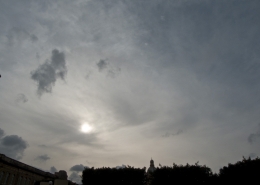 https://maltaclouds.net/wp-content/uploads/2018/09/Cs-fibratus3-1.jpg?v=1569920095
1536
2048
admin
http://maltaclouds.net/wp-content/uploads/2018/10/logo-1-300x138.png
admin2013-09-03 13:04:132018-10-24 13:07:26Cs fibratus
https://maltaclouds.net/wp-content/uploads/2018/09/Cs-fibratus3-1.jpg?v=1569920095
1536
2048
admin
http://maltaclouds.net/wp-content/uploads/2018/10/logo-1-300x138.png
admin2013-09-03 13:04:132018-10-24 13:07:26Cs fibratus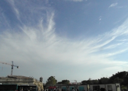 https://maltaclouds.net/wp-content/uploads/2018/09/Cs-fibratus2-1.jpg?v=1569920096
1692
2540
admin
http://maltaclouds.net/wp-content/uploads/2018/10/logo-1-300x138.png
admin2012-10-02 13:09:242018-10-24 13:10:03Cs fibratus
https://maltaclouds.net/wp-content/uploads/2018/09/Cs-fibratus2-1.jpg?v=1569920096
1692
2540
admin
http://maltaclouds.net/wp-content/uploads/2018/10/logo-1-300x138.png
admin2012-10-02 13:09:242018-10-24 13:10:03Cs fibratus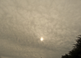 https://maltaclouds.net/wp-content/uploads/2018/09/H-l_overcast-1.jpg?v=1569920089
1536
2048
admin
http://maltaclouds.net/wp-content/uploads/2018/10/logo-1-300x138.png
admin2011-12-11 13:10:442018-10-24 13:12:29Cs nebulosus
https://maltaclouds.net/wp-content/uploads/2018/09/H-l_overcast-1.jpg?v=1569920089
1536
2048
admin
http://maltaclouds.net/wp-content/uploads/2018/10/logo-1-300x138.png
admin2011-12-11 13:10:442018-10-24 13:12:29Cs nebulosusCs fibratus
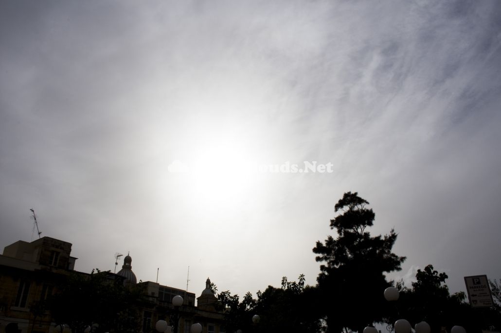
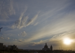
These clouds were seen in mid-afternoon and could have been remnants from high-based cumulonimbus clouds that passed in the vicinity of the area. As can be seen in the weather sounding of the first thumbnail, the cloud`s temperature of at least -30C with a base of at least 8.3km, the cloud`s droplets were definitely composed of ice cyrstals. A very strong overhead jet stream, created the fibratus effect on the cloud cover meaning that they were changing shape rapidly and the wind`s affect on the cloud made it look as if the trails of the cloud were curling up. The jet stream wind is shown in the second thumbnail.


Leave a Reply
Want to join the discussion?Feel free to contribute!