 https://maltaclouds.net/wp-content/uploads/2019/09/Ac-floccus15.jpg?v=1569918579
1888
3600
admin
http://maltaclouds.net/wp-content/uploads/2018/10/logo-1-300x138.png
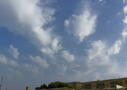
admin2019-07-15 18:20:202019-09-03 16:36:50Ac floccus
https://maltaclouds.net/wp-content/uploads/2019/09/Ac-floccus15.jpg?v=1569918579
1888
3600
admin
http://maltaclouds.net/wp-content/uploads/2018/10/logo-1-300x138.png
admin2019-07-15 18:20:202019-09-03 16:36:50Ac floccus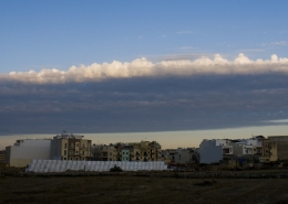 https://maltaclouds.net/wp-content/uploads/2019/09/Ac-castellanus33.jpg?v=1569918580
1272
3072
admin
http://maltaclouds.net/wp-content/uploads/2018/10/logo-1-300x138.png
admin2019-05-29 18:14:312019-09-05 14:08:29Ac castellanus
https://maltaclouds.net/wp-content/uploads/2019/09/Ac-castellanus33.jpg?v=1569918580
1272
3072
admin
http://maltaclouds.net/wp-content/uploads/2018/10/logo-1-300x138.png
admin2019-05-29 18:14:312019-09-05 14:08:29Ac castellanus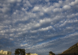 https://maltaclouds.net/wp-content/uploads/2019/09/Ac-stratiformis18.jpg?v=1569918577
2017
3072
admin
http://maltaclouds.net/wp-content/uploads/2018/10/logo-1-300x138.png
admin2019-05-29 18:10:032019-09-03 16:29:50Ac stratiformis
https://maltaclouds.net/wp-content/uploads/2019/09/Ac-stratiformis18.jpg?v=1569918577
2017
3072
admin
http://maltaclouds.net/wp-content/uploads/2018/10/logo-1-300x138.png
admin2019-05-29 18:10:032019-09-03 16:29:50Ac stratiformis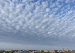 https://maltaclouds.net/wp-content/uploads/2019/09/Ac-stratiformis17.jpg?v=1569918578
2784
3712
admin
http://maltaclouds.net/wp-content/uploads/2018/10/logo-1-300x138.png
admin2019-05-20 18:03:472019-09-01 18:09:26Ac stratiformis
https://maltaclouds.net/wp-content/uploads/2019/09/Ac-stratiformis17.jpg?v=1569918578
2784
3712
admin
http://maltaclouds.net/wp-content/uploads/2018/10/logo-1-300x138.png
admin2019-05-20 18:03:472019-09-01 18:09:26Ac stratiformis https://maltaclouds.net/wp-content/uploads/2019/09/Ac-castellanus32.jpg?v=1569918581
2048
3072
admin
http://maltaclouds.net/wp-content/uploads/2018/10/logo-1-300x138.png
admin2019-05-12 17:56:392019-09-01 18:02:28Ac castellanus
https://maltaclouds.net/wp-content/uploads/2019/09/Ac-castellanus32.jpg?v=1569918581
2048
3072
admin
http://maltaclouds.net/wp-content/uploads/2018/10/logo-1-300x138.png
admin2019-05-12 17:56:392019-09-01 18:02:28Ac castellanus https://maltaclouds.net/wp-content/uploads/2019/05/Ac-castellanus31.jpg?v=1569919544
1432
4153
admin
http://maltaclouds.net/wp-content/uploads/2018/10/logo-1-300x138.png
admin2019-04-11 14:58:302019-06-02 15:00:30Ac castellanus
https://maltaclouds.net/wp-content/uploads/2019/05/Ac-castellanus31.jpg?v=1569919544
1432
4153
admin
http://maltaclouds.net/wp-content/uploads/2018/10/logo-1-300x138.png
admin2019-04-11 14:58:302019-06-02 15:00:30Ac castellanus https://maltaclouds.net/wp-content/uploads/2019/05/Ac-lenticularis6.jpg?v=1569919544
2082
2848
admin
http://maltaclouds.net/wp-content/uploads/2018/10/logo-1-300x138.png
admin2019-04-09 14:55:592019-06-02 14:57:58Ac lenticularis
https://maltaclouds.net/wp-content/uploads/2019/05/Ac-lenticularis6.jpg?v=1569919544
2082
2848
admin
http://maltaclouds.net/wp-content/uploads/2018/10/logo-1-300x138.png
admin2019-04-09 14:55:592019-06-02 14:57:58Ac lenticularis https://maltaclouds.net/wp-content/uploads/2019/05/Ac-castellanus30.jpg?v=1569919539
2978
7638
admin
http://maltaclouds.net/wp-content/uploads/2018/10/logo-1-300x138.png
admin2019-03-19 14:52:532019-06-02 14:55:22Ac castellanus
https://maltaclouds.net/wp-content/uploads/2019/05/Ac-castellanus30.jpg?v=1569919539
2978
7638
admin
http://maltaclouds.net/wp-content/uploads/2018/10/logo-1-300x138.png
admin2019-03-19 14:52:532019-06-02 14:55:22Ac castellanus https://maltaclouds.net/wp-content/uploads/2019/05/Ac-mammatus12.jpg?v=1569919530
1365
2048
admin
http://maltaclouds.net/wp-content/uploads/2018/10/logo-1-300x138.png
admin2019-02-02 14:47:192019-06-02 14:52:18Ac mammatus
https://maltaclouds.net/wp-content/uploads/2019/05/Ac-mammatus12.jpg?v=1569919530
1365
2048
admin
http://maltaclouds.net/wp-content/uploads/2018/10/logo-1-300x138.png
admin2019-02-02 14:47:192019-06-02 14:52:18Ac mammatus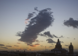 https://maltaclouds.net/wp-content/uploads/2019/05/Ac-lenticularis5.jpg?v=1569919518
1683
2769
admin
http://maltaclouds.net/wp-content/uploads/2018/10/logo-1-300x138.png
admin2018-12-17 14:36:502019-06-02 14:45:59Ac lenticularis
https://maltaclouds.net/wp-content/uploads/2019/05/Ac-lenticularis5.jpg?v=1569919518
1683
2769
admin
http://maltaclouds.net/wp-content/uploads/2018/10/logo-1-300x138.png
admin2018-12-17 14:36:502019-06-02 14:45:59Ac lenticularis https://maltaclouds.net/wp-content/uploads/2019/05/Ac-stratiformis16.jpg?v=1569919516
2448
3264
admin
http://maltaclouds.net/wp-content/uploads/2018/10/logo-1-300x138.png
admin2018-12-03 14:34:092019-06-02 14:36:26Ac stratiformis
https://maltaclouds.net/wp-content/uploads/2019/05/Ac-stratiformis16.jpg?v=1569919516
2448
3264
admin
http://maltaclouds.net/wp-content/uploads/2018/10/logo-1-300x138.png
admin2018-12-03 14:34:092019-06-02 14:36:26Ac stratiformis https://maltaclouds.net/wp-content/uploads/2019/05/Ac-floccus14.jpg?v=1569919511
3105
4709
admin
http://maltaclouds.net/wp-content/uploads/2018/10/logo-1-300x138.png
admin2018-11-22 14:31:172019-06-02 14:33:44Ac floccus
https://maltaclouds.net/wp-content/uploads/2019/05/Ac-floccus14.jpg?v=1569919511
3105
4709
admin
http://maltaclouds.net/wp-content/uploads/2018/10/logo-1-300x138.png
admin2018-11-22 14:31:172019-06-02 14:33:44Ac floccus https://maltaclouds.net/wp-content/uploads/2019/05/Ac-altostratomutatus.jpg?v=1569919501
2448
3264
admin
http://maltaclouds.net/wp-content/uploads/2018/10/logo-1-300x138.png
admin2018-11-04 14:29:032019-06-02 14:30:42Ac altostratomutatus
https://maltaclouds.net/wp-content/uploads/2019/05/Ac-altostratomutatus.jpg?v=1569919501
2448
3264
admin
http://maltaclouds.net/wp-content/uploads/2018/10/logo-1-300x138.png
admin2018-11-04 14:29:032019-06-02 14:30:42Ac altostratomutatus https://maltaclouds.net/wp-content/uploads/2019/05/Ac-castellanus29-OtherView.jpg?v=1569918991
3888
5184
admin
http://maltaclouds.net/wp-content/uploads/2018/10/logo-1-300x138.png
admin2018-10-02 14:25:492019-06-06 20:50:00Ac castellanus
https://maltaclouds.net/wp-content/uploads/2019/05/Ac-castellanus29-OtherView.jpg?v=1569918991
3888
5184
admin
http://maltaclouds.net/wp-content/uploads/2018/10/logo-1-300x138.png
admin2018-10-02 14:25:492019-06-06 20:50:00Ac castellanus https://maltaclouds.net/wp-content/uploads/2019/05/Ac-stratiformis15.jpg?v=1569919490
1365
2048
admin
http://maltaclouds.net/wp-content/uploads/2018/10/logo-1-300x138.png
admin2018-09-28 14:21:492019-06-06 20:48:24Ac stratiformis
https://maltaclouds.net/wp-content/uploads/2019/05/Ac-stratiformis15.jpg?v=1569919490
1365
2048
admin
http://maltaclouds.net/wp-content/uploads/2018/10/logo-1-300x138.png
admin2018-09-28 14:21:492019-06-06 20:48:24Ac stratiformis https://maltaclouds.net/wp-content/uploads/2019/05/Ac-undulatus40.jpg?v=1569919478
1299
1982
admin
http://maltaclouds.net/wp-content/uploads/2018/10/logo-1-300x138.png
admin2018-08-08 14:19:162019-06-02 14:21:18Ac undulatus
https://maltaclouds.net/wp-content/uploads/2019/05/Ac-undulatus40.jpg?v=1569919478
1299
1982
admin
http://maltaclouds.net/wp-content/uploads/2018/10/logo-1-300x138.png
admin2018-08-08 14:19:162019-06-02 14:21:18Ac undulatus https://maltaclouds.net/wp-content/uploads/2019/05/Ac-opacus6.jpg?v=1569919475
3079
6174
admin
http://maltaclouds.net/wp-content/uploads/2018/10/logo-1-300x138.png
admin2018-07-23 18:25:512019-06-02 14:16:07Ac opacus
https://maltaclouds.net/wp-content/uploads/2019/05/Ac-opacus6.jpg?v=1569919475
3079
6174
admin
http://maltaclouds.net/wp-content/uploads/2018/10/logo-1-300x138.png
admin2018-07-23 18:25:512019-06-02 14:16:07Ac opacus https://maltaclouds.net/wp-content/uploads/2019/05/Ac-castellanus28.jpg?v=1569919470
2405
3264
admin
http://maltaclouds.net/wp-content/uploads/2018/10/logo-1-300x138.png
admin2018-06-13 13:56:402019-06-02 14:09:14Ac castellanus
https://maltaclouds.net/wp-content/uploads/2019/05/Ac-castellanus28.jpg?v=1569919470
2405
3264
admin
http://maltaclouds.net/wp-content/uploads/2018/10/logo-1-300x138.png
admin2018-06-13 13:56:402019-06-02 14:09:14Ac castellanus https://maltaclouds.net/wp-content/uploads/2019/05/Ac-floccus13.jpg?v=1569919469
943
1914
admin
http://maltaclouds.net/wp-content/uploads/2018/10/logo-1-300x138.png
admin2018-06-11 18:25:582019-06-02 14:11:03Ac floccus
https://maltaclouds.net/wp-content/uploads/2019/05/Ac-floccus13.jpg?v=1569919469
943
1914
admin
http://maltaclouds.net/wp-content/uploads/2018/10/logo-1-300x138.png
admin2018-06-11 18:25:582019-06-02 14:11:03Ac floccus https://maltaclouds.net/wp-content/uploads/2019/05/Ac-stratiformis14.jpg?v=1569919465
2448
3264
admin
http://maltaclouds.net/wp-content/uploads/2018/10/logo-1-300x138.png
admin2018-05-17 18:45:212019-06-02 13:47:15Ac stratiformis
https://maltaclouds.net/wp-content/uploads/2019/05/Ac-stratiformis14.jpg?v=1569919465
2448
3264
admin
http://maltaclouds.net/wp-content/uploads/2018/10/logo-1-300x138.png
admin2018-05-17 18:45:212019-06-02 13:47:15Ac stratiformis https://maltaclouds.net/wp-content/uploads/2019/05/Ac-castellanus27.jpg?v=1569919465
3096
5032
admin
http://maltaclouds.net/wp-content/uploads/2018/10/logo-1-300x138.png
admin2018-05-14 13:41:512019-06-02 13:44:34Ac castellanus
https://maltaclouds.net/wp-content/uploads/2019/05/Ac-castellanus27.jpg?v=1569919465
3096
5032
admin
http://maltaclouds.net/wp-content/uploads/2018/10/logo-1-300x138.png
admin2018-05-14 13:41:512019-06-02 13:44:34Ac castellanus https://maltaclouds.net/wp-content/uploads/2018/09/Ac-lacunosus1.jpg?v=1569919770
2268
2609
admin
http://maltaclouds.net/wp-content/uploads/2018/10/logo-1-300x138.png
admin2018-05-04 13:12:382019-06-02 13:30:35Ac lacunosus
https://maltaclouds.net/wp-content/uploads/2018/09/Ac-lacunosus1.jpg?v=1569919770
2268
2609
admin
http://maltaclouds.net/wp-content/uploads/2018/10/logo-1-300x138.png
admin2018-05-04 13:12:382019-06-02 13:30:35Ac lacunosus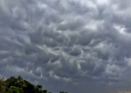 https://maltaclouds.net/wp-content/uploads/2019/05/Ac-mammatus11.jpg?v=1569919457
2448
3264
admin
http://maltaclouds.net/wp-content/uploads/2018/10/logo-1-300x138.png
admin2018-04-08 13:05:342019-06-02 13:11:10Ac mammatus
https://maltaclouds.net/wp-content/uploads/2019/05/Ac-mammatus11.jpg?v=1569919457
2448
3264
admin
http://maltaclouds.net/wp-content/uploads/2018/10/logo-1-300x138.png
admin2018-04-08 13:05:342019-06-02 13:11:10Ac mammatus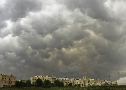 https://maltaclouds.net/wp-content/uploads/2019/05/Ac-mammatus10.jpg?v=1569919454
3094
5374
admin
http://maltaclouds.net/wp-content/uploads/2018/10/logo-1-300x138.png
admin2018-03-25 08:55:182019-06-02 13:04:59Ac mammatus
https://maltaclouds.net/wp-content/uploads/2019/05/Ac-mammatus10.jpg?v=1569919454
3094
5374
admin
http://maltaclouds.net/wp-content/uploads/2018/10/logo-1-300x138.png
admin2018-03-25 08:55:182019-06-02 13:04:59Ac mammatus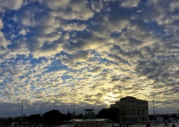 https://maltaclouds.net/wp-content/uploads/2019/05/Ac-stratiformis-perlucidus.jpg?v=1569919445
3154
5452
admin
http://maltaclouds.net/wp-content/uploads/2018/10/logo-1-300x138.png
admin2018-01-31 12:58:092019-06-02 13:01:43Ac stratiformis perlucidus
https://maltaclouds.net/wp-content/uploads/2019/05/Ac-stratiformis-perlucidus.jpg?v=1569919445
3154
5452
admin
http://maltaclouds.net/wp-content/uploads/2018/10/logo-1-300x138.png
admin2018-01-31 12:58:092019-06-02 13:01:43Ac stratiformis perlucidus https://maltaclouds.net/wp-content/uploads/2019/05/Ac-floccus-virga.jpg?v=1569919428
2048
3072
admin
http://maltaclouds.net/wp-content/uploads/2018/10/logo-1-300x138.png
admin2017-12-08 10:03:202019-06-01 16:06:48Ac floccus virga
https://maltaclouds.net/wp-content/uploads/2019/05/Ac-floccus-virga.jpg?v=1569919428
2048
3072
admin
http://maltaclouds.net/wp-content/uploads/2018/10/logo-1-300x138.png
admin2017-12-08 10:03:202019-06-01 16:06:48Ac floccus virga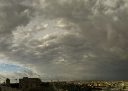 https://maltaclouds.net/wp-content/uploads/2019/05/Ac-cumulonimbogenitus.jpg?v=1569919556
3150
7074
admin
http://maltaclouds.net/wp-content/uploads/2018/10/logo-1-300x138.png
admin2017-11-01 15:49:032019-06-01 15:51:21Ac cumulonimbogenitus
https://maltaclouds.net/wp-content/uploads/2019/05/Ac-cumulonimbogenitus.jpg?v=1569919556
3150
7074
admin
http://maltaclouds.net/wp-content/uploads/2018/10/logo-1-300x138.png
admin2017-11-01 15:49:032019-06-01 15:51:21Ac cumulonimbogenitus https://maltaclouds.net/wp-content/uploads/2019/05/Ac-floccus12.jpg?v=1569919552
2048
3072
admin
http://maltaclouds.net/wp-content/uploads/2018/10/logo-1-300x138.png
admin2017-10-19 15:44:022019-06-06 20:42:55Ac floccus
https://maltaclouds.net/wp-content/uploads/2019/05/Ac-floccus12.jpg?v=1569919552
2048
3072
admin
http://maltaclouds.net/wp-content/uploads/2018/10/logo-1-300x138.png
admin2017-10-19 15:44:022019-06-06 20:42:55Ac floccus https://maltaclouds.net/wp-content/uploads/2018/09/Ac-castellanus26.jpg?v=1569920212
2448
3264
admin
http://maltaclouds.net/wp-content/uploads/2018/10/logo-1-300x138.png
admin2017-09-19 17:25:492018-10-26 17:26:59Ac castellanus
https://maltaclouds.net/wp-content/uploads/2018/09/Ac-castellanus26.jpg?v=1569920212
2448
3264
admin
http://maltaclouds.net/wp-content/uploads/2018/10/logo-1-300x138.png
admin2017-09-19 17:25:492018-10-26 17:26:59Ac castellanus https://maltaclouds.net/wp-content/uploads/2018/09/Ac-floccus11.jpg?v=1569920202
2799
3072
admin
http://maltaclouds.net/wp-content/uploads/2018/10/logo-1-300x138.png
admin2017-08-06 17:28:452018-10-26 17:31:46Ac floccus
https://maltaclouds.net/wp-content/uploads/2018/09/Ac-floccus11.jpg?v=1569920202
2799
3072
admin
http://maltaclouds.net/wp-content/uploads/2018/10/logo-1-300x138.png
admin2017-08-06 17:28:452018-10-26 17:31:46Ac floccus https://maltaclouds.net/wp-content/uploads/2018/09/Ac-cumulogenitus.jpg?v=1569920211
1427
3608
admin
http://maltaclouds.net/wp-content/uploads/2018/10/logo-1-300x138.png
admin2017-06-06 17:32:372018-10-26 17:35:48Ac cumulogenitus
https://maltaclouds.net/wp-content/uploads/2018/09/Ac-cumulogenitus.jpg?v=1569920211
1427
3608
admin
http://maltaclouds.net/wp-content/uploads/2018/10/logo-1-300x138.png
admin2017-06-06 17:32:372018-10-26 17:35:48Ac cumulogenitus https://maltaclouds.net/wp-content/uploads/2018/09/Ac-castellanus25.jpg?v=1569920213
1312
2929
admin
http://maltaclouds.net/wp-content/uploads/2018/10/logo-1-300x138.png
admin2017-06-05 17:37:362018-10-26 17:38:54Ac castellanus
https://maltaclouds.net/wp-content/uploads/2018/09/Ac-castellanus25.jpg?v=1569920213
1312
2929
admin
http://maltaclouds.net/wp-content/uploads/2018/10/logo-1-300x138.png
admin2017-06-05 17:37:362018-10-26 17:38:54Ac castellanus https://maltaclouds.net/wp-content/uploads/2018/09/Ac-castellanus24.jpg?v=1569920214
2983
6958
admin
http://maltaclouds.net/wp-content/uploads/2018/10/logo-1-300x138.png
admin2017-05-12 17:40:202018-10-26 17:42:38Ac castellanus
https://maltaclouds.net/wp-content/uploads/2018/09/Ac-castellanus24.jpg?v=1569920214
2983
6958
admin
http://maltaclouds.net/wp-content/uploads/2018/10/logo-1-300x138.png
admin2017-05-12 17:40:202018-10-26 17:42:38Ac castellanus https://maltaclouds.net/wp-content/uploads/2018/09/Ac-mammatus9.jpg?v=1569920189
2354
4096
admin
http://maltaclouds.net/wp-content/uploads/2018/10/logo-1-300x138.png
admin2017-04-02 17:49:202018-10-26 17:53:06Ac mammatus
https://maltaclouds.net/wp-content/uploads/2018/09/Ac-mammatus9.jpg?v=1569920189
2354
4096
admin
http://maltaclouds.net/wp-content/uploads/2018/10/logo-1-300x138.png
admin2017-04-02 17:49:202018-10-26 17:53:06Ac mammatus https://maltaclouds.net/wp-content/uploads/2018/09/Ac-stratiformis13.jpg?v=1569920171
2048
3072
admin
http://maltaclouds.net/wp-content/uploads/2018/10/logo-1-300x138.png
admin2017-04-02 17:43:492018-10-26 17:46:50Ac stratiformis
https://maltaclouds.net/wp-content/uploads/2018/09/Ac-stratiformis13.jpg?v=1569920171
2048
3072
admin
http://maltaclouds.net/wp-content/uploads/2018/10/logo-1-300x138.png
admin2017-04-02 17:43:492018-10-26 17:46:50Ac stratiformis https://maltaclouds.net/wp-content/uploads/2018/09/Ac-perlucidus17.jpg?v=1569920175
1057
1869
admin
http://maltaclouds.net/wp-content/uploads/2018/10/logo-1-300x138.png
admin2016-12-14 17:53:452018-10-26 17:56:00Ac perlucidus
https://maltaclouds.net/wp-content/uploads/2018/09/Ac-perlucidus17.jpg?v=1569920175
1057
1869
admin
http://maltaclouds.net/wp-content/uploads/2018/10/logo-1-300x138.png
admin2016-12-14 17:53:452018-10-26 17:56:00Ac perlucidus https://maltaclouds.net/wp-content/uploads/2018/09/Ac-perlucidus16.jpg?v=1569920175
2721
7051
admin
http://maltaclouds.net/wp-content/uploads/2018/10/logo-1-300x138.png
admin2016-11-23 18:00:072018-10-26 18:14:47Ac perlucidus
https://maltaclouds.net/wp-content/uploads/2018/09/Ac-perlucidus16.jpg?v=1569920175
2721
7051
admin
http://maltaclouds.net/wp-content/uploads/2018/10/logo-1-300x138.png
admin2016-11-23 18:00:072018-10-26 18:14:47Ac perlucidus https://maltaclouds.net/wp-content/uploads/2018/09/Ac-virga16.jpg?v=1569920136
3202
4342
admin
http://maltaclouds.net/wp-content/uploads/2018/10/logo-1-300x138.png
admin2016-11-06 18:15:182018-10-26 18:19:49Ac virga
https://maltaclouds.net/wp-content/uploads/2018/09/Ac-virga16.jpg?v=1569920136
3202
4342
admin
http://maltaclouds.net/wp-content/uploads/2018/10/logo-1-300x138.png
admin2016-11-06 18:15:182018-10-26 18:19:49Ac virga https://maltaclouds.net/wp-content/uploads/2018/09/Ac-undulatus39.jpg?v=1569919752
3140
5532
admin
http://maltaclouds.net/wp-content/uploads/2018/10/logo-1-300x138.png
admin2016-10-31 15:41:172019-06-01 15:43:29Ac undulatus
https://maltaclouds.net/wp-content/uploads/2018/09/Ac-undulatus39.jpg?v=1569919752
3140
5532
admin
http://maltaclouds.net/wp-content/uploads/2018/10/logo-1-300x138.png
admin2016-10-31 15:41:172019-06-01 15:43:29Ac undulatus https://maltaclouds.net/wp-content/uploads/2018/09/Ac-castellanus23.jpg?v=1569920215
2684
5432
admin
http://maltaclouds.net/wp-content/uploads/2018/10/logo-1-300x138.png
admin2016-10-03 18:20:242018-10-26 18:22:10Ac castellanus
https://maltaclouds.net/wp-content/uploads/2018/09/Ac-castellanus23.jpg?v=1569920215
2684
5432
admin
http://maltaclouds.net/wp-content/uploads/2018/10/logo-1-300x138.png
admin2016-10-03 18:20:242018-10-26 18:22:10Ac castellanus https://maltaclouds.net/wp-content/uploads/2018/09/Cc-Ac-virga.jpg?v=1569920135
2448
3264
admin
http://maltaclouds.net/wp-content/uploads/2018/10/logo-1-300x138.png
admin2016-09-23 18:25:122018-10-26 18:28:43Cc & Ac virga
https://maltaclouds.net/wp-content/uploads/2018/09/Cc-Ac-virga.jpg?v=1569920135
2448
3264
admin
http://maltaclouds.net/wp-content/uploads/2018/10/logo-1-300x138.png
admin2016-09-23 18:25:122018-10-26 18:28:43Cc & Ac virga https://maltaclouds.net/wp-content/uploads/2018/09/Ac-floccus10.jpg?v=1569920203
1156
2038
admin
http://maltaclouds.net/wp-content/uploads/2018/10/logo-1-300x138.png
admin2016-09-18 18:29:522018-10-26 18:32:06Ac floccus
https://maltaclouds.net/wp-content/uploads/2018/09/Ac-floccus10.jpg?v=1569920203
1156
2038
admin
http://maltaclouds.net/wp-content/uploads/2018/10/logo-1-300x138.png
admin2016-09-18 18:29:522018-10-26 18:32:06Ac floccus https://maltaclouds.net/wp-content/uploads/2018/09/Ac-virga15.jpg?v=1569920137
1779
3264
admin
http://maltaclouds.net/wp-content/uploads/2018/10/logo-1-300x138.png
admin2016-09-05 18:32:452018-10-26 18:34:48Ac virga
https://maltaclouds.net/wp-content/uploads/2018/09/Ac-virga15.jpg?v=1569920137
1779
3264
admin
http://maltaclouds.net/wp-content/uploads/2018/10/logo-1-300x138.png
admin2016-09-05 18:32:452018-10-26 18:34:48Ac virga https://maltaclouds.net/wp-content/uploads/2018/09/Ac-castellanus22.jpg?v=1569919778
2448
3264
admin
http://maltaclouds.net/wp-content/uploads/2018/10/logo-1-300x138.png
admin2016-07-01 18:35:192018-10-26 18:37:34Ac castellanus
https://maltaclouds.net/wp-content/uploads/2018/09/Ac-castellanus22.jpg?v=1569919778
2448
3264
admin
http://maltaclouds.net/wp-content/uploads/2018/10/logo-1-300x138.png
admin2016-07-01 18:35:192018-10-26 18:37:34Ac castellanus https://maltaclouds.net/wp-content/uploads/2018/09/Ac-mammatus8.jpg?v=1569920190
2731
4096
admin
http://maltaclouds.net/wp-content/uploads/2018/10/logo-1-300x138.png
admin2016-06-21 18:38:462018-10-26 18:41:43Ac mammatus
https://maltaclouds.net/wp-content/uploads/2018/09/Ac-mammatus8.jpg?v=1569920190
2731
4096
admin
http://maltaclouds.net/wp-content/uploads/2018/10/logo-1-300x138.png
admin2016-06-21 18:38:462018-10-26 18:41:43Ac mammatus https://maltaclouds.net/wp-content/uploads/2018/09/Ac-duplicatus1.jpg?v=1569920209
2448
3264
admin
http://maltaclouds.net/wp-content/uploads/2018/10/logo-1-300x138.png
admin2016-06-16 18:42:292018-10-26 18:45:32Ac duplicatus
https://maltaclouds.net/wp-content/uploads/2018/09/Ac-duplicatus1.jpg?v=1569920209
2448
3264
admin
http://maltaclouds.net/wp-content/uploads/2018/10/logo-1-300x138.png
admin2016-06-16 18:42:292018-10-26 18:45:32Ac duplicatus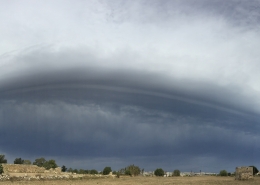 https://maltaclouds.net/wp-content/uploads/2018/09/Roll-cloud.jpg?v=1569920134
3112
9794
admin
http://maltaclouds.net/wp-content/uploads/2018/10/logo-1-300x138.png
admin2016-06-05 18:46:452018-10-26 18:49:47Ac volutus
https://maltaclouds.net/wp-content/uploads/2018/09/Roll-cloud.jpg?v=1569920134
3112
9794
admin
http://maltaclouds.net/wp-content/uploads/2018/10/logo-1-300x138.png
admin2016-06-05 18:46:452018-10-26 18:49:47Ac volutus https://maltaclouds.net/wp-content/uploads/2018/09/Ac-castellanus21.jpg?v=1569920215
2925
4828
admin
http://maltaclouds.net/wp-content/uploads/2018/10/logo-1-300x138.png
admin2016-06-01 18:50:282018-10-26 18:53:13Ac castellanus
https://maltaclouds.net/wp-content/uploads/2018/09/Ac-castellanus21.jpg?v=1569920215
2925
4828
admin
http://maltaclouds.net/wp-content/uploads/2018/10/logo-1-300x138.png
admin2016-06-01 18:50:282018-10-26 18:53:13Ac castellanus https://maltaclouds.net/wp-content/uploads/2018/09/Ac-undulatus38.jpg?v=1569920145
2448
3264
admin
http://maltaclouds.net/wp-content/uploads/2018/10/logo-1-300x138.png
admin2016-05-31 18:53:482018-10-26 18:56:21Ac undulatus
https://maltaclouds.net/wp-content/uploads/2018/09/Ac-undulatus38.jpg?v=1569920145
2448
3264
admin
http://maltaclouds.net/wp-content/uploads/2018/10/logo-1-300x138.png
admin2016-05-31 18:53:482018-10-26 18:56:21Ac undulatus https://maltaclouds.net/wp-content/uploads/2018/09/Ac-undulatus37.jpg?v=1569920146
3144
7224
admin
http://maltaclouds.net/wp-content/uploads/2018/10/logo-1-300x138.png
admin2016-05-19 18:56:542018-10-26 18:59:34Ac undulatus
https://maltaclouds.net/wp-content/uploads/2018/09/Ac-undulatus37.jpg?v=1569920146
3144
7224
admin
http://maltaclouds.net/wp-content/uploads/2018/10/logo-1-300x138.png
admin2016-05-19 18:56:542018-10-26 18:59:34Ac undulatus https://maltaclouds.net/wp-content/uploads/2018/09/Ac-undulatus36.jpg?v=1569920146
1365
2048
admin
http://maltaclouds.net/wp-content/uploads/2018/10/logo-1-300x138.png
admin2016-05-07 18:59:582018-11-17 16:12:36Ac undulatus
https://maltaclouds.net/wp-content/uploads/2018/09/Ac-undulatus36.jpg?v=1569920146
1365
2048
admin
http://maltaclouds.net/wp-content/uploads/2018/10/logo-1-300x138.png
admin2016-05-07 18:59:582018-11-17 16:12:36Ac undulatus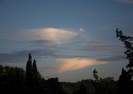 https://maltaclouds.net/wp-content/uploads/2018/09/Ac-virga13.jpg?v=1569920138
1365
2048
admin
http://maltaclouds.net/wp-content/uploads/2018/10/logo-1-300x138.png
admin2016-05-06 13:24:022018-10-27 13:26:04Ac virga
https://maltaclouds.net/wp-content/uploads/2018/09/Ac-virga13.jpg?v=1569920138
1365
2048
admin
http://maltaclouds.net/wp-content/uploads/2018/10/logo-1-300x138.png
admin2016-05-06 13:24:022018-10-27 13:26:04Ac virga https://maltaclouds.net/wp-content/uploads/2018/09/Ac-undulatus35.jpg?v=1569920147
3072
2048
admin
http://maltaclouds.net/wp-content/uploads/2018/10/logo-1-300x138.png
admin2016-04-30 13:26:302018-10-27 13:28:28Ac undulatus
https://maltaclouds.net/wp-content/uploads/2018/09/Ac-undulatus35.jpg?v=1569920147
3072
2048
admin
http://maltaclouds.net/wp-content/uploads/2018/10/logo-1-300x138.png
admin2016-04-30 13:26:302018-10-27 13:28:28Ac undulatus https://maltaclouds.net/wp-content/uploads/2018/09/Ac-virga12.jpg?v=1569920139
2448
3264
admin
http://maltaclouds.net/wp-content/uploads/2018/10/logo-1-300x138.png
admin2016-04-27 13:28:532018-10-27 13:31:18Ac virga
https://maltaclouds.net/wp-content/uploads/2018/09/Ac-virga12.jpg?v=1569920139
2448
3264
admin
http://maltaclouds.net/wp-content/uploads/2018/10/logo-1-300x138.png
admin2016-04-27 13:28:532018-10-27 13:31:18Ac virga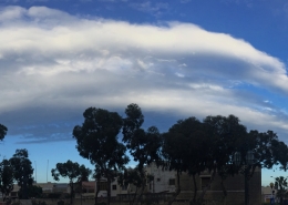 https://maltaclouds.net/wp-content/uploads/2018/09/Ac-undulatus34.jpg?v=1569920148
2549
8154
admin
http://maltaclouds.net/wp-content/uploads/2018/10/logo-1-300x138.png
admin2016-04-07 13:31:502018-10-27 13:34:36Ac undulatus
https://maltaclouds.net/wp-content/uploads/2018/09/Ac-undulatus34.jpg?v=1569920148
2549
8154
admin
http://maltaclouds.net/wp-content/uploads/2018/10/logo-1-300x138.png
admin2016-04-07 13:31:502018-10-27 13:34:36Ac undulatus https://maltaclouds.net/wp-content/uploads/2018/09/Ac-floccus9.jpg?v=1569920204
2048
3072
admin
http://maltaclouds.net/wp-content/uploads/2018/10/logo-1-300x138.png
admin2016-03-06 13:35:082018-10-27 13:51:45Ac floccus
https://maltaclouds.net/wp-content/uploads/2018/09/Ac-floccus9.jpg?v=1569920204
2048
3072
admin
http://maltaclouds.net/wp-content/uploads/2018/10/logo-1-300x138.png
admin2016-03-06 13:35:082018-10-27 13:51:45Ac floccus https://maltaclouds.net/wp-content/uploads/2018/09/Ac-floccus8.jpg?v=1569920204
2048
3072
admin
http://maltaclouds.net/wp-content/uploads/2018/10/logo-1-300x138.png
admin2016-02-16 13:52:102018-10-27 13:54:40Ac floccus
https://maltaclouds.net/wp-content/uploads/2018/09/Ac-floccus8.jpg?v=1569920204
2048
3072
admin
http://maltaclouds.net/wp-content/uploads/2018/10/logo-1-300x138.png
admin2016-02-16 13:52:102018-10-27 13:54:40Ac floccus https://maltaclouds.net/wp-content/uploads/2018/09/Ac-virga10.jpg?v=1569920139
2448
3264
admin
http://maltaclouds.net/wp-content/uploads/2018/10/logo-1-300x138.png
admin2016-02-13 13:55:112018-10-27 13:57:30Ac virga
https://maltaclouds.net/wp-content/uploads/2018/09/Ac-virga10.jpg?v=1569920139
2448
3264
admin
http://maltaclouds.net/wp-content/uploads/2018/10/logo-1-300x138.png
admin2016-02-13 13:55:112018-10-27 13:57:30Ac virga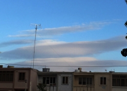 https://maltaclouds.net/wp-content/uploads/2018/09/Ac-lenticularis3.jpg?v=1569920199
1360
2644
admin
http://maltaclouds.net/wp-content/uploads/2018/10/logo-1-300x138.png
admin2016-02-10 13:58:072018-10-27 14:00:55Ac lenticularis
https://maltaclouds.net/wp-content/uploads/2018/09/Ac-lenticularis3.jpg?v=1569920199
1360
2644
admin
http://maltaclouds.net/wp-content/uploads/2018/10/logo-1-300x138.png
admin2016-02-10 13:58:072018-10-27 14:00:55Ac lenticularis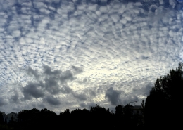 https://maltaclouds.net/wp-content/uploads/2018/09/Ac-perlucidus15.jpg?v=1569920176
3072
7146
admin
http://maltaclouds.net/wp-content/uploads/2018/10/logo-1-300x138.png
admin2016-02-07 14:01:292018-10-27 14:04:03Ac perlucidus
https://maltaclouds.net/wp-content/uploads/2018/09/Ac-perlucidus15.jpg?v=1569920176
3072
7146
admin
http://maltaclouds.net/wp-content/uploads/2018/10/logo-1-300x138.png
admin2016-02-07 14:01:292018-10-27 14:04:03Ac perlucidus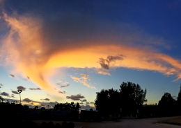 https://maltaclouds.net/wp-content/uploads/2018/09/Ac-virga9.jpg?v=1569920140
3116
6366
admin
http://maltaclouds.net/wp-content/uploads/2018/10/logo-1-300x138.png
admin2016-01-18 14:04:352018-10-27 14:07:20Ac virga
https://maltaclouds.net/wp-content/uploads/2018/09/Ac-virga9.jpg?v=1569920140
3116
6366
admin
http://maltaclouds.net/wp-content/uploads/2018/10/logo-1-300x138.png
admin2016-01-18 14:04:352018-10-27 14:07:20Ac virga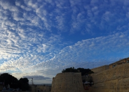 https://maltaclouds.net/wp-content/uploads/2018/09/Ac-undulatus33-1.jpg?v=1569919753
3152
6554
admin
http://maltaclouds.net/wp-content/uploads/2018/10/logo-1-300x138.png
admin2016-01-15 15:33:302019-06-01 15:35:38Ac undulatus
https://maltaclouds.net/wp-content/uploads/2018/09/Ac-undulatus33-1.jpg?v=1569919753
3152
6554
admin
http://maltaclouds.net/wp-content/uploads/2018/10/logo-1-300x138.png
admin2016-01-15 15:33:302019-06-01 15:35:38Ac undulatus https://maltaclouds.net/wp-content/uploads/2018/09/Ac-floccus7.jpg?v=1569920205
2448
3264
admin
http://maltaclouds.net/wp-content/uploads/2018/10/logo-1-300x138.png
admin2016-01-04 14:07:512018-10-30 17:41:44Ac floccus
https://maltaclouds.net/wp-content/uploads/2018/09/Ac-floccus7.jpg?v=1569920205
2448
3264
admin
http://maltaclouds.net/wp-content/uploads/2018/10/logo-1-300x138.png
admin2016-01-04 14:07:512018-10-30 17:41:44Ac floccus https://maltaclouds.net/wp-content/uploads/2018/09/Ac-undulatus32.jpg?v=1569920149
3084
6742
admin
http://maltaclouds.net/wp-content/uploads/2018/10/logo-1-300x138.png
admin2015-10-30 14:10:552019-10-02 17:56:54Ac undulatus
https://maltaclouds.net/wp-content/uploads/2018/09/Ac-undulatus32.jpg?v=1569920149
3084
6742
admin
http://maltaclouds.net/wp-content/uploads/2018/10/logo-1-300x138.png
admin2015-10-30 14:10:552019-10-02 17:56:54Ac undulatus https://maltaclouds.net/wp-content/uploads/2018/09/Ac-castellanus20.jpg?v=1569920216
1365
2048
admin
http://maltaclouds.net/wp-content/uploads/2018/10/logo-1-300x138.png
admin2015-10-10 14:19:402018-10-27 14:22:01Ac castellanus
https://maltaclouds.net/wp-content/uploads/2018/09/Ac-castellanus20.jpg?v=1569920216
1365
2048
admin
http://maltaclouds.net/wp-content/uploads/2018/10/logo-1-300x138.png
admin2015-10-10 14:19:402018-10-27 14:22:01Ac castellanus https://maltaclouds.net/wp-content/uploads/2018/09/Ac-undulatus31.jpg?v=1569920150
1365
2048
admin
http://maltaclouds.net/wp-content/uploads/2018/10/logo-1-300x138.png
admin2015-10-10 14:15:042018-10-27 14:18:38Ac undulatus
https://maltaclouds.net/wp-content/uploads/2018/09/Ac-undulatus31.jpg?v=1569920150
1365
2048
admin
http://maltaclouds.net/wp-content/uploads/2018/10/logo-1-300x138.png
admin2015-10-10 14:15:042018-10-27 14:18:38Ac undulatus https://maltaclouds.net/wp-content/uploads/2018/09/Ac-castellanus19-1.jpg?v=1569920217
1536
2048
admin
http://maltaclouds.net/wp-content/uploads/2018/10/logo-1-300x138.png
admin2015-09-08 14:22:252018-10-27 14:25:33Ac castellanus
https://maltaclouds.net/wp-content/uploads/2018/09/Ac-castellanus19-1.jpg?v=1569920217
1536
2048
admin
http://maltaclouds.net/wp-content/uploads/2018/10/logo-1-300x138.png
admin2015-09-08 14:22:252018-10-27 14:25:33Ac castellanus https://maltaclouds.net/wp-content/uploads/2018/09/Ac-lacunosos.jpg?v=1569920201
768
1024
admin
http://maltaclouds.net/wp-content/uploads/2018/10/logo-1-300x138.png
admin2015-08-16 14:26:062018-10-27 15:45:38Ac lacunosos
https://maltaclouds.net/wp-content/uploads/2018/09/Ac-lacunosos.jpg?v=1569920201
768
1024
admin
http://maltaclouds.net/wp-content/uploads/2018/10/logo-1-300x138.png
admin2015-08-16 14:26:062018-10-27 15:45:38Ac lacunosos https://maltaclouds.net/wp-content/uploads/2018/09/Ac-undulatus30-1.jpg?v=1569920150
1806
2592
admin
http://maltaclouds.net/wp-content/uploads/2018/10/logo-1-300x138.png
admin2015-06-26 14:31:152018-10-27 14:34:04Ac undulatus
https://maltaclouds.net/wp-content/uploads/2018/09/Ac-undulatus30-1.jpg?v=1569920150
1806
2592
admin
http://maltaclouds.net/wp-content/uploads/2018/10/logo-1-300x138.png
admin2015-06-26 14:31:152018-10-27 14:34:04Ac undulatus https://maltaclouds.net/wp-content/uploads/2018/09/Ac-undulatus29-1.jpg?v=1569920151
1944
2592
admin
http://maltaclouds.net/wp-content/uploads/2018/10/logo-1-300x138.png
admin2015-06-24 14:35:042018-10-27 14:38:39Ac undulatus
https://maltaclouds.net/wp-content/uploads/2018/09/Ac-undulatus29-1.jpg?v=1569920151
1944
2592
admin
http://maltaclouds.net/wp-content/uploads/2018/10/logo-1-300x138.png
admin2015-06-24 14:35:042018-10-27 14:38:39Ac undulatus https://maltaclouds.net/wp-content/uploads/2018/09/Ac-virga8-1.jpg?v=1569920141
1498
1989
admin
http://maltaclouds.net/wp-content/uploads/2018/10/logo-1-300x138.png
admin2015-05-30 14:39:302018-10-27 14:42:41Ac virga
https://maltaclouds.net/wp-content/uploads/2018/09/Ac-virga8-1.jpg?v=1569920141
1498
1989
admin
http://maltaclouds.net/wp-content/uploads/2018/10/logo-1-300x138.png
admin2015-05-30 14:39:302018-10-27 14:42:41Ac virga https://maltaclouds.net/wp-content/uploads/2018/09/Ac-radiatus1-1.jpg?v=1569920174
1536
2048
admin
http://maltaclouds.net/wp-content/uploads/2018/10/logo-1-300x138.png
admin2015-05-18 14:43:322018-11-17 16:15:22Ac radiatus
https://maltaclouds.net/wp-content/uploads/2018/09/Ac-radiatus1-1.jpg?v=1569920174
1536
2048
admin
http://maltaclouds.net/wp-content/uploads/2018/10/logo-1-300x138.png
admin2015-05-18 14:43:322018-11-17 16:15:22Ac radiatus https://maltaclouds.net/wp-content/uploads/2018/09/Ac-undulatus28-1.jpg?v=1569920152
1536
2048
admin
http://maltaclouds.net/wp-content/uploads/2018/10/logo-1-300x138.png
admin2015-05-10 14:49:452018-11-17 16:17:11Ac undulatus
https://maltaclouds.net/wp-content/uploads/2018/09/Ac-undulatus28-1.jpg?v=1569920152
1536
2048
admin
http://maltaclouds.net/wp-content/uploads/2018/10/logo-1-300x138.png
admin2015-05-10 14:49:452018-11-17 16:17:11Ac undulatus https://maltaclouds.net/wp-content/uploads/2018/09/Ac-opacus5-1.jpg?v=1569920185
1944
2592
admin
http://maltaclouds.net/wp-content/uploads/2018/10/logo-1-300x138.png
admin2015-04-30 14:54:172018-10-27 14:57:37Ac opacus
https://maltaclouds.net/wp-content/uploads/2018/09/Ac-opacus5-1.jpg?v=1569920185
1944
2592
admin
http://maltaclouds.net/wp-content/uploads/2018/10/logo-1-300x138.png
admin2015-04-30 14:54:172018-10-27 14:57:37Ac opacus https://maltaclouds.net/wp-content/uploads/2018/09/Ac-undulatus27-1.jpg?v=1569920153
1944
2592
admin
http://maltaclouds.net/wp-content/uploads/2018/10/logo-1-300x138.png
admin2015-04-24 14:58:112018-10-27 15:00:22Ac undulatus
https://maltaclouds.net/wp-content/uploads/2018/09/Ac-undulatus27-1.jpg?v=1569920153
1944
2592
admin
http://maltaclouds.net/wp-content/uploads/2018/10/logo-1-300x138.png
admin2015-04-24 14:58:112018-10-27 15:00:22Ac undulatus https://maltaclouds.net/wp-content/uploads/2018/09/Ac-perlucidus14-1.jpg?v=1569920177
1944
2592
admin
http://maltaclouds.net/wp-content/uploads/2018/10/logo-1-300x138.png
admin2015-03-04 15:00:552018-10-27 15:03:13Ac perlucidus
https://maltaclouds.net/wp-content/uploads/2018/09/Ac-perlucidus14-1.jpg?v=1569920177
1944
2592
admin
http://maltaclouds.net/wp-content/uploads/2018/10/logo-1-300x138.png
admin2015-03-04 15:00:552018-10-27 15:03:13Ac perlucidus https://maltaclouds.net/wp-content/uploads/2018/09/Ac-stratiformis12-1.jpg?v=1569920172
1536
2048
admin
http://maltaclouds.net/wp-content/uploads/2018/10/logo-1-300x138.png
admin2014-12-28 15:03:502018-10-27 15:06:52Ac stratiformis
https://maltaclouds.net/wp-content/uploads/2018/09/Ac-stratiformis12-1.jpg?v=1569920172
1536
2048
admin
http://maltaclouds.net/wp-content/uploads/2018/10/logo-1-300x138.png
admin2014-12-28 15:03:502018-10-27 15:06:52Ac stratiformis https://maltaclouds.net/wp-content/uploads/2018/09/Ac-virga7-1.jpg?v=1569920142
1536
2048
admin
http://maltaclouds.net/wp-content/uploads/2018/10/logo-1-300x138.png
admin2014-12-15 15:13:452018-10-27 15:32:05Ac virga
https://maltaclouds.net/wp-content/uploads/2018/09/Ac-virga7-1.jpg?v=1569920142
1536
2048
admin
http://maltaclouds.net/wp-content/uploads/2018/10/logo-1-300x138.png
admin2014-12-15 15:13:452018-10-27 15:32:05Ac virga https://maltaclouds.net/wp-content/uploads/2018/09/Ac-mammatus7-1.jpg?v=1569920191
1536
2048
admin
http://maltaclouds.net/wp-content/uploads/2018/10/logo-1-300x138.png
admin2014-12-15 15:07:212018-11-17 16:12:59Ac mammatus
https://maltaclouds.net/wp-content/uploads/2018/09/Ac-mammatus7-1.jpg?v=1569920191
1536
2048
admin
http://maltaclouds.net/wp-content/uploads/2018/10/logo-1-300x138.png
admin2014-12-15 15:07:212018-11-17 16:12:59Ac mammatus https://maltaclouds.net/wp-content/uploads/2018/09/Ac-undulatus26-1.jpg?v=1569920154
1536
3493
admin
http://maltaclouds.net/wp-content/uploads/2018/10/logo-1-300x138.png
admin2014-12-09 15:36:002018-10-27 15:43:37Ac opacus
https://maltaclouds.net/wp-content/uploads/2018/09/Ac-undulatus26-1.jpg?v=1569920154
1536
3493
admin
http://maltaclouds.net/wp-content/uploads/2018/10/logo-1-300x138.png
admin2014-12-09 15:36:002018-10-27 15:43:37Ac opacus https://maltaclouds.net/wp-content/uploads/2018/09/Ac-undulatus25-1.jpg?v=1569920154
1944
2592
admin
http://maltaclouds.net/wp-content/uploads/2018/10/logo-1-300x138.png
admin2014-12-03 15:12:032018-10-28 15:14:01Ac undulatus
https://maltaclouds.net/wp-content/uploads/2018/09/Ac-undulatus25-1.jpg?v=1569920154
1944
2592
admin
http://maltaclouds.net/wp-content/uploads/2018/10/logo-1-300x138.png
admin2014-12-03 15:12:032018-10-28 15:14:01Ac undulatus https://maltaclouds.net/wp-content/uploads/2018/09/Ac-opacus4-1.jpg?v=1569920187
2304
3072
admin
http://maltaclouds.net/wp-content/uploads/2018/10/logo-1-300x138.png
admin2014-11-26 15:14:532018-10-28 15:17:16Ac opacus
https://maltaclouds.net/wp-content/uploads/2018/09/Ac-opacus4-1.jpg?v=1569920187
2304
3072
admin
http://maltaclouds.net/wp-content/uploads/2018/10/logo-1-300x138.png
admin2014-11-26 15:14:532018-10-28 15:17:16Ac opacus https://maltaclouds.net/wp-content/uploads/2018/09/Ac-undulatus24-OtherView.jpg?v=1569921107
1944
2592
admin
http://maltaclouds.net/wp-content/uploads/2018/10/logo-1-300x138.png
admin2014-11-04 15:18:362018-10-28 15:21:01Ac undulatus
https://maltaclouds.net/wp-content/uploads/2018/09/Ac-undulatus24-OtherView.jpg?v=1569921107
1944
2592
admin
http://maltaclouds.net/wp-content/uploads/2018/10/logo-1-300x138.png
admin2014-11-04 15:18:362018-10-28 15:21:01Ac undulatus https://maltaclouds.net/wp-content/uploads/2018/09/Ac-perlucidus13-1.jpg?v=1569920178
2304
3072
admin
http://maltaclouds.net/wp-content/uploads/2018/10/logo-1-300x138.png
admin2014-11-02 18:22:172018-10-28 18:25:19Ac perlucidus
https://maltaclouds.net/wp-content/uploads/2018/09/Ac-perlucidus13-1.jpg?v=1569920178
2304
3072
admin
http://maltaclouds.net/wp-content/uploads/2018/10/logo-1-300x138.png
admin2014-11-02 18:22:172018-10-28 18:25:19Ac perlucidus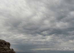 https://maltaclouds.net/wp-content/uploads/2018/09/Ac-undulatus23-OtherView.jpg?v=1569921108
1536
2048
admin
http://maltaclouds.net/wp-content/uploads/2018/10/logo-1-300x138.png
admin2014-10-04 19:13:262018-10-30 18:18:45Ac undulatus
https://maltaclouds.net/wp-content/uploads/2018/09/Ac-undulatus23-OtherView.jpg?v=1569921108
1536
2048
admin
http://maltaclouds.net/wp-content/uploads/2018/10/logo-1-300x138.png
admin2014-10-04 19:13:262018-10-30 18:18:45Ac undulatus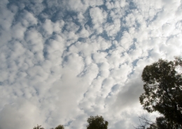 https://maltaclouds.net/wp-content/uploads/2018/09/Ac-perlucidus12-1.jpg?v=1569920179
1536
2048
admin
http://maltaclouds.net/wp-content/uploads/2018/10/logo-1-300x138.png
admin2014-10-03 19:17:162018-11-17 16:27:23Ac perlucidus
https://maltaclouds.net/wp-content/uploads/2018/09/Ac-perlucidus12-1.jpg?v=1569920179
1536
2048
admin
http://maltaclouds.net/wp-content/uploads/2018/10/logo-1-300x138.png
admin2014-10-03 19:17:162018-11-17 16:27:23Ac perlucidus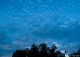 https://maltaclouds.net/wp-content/uploads/2018/09/Ac-duplicatus-1.jpg?v=1569920210
1536
2048
admin
http://maltaclouds.net/wp-content/uploads/2018/10/logo-1-300x138.png
admin2014-09-08 19:30:272018-10-28 19:34:18Ac duplicatus
https://maltaclouds.net/wp-content/uploads/2018/09/Ac-duplicatus-1.jpg?v=1569920210
1536
2048
admin
http://maltaclouds.net/wp-content/uploads/2018/10/logo-1-300x138.png
admin2014-09-08 19:30:272018-10-28 19:34:18Ac duplicatus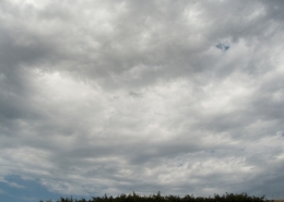 https://maltaclouds.net/wp-content/uploads/2018/09/Ac-undulatus22-1.jpg?v=1569920157
1536
2048
admin
http://maltaclouds.net/wp-content/uploads/2018/10/logo-1-300x138.png
admin2014-08-24 19:35:552018-10-28 19:38:33Ac undulatus
https://maltaclouds.net/wp-content/uploads/2018/09/Ac-undulatus22-1.jpg?v=1569920157
1536
2048
admin
http://maltaclouds.net/wp-content/uploads/2018/10/logo-1-300x138.png
admin2014-08-24 19:35:552018-10-28 19:38:33Ac undulatus https://maltaclouds.net/wp-content/uploads/2018/09/Ac-castellanus18-1.jpg?v=1569920218
2736
3648
admin
http://maltaclouds.net/wp-content/uploads/2018/10/logo-1-300x138.png
admin2014-07-30 19:39:282018-10-28 19:42:12Ac castellanus
https://maltaclouds.net/wp-content/uploads/2018/09/Ac-castellanus18-1.jpg?v=1569920218
2736
3648
admin
http://maltaclouds.net/wp-content/uploads/2018/10/logo-1-300x138.png
admin2014-07-30 19:39:282018-10-28 19:42:12Ac castellanus https://maltaclouds.net/wp-content/uploads/2018/09/Ac-castellanus17-1.jpg?v=1569920219
3240
4320
admin
http://maltaclouds.net/wp-content/uploads/2018/10/logo-1-300x138.png
admin2014-07-10 19:43:562018-10-28 19:46:27Ac castellanus
https://maltaclouds.net/wp-content/uploads/2018/09/Ac-castellanus17-1.jpg?v=1569920219
3240
4320
admin
http://maltaclouds.net/wp-content/uploads/2018/10/logo-1-300x138.png
admin2014-07-10 19:43:562018-10-28 19:46:27Ac castellanus https://maltaclouds.net/wp-content/uploads/2018/09/Ac-virga6-1.jpg?v=1569920143
1536
2048
admin
http://maltaclouds.net/wp-content/uploads/2018/10/logo-1-300x138.png
admin2014-07-09 19:47:052018-10-28 19:49:40Ac virga
https://maltaclouds.net/wp-content/uploads/2018/09/Ac-virga6-1.jpg?v=1569920143
1536
2048
admin
http://maltaclouds.net/wp-content/uploads/2018/10/logo-1-300x138.png
admin2014-07-09 19:47:052018-10-28 19:49:40Ac virga https://maltaclouds.net/wp-content/uploads/2018/09/Ac-undulatus21-1.jpg?v=1569920157
3240
4320
admin
http://maltaclouds.net/wp-content/uploads/2018/10/logo-1-300x138.png
admin2014-06-03 19:50:272018-10-28 19:52:45Ac undulatus
https://maltaclouds.net/wp-content/uploads/2018/09/Ac-undulatus21-1.jpg?v=1569920157
3240
4320
admin
http://maltaclouds.net/wp-content/uploads/2018/10/logo-1-300x138.png
admin2014-06-03 19:50:272018-10-28 19:52:45Ac undulatus https://maltaclouds.net/wp-content/uploads/2018/09/Ac-virga5-1.jpg?v=1569920143
1536
2048
admin
http://maltaclouds.net/wp-content/uploads/2018/10/logo-1-300x138.png
admin2014-06-01 19:53:252018-10-28 19:56:30Ac virga
https://maltaclouds.net/wp-content/uploads/2018/09/Ac-virga5-1.jpg?v=1569920143
1536
2048
admin
http://maltaclouds.net/wp-content/uploads/2018/10/logo-1-300x138.png
admin2014-06-01 19:53:252018-10-28 19:56:30Ac virga https://maltaclouds.net/wp-content/uploads/2018/09/Ac-perlucidus11-1.jpg?v=1569920179
3240
4320
admin
http://maltaclouds.net/wp-content/uploads/2018/10/logo-1-300x138.png
admin2014-03-25 18:43:362018-10-29 18:46:16Ac perlucidus
https://maltaclouds.net/wp-content/uploads/2018/09/Ac-perlucidus11-1.jpg?v=1569920179
3240
4320
admin
http://maltaclouds.net/wp-content/uploads/2018/10/logo-1-300x138.png
admin2014-03-25 18:43:362018-10-29 18:46:16Ac perlucidus https://maltaclouds.net/wp-content/uploads/2018/09/Ac-floccus6-1.jpg?v=1569920206
1536
2048
admin
http://maltaclouds.net/wp-content/uploads/2018/10/logo-1-300x138.png
admin2014-02-10 18:49:412018-11-17 16:13:24Ac floccus
https://maltaclouds.net/wp-content/uploads/2018/09/Ac-floccus6-1.jpg?v=1569920206
1536
2048
admin
http://maltaclouds.net/wp-content/uploads/2018/10/logo-1-300x138.png
admin2014-02-10 18:49:412018-11-17 16:13:24Ac floccus https://maltaclouds.net/wp-content/uploads/2018/09/Ac-undulatus19-1.jpg?v=1569920158
3240
4320
admin
http://maltaclouds.net/wp-content/uploads/2018/10/logo-1-300x138.png
admin2014-02-05 19:02:232018-10-29 19:05:10Ac undulatus
https://maltaclouds.net/wp-content/uploads/2018/09/Ac-undulatus19-1.jpg?v=1569920158
3240
4320
admin
http://maltaclouds.net/wp-content/uploads/2018/10/logo-1-300x138.png
admin2014-02-05 19:02:232018-10-29 19:05:10Ac undulatus https://maltaclouds.net/wp-content/uploads/2018/09/Ac-mammatus5-1.jpg?v=1569920192
1536
2048
admin
http://maltaclouds.net/wp-content/uploads/2018/10/logo-1-300x138.png
admin2014-01-28 19:05:442018-11-17 16:30:29Ac mammatus
https://maltaclouds.net/wp-content/uploads/2018/09/Ac-mammatus5-1.jpg?v=1569920192
1536
2048
admin
http://maltaclouds.net/wp-content/uploads/2018/10/logo-1-300x138.png
admin2014-01-28 19:05:442018-11-17 16:30:29Ac mammatus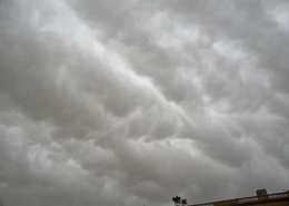 https://maltaclouds.net/wp-content/uploads/2018/09/Ac-mammatus4-1.jpg?v=1569920193
1536
2048
admin
http://maltaclouds.net/wp-content/uploads/2018/10/logo-1-300x138.png
admin2014-01-19 19:10:402018-10-29 19:13:31Ac mammatus
https://maltaclouds.net/wp-content/uploads/2018/09/Ac-mammatus4-1.jpg?v=1569920193
1536
2048
admin
http://maltaclouds.net/wp-content/uploads/2018/10/logo-1-300x138.png
admin2014-01-18 19:14:042018-10-29 19:16:31Ac undulatus
https://maltaclouds.net/wp-content/uploads/2018/09/Ac-mammatus4-1.jpg?v=1569920193
1536
2048
admin
http://maltaclouds.net/wp-content/uploads/2018/10/logo-1-300x138.png
admin2014-01-19 19:10:402018-10-29 19:13:31Ac mammatus
https://maltaclouds.net/wp-content/uploads/2018/09/Ac-mammatus4-1.jpg?v=1569920193
1536
2048
admin
http://maltaclouds.net/wp-content/uploads/2018/10/logo-1-300x138.png
admin2014-01-18 19:14:042018-10-29 19:16:31Ac undulatus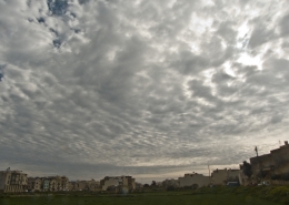 https://maltaclouds.net/wp-content/uploads/2018/09/Ac-perlucidus10-2.jpg?v=1569920180
1536
2048
admin
http://maltaclouds.net/wp-content/uploads/2018/10/logo-1-300x138.png
admin2014-01-12 19:20:352018-10-29 19:24:31Ac perlucidus
https://maltaclouds.net/wp-content/uploads/2018/09/Ac-perlucidus10-2.jpg?v=1569920180
1536
2048
admin
http://maltaclouds.net/wp-content/uploads/2018/10/logo-1-300x138.png
admin2014-01-12 19:20:352018-10-29 19:24:31Ac perlucidus https://maltaclouds.net/wp-content/uploads/2018/09/Ac-undulatus17-1.jpg?v=1569920160
1536
2048
admin
http://maltaclouds.net/wp-content/uploads/2018/10/logo-1-300x138.png
admin2014-01-05 19:25:072018-10-29 19:27:16Ac undulatus
https://maltaclouds.net/wp-content/uploads/2018/09/Ac-undulatus17-1.jpg?v=1569920160
1536
2048
admin
http://maltaclouds.net/wp-content/uploads/2018/10/logo-1-300x138.png
admin2014-01-05 19:25:072018-10-29 19:27:16Ac undulatus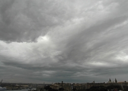 https://maltaclouds.net/wp-content/uploads/2018/09/Ac-undulatus16-1.jpg?v=1569920161
3240
4320
admin
http://maltaclouds.net/wp-content/uploads/2018/10/logo-1-300x138.png
admin2013-11-28 19:27:432018-10-29 19:30:41Ac undulatus
https://maltaclouds.net/wp-content/uploads/2018/09/Ac-undulatus16-1.jpg?v=1569920161
3240
4320
admin
http://maltaclouds.net/wp-content/uploads/2018/10/logo-1-300x138.png
admin2013-11-28 19:27:432018-10-29 19:30:41Ac undulatus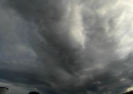 https://maltaclouds.net/wp-content/uploads/2018/09/Ac-undulatus15-1.jpg?v=1569920162
3240
4320
admin
http://maltaclouds.net/wp-content/uploads/2018/10/logo-1-300x138.png
admin2013-11-15 19:31:092018-11-17 16:13:53Ac undulatus
https://maltaclouds.net/wp-content/uploads/2018/09/Ac-undulatus15-1.jpg?v=1569920162
3240
4320
admin
http://maltaclouds.net/wp-content/uploads/2018/10/logo-1-300x138.png
admin2013-11-15 19:31:092018-11-17 16:13:53Ac undulatus https://maltaclouds.net/wp-content/uploads/2018/09/Ac-perlucidus9-1.jpg?v=1569920181
720
960
admin
http://maltaclouds.net/wp-content/uploads/2018/10/logo-1-300x138.png
admin2013-10-20 19:34:352018-10-29 19:36:05Ac perlucidus
https://maltaclouds.net/wp-content/uploads/2018/09/Ac-perlucidus9-1.jpg?v=1569920181
720
960
admin
http://maltaclouds.net/wp-content/uploads/2018/10/logo-1-300x138.png
admin2013-10-20 19:34:352018-10-29 19:36:05Ac perlucidus https://maltaclouds.net/wp-content/uploads/2018/09/Ac-stratiformis11-1.jpg?v=1569920172
1536
2048
admin
http://maltaclouds.net/wp-content/uploads/2018/10/logo-1-300x138.png
admin2013-10-13 19:37:052018-10-29 19:40:12Ac stratiformis
https://maltaclouds.net/wp-content/uploads/2018/09/Ac-stratiformis11-1.jpg?v=1569920172
1536
2048
admin
http://maltaclouds.net/wp-content/uploads/2018/10/logo-1-300x138.png
admin2013-10-13 19:37:052018-10-29 19:40:12Ac stratiformis https://maltaclouds.net/wp-content/uploads/2018/09/Ac-floccus4-1.jpg?v=1569920207
1536
2048
admin
http://maltaclouds.net/wp-content/uploads/2018/10/logo-1-300x138.png
admin2013-09-30 19:40:442018-10-29 19:42:48Ac floccus
https://maltaclouds.net/wp-content/uploads/2018/09/Ac-floccus4-1.jpg?v=1569920207
1536
2048
admin
http://maltaclouds.net/wp-content/uploads/2018/10/logo-1-300x138.png
admin2013-09-30 19:40:442018-10-29 19:42:48Ac floccus https://maltaclouds.net/wp-content/uploads/2013/09/Ac-perlucidus8.jpg?v=1569918450
1536
2048
admin
http://maltaclouds.net/wp-content/uploads/2018/10/logo-1-300x138.png
admin2013-09-11 19:43:272019-09-25 17:23:13Ac perlucidus
https://maltaclouds.net/wp-content/uploads/2013/09/Ac-perlucidus8.jpg?v=1569918450
1536
2048
admin
http://maltaclouds.net/wp-content/uploads/2018/10/logo-1-300x138.png
admin2013-09-11 19:43:272019-09-25 17:23:13Ac perlucidus https://maltaclouds.net/wp-content/uploads/2018/09/Ac-mammatus3-1.jpg?v=1569920194
1536
2048
admin
http://maltaclouds.net/wp-content/uploads/2018/10/logo-1-300x138.png
admin2013-09-01 19:45:422018-10-29 19:47:08Ac mammatus
https://maltaclouds.net/wp-content/uploads/2018/09/Ac-mammatus3-1.jpg?v=1569920194
1536
2048
admin
http://maltaclouds.net/wp-content/uploads/2018/10/logo-1-300x138.png
admin2013-09-01 19:45:422018-10-29 19:47:08Ac mammatus https://maltaclouds.net/wp-content/uploads/2018/09/Cu-congestus37-1.jpg?v=1569920135
3240
4320
admin
http://maltaclouds.net/wp-content/uploads/2018/10/logo-1-300x138.png
admin2013-06-06 19:48:142018-10-29 19:50:29Ac castellanus
https://maltaclouds.net/wp-content/uploads/2018/09/Cu-congestus37-1.jpg?v=1569920135
3240
4320
admin
http://maltaclouds.net/wp-content/uploads/2018/10/logo-1-300x138.png
admin2013-06-06 19:48:142018-10-29 19:50:29Ac castellanus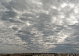 https://maltaclouds.net/wp-content/uploads/2018/09/Ac-stratiformis10-1.jpg?v=1569920173
1536
2048
admin
http://maltaclouds.net/wp-content/uploads/2018/10/logo-1-300x138.png
admin2013-06-01 19:51:212018-10-29 19:54:20Ac stratiformis
https://maltaclouds.net/wp-content/uploads/2018/09/Ac-stratiformis10-1.jpg?v=1569920173
1536
2048
admin
http://maltaclouds.net/wp-content/uploads/2018/10/logo-1-300x138.png
admin2013-06-01 19:51:212018-10-29 19:54:20Ac stratiformis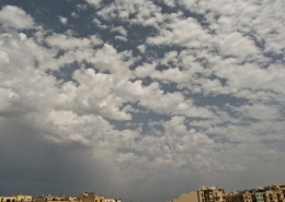 https://maltaclouds.net/wp-content/uploads/2018/09/Ac-castellanus15-1.jpg?v=1569920221
1536
2048
admin
http://maltaclouds.net/wp-content/uploads/2018/10/logo-1-300x138.png
admin2013-05-04 19:54:582018-10-29 19:58:26Ac castellanus
https://maltaclouds.net/wp-content/uploads/2018/09/Ac-castellanus15-1.jpg?v=1569920221
1536
2048
admin
http://maltaclouds.net/wp-content/uploads/2018/10/logo-1-300x138.png
admin2013-05-04 19:54:582018-10-29 19:58:26Ac castellanus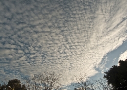 https://maltaclouds.net/wp-content/uploads/2018/09/Ac-castellanus14-1.jpg?v=1569920222
1536
2048
admin
http://maltaclouds.net/wp-content/uploads/2018/10/logo-1-300x138.png
admin2013-04-10 20:17:132018-10-29 20:19:54Ac castellanus
https://maltaclouds.net/wp-content/uploads/2018/09/Ac-castellanus14-1.jpg?v=1569920222
1536
2048
admin
http://maltaclouds.net/wp-content/uploads/2018/10/logo-1-300x138.png
admin2013-04-10 20:17:132018-10-29 20:19:54Ac castellanus https://maltaclouds.net/wp-content/uploads/2018/09/Ac-undulatus13-1.jpg?v=1569920162
1536
2048
admin
http://maltaclouds.net/wp-content/uploads/2018/10/logo-1-300x138.png
admin2013-04-02 20:03:152018-10-29 20:06:48Ac undulatus
https://maltaclouds.net/wp-content/uploads/2018/09/Ac-undulatus13-1.jpg?v=1569920162
1536
2048
admin
http://maltaclouds.net/wp-content/uploads/2018/10/logo-1-300x138.png
admin2013-04-02 20:03:152018-10-29 20:06:48Ac undulatus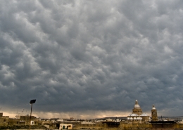 https://maltaclouds.net/wp-content/uploads/2018/09/Ac-mammatus1.jpg?v=1569924778
1536
2048
admin
http://maltaclouds.net/wp-content/uploads/2018/10/logo-1-300x138.png
admin2013-04-01 16:03:432018-10-30 16:07:13Ac mammatus
https://maltaclouds.net/wp-content/uploads/2018/09/Ac-mammatus1.jpg?v=1569924778
1536
2048
admin
http://maltaclouds.net/wp-content/uploads/2018/10/logo-1-300x138.png
admin2013-04-01 16:03:432018-10-30 16:07:13Ac mammatus https://maltaclouds.net/wp-content/uploads/2018/09/Ac-undulatus12-1.jpg?v=1569920163
1536
2048
admin
http://maltaclouds.net/wp-content/uploads/2018/10/logo-1-300x138.png
admin2013-03-11 16:07:522018-10-30 16:09:44Ac undulatus
https://maltaclouds.net/wp-content/uploads/2018/09/Ac-undulatus12-1.jpg?v=1569920163
1536
2048
admin
http://maltaclouds.net/wp-content/uploads/2018/10/logo-1-300x138.png
admin2013-03-11 16:07:522018-10-30 16:09:44Ac undulatus https://maltaclouds.net/wp-content/uploads/2018/09/Ac-lenticularis2-1.jpg?v=1569920199
2448
3264
admin
http://maltaclouds.net/wp-content/uploads/2018/10/logo-1-300x138.png
admin2013-02-18 16:10:162018-10-30 16:12:12Ac lenticularis
https://maltaclouds.net/wp-content/uploads/2018/09/Ac-lenticularis2-1.jpg?v=1569920199
2448
3264
admin
http://maltaclouds.net/wp-content/uploads/2018/10/logo-1-300x138.png
admin2013-02-18 16:10:162018-10-30 16:12:12Ac lenticularis https://maltaclouds.net/wp-content/uploads/2018/09/Ac-opacus2.jpg?v=1569924717
1536
2048
admin
http://maltaclouds.net/wp-content/uploads/2018/10/logo-1-300x138.png
admin2013-01-13 16:12:462018-10-30 16:15:36Ac opacus
https://maltaclouds.net/wp-content/uploads/2018/09/Ac-opacus2.jpg?v=1569924717
1536
2048
admin
http://maltaclouds.net/wp-content/uploads/2018/10/logo-1-300x138.png
admin2013-01-13 16:12:462018-10-30 16:15:36Ac opacus https://maltaclouds.net/wp-content/uploads/2018/09/Ac-perlucidus6-1.jpg?v=1569920182
1536
2048
admin
http://maltaclouds.net/wp-content/uploads/2018/10/logo-1-300x138.png
admin2012-12-16 16:17:402018-10-30 16:24:33Ac perlucidus
https://maltaclouds.net/wp-content/uploads/2018/09/Ac-perlucidus6-1.jpg?v=1569920182
1536
2048
admin
http://maltaclouds.net/wp-content/uploads/2018/10/logo-1-300x138.png
admin2012-12-16 16:17:402018-10-30 16:24:33Ac perlucidus https://maltaclouds.net/wp-content/uploads/2018/09/Ac-mamma6-1.jpg?v=1569920196
1944
2592
admin
http://maltaclouds.net/wp-content/uploads/2018/10/logo-1-300x138.png
admin2012-11-14 16:26:402018-10-30 16:28:37Ac mammatus
https://maltaclouds.net/wp-content/uploads/2018/09/Ac-mamma6-1.jpg?v=1569920196
1944
2592
admin
http://maltaclouds.net/wp-content/uploads/2018/10/logo-1-300x138.png
admin2012-11-14 16:26:402018-10-30 16:28:37Ac mammatus https://maltaclouds.net/wp-content/uploads/2018/09/Ac-undulatus11-1.jpg?v=1569920164
1536
2048
admin
http://maltaclouds.net/wp-content/uploads/2018/10/logo-1-300x138.png
admin2012-10-27 16:29:152018-10-30 16:31:16Ac undulatus
https://maltaclouds.net/wp-content/uploads/2018/09/Ac-undulatus11-1.jpg?v=1569920164
1536
2048
admin
http://maltaclouds.net/wp-content/uploads/2018/10/logo-1-300x138.png
admin2012-10-27 16:29:152018-10-30 16:31:16Ac undulatus https://maltaclouds.net/wp-content/uploads/2018/09/Ac-mamma5-1.jpg?v=1569920197
1944
2592
admin
http://maltaclouds.net/wp-content/uploads/2018/10/logo-1-300x138.png
admin2012-10-16 16:31:562018-10-30 16:35:11Ac mammatus
https://maltaclouds.net/wp-content/uploads/2018/09/Ac-mamma5-1.jpg?v=1569920197
1944
2592
admin
http://maltaclouds.net/wp-content/uploads/2018/10/logo-1-300x138.png
admin2012-10-16 16:31:562018-10-30 16:35:11Ac mammatus https://maltaclouds.net/wp-content/uploads/2018/09/Ac-mammatus2-1.jpg?v=1569920195
1944
2592
admin
http://maltaclouds.net/wp-content/uploads/2018/10/logo-1-300x138.png
admin2012-10-01 16:36:472018-10-30 16:39:29Ac mammatus
https://maltaclouds.net/wp-content/uploads/2018/09/Ac-mammatus2-1.jpg?v=1569920195
1944
2592
admin
http://maltaclouds.net/wp-content/uploads/2018/10/logo-1-300x138.png
admin2012-10-01 16:36:472018-10-30 16:39:29Ac mammatus https://maltaclouds.net/wp-content/uploads/2018/09/Ac-castellanus12-1.jpg?v=1569920222
1536
2048
admin
http://maltaclouds.net/wp-content/uploads/2018/10/logo-1-300x138.png
admin2012-09-13 16:40:002018-10-30 16:42:38Ac castellanus
https://maltaclouds.net/wp-content/uploads/2018/09/Ac-castellanus12-1.jpg?v=1569920222
1536
2048
admin
http://maltaclouds.net/wp-content/uploads/2018/10/logo-1-300x138.png
admin2012-09-13 16:40:002018-10-30 16:42:38Ac castellanus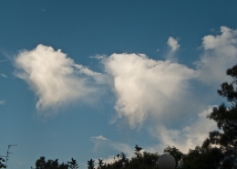 https://maltaclouds.net/wp-content/uploads/2018/09/Ac-virga4-1.jpg?v=1569920144
1536
2048
admin
http://maltaclouds.net/wp-content/uploads/2018/10/logo-1-300x138.png
admin2012-06-01 16:43:062018-10-30 16:45:10Ac virga
https://maltaclouds.net/wp-content/uploads/2018/09/Ac-virga4-1.jpg?v=1569920144
1536
2048
admin
http://maltaclouds.net/wp-content/uploads/2018/10/logo-1-300x138.png
admin2012-06-01 16:43:062018-10-30 16:45:10Ac virga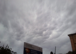 https://maltaclouds.net/wp-content/uploads/2018/10/Ac-mamma4.jpg?v=1569919589
1920
2560
admin
http://maltaclouds.net/wp-content/uploads/2018/10/logo-1-300x138.png
admin2012-04-23 16:45:522018-10-30 16:51:31Ac mammatus
https://maltaclouds.net/wp-content/uploads/2018/10/Ac-mamma4.jpg?v=1569919589
1920
2560
admin
http://maltaclouds.net/wp-content/uploads/2018/10/logo-1-300x138.png
admin2012-04-23 16:45:522018-10-30 16:51:31Ac mammatus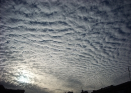 https://maltaclouds.net/wp-content/uploads/2018/09/Ac-undulatus10-1.jpg?v=1569920165
1536
2048
admin
http://maltaclouds.net/wp-content/uploads/2018/10/logo-1-300x138.png
admin2012-03-21 16:52:142018-10-30 16:54:08Ac undulatus
https://maltaclouds.net/wp-content/uploads/2018/09/Ac-undulatus10-1.jpg?v=1569920165
1536
2048
admin
http://maltaclouds.net/wp-content/uploads/2018/10/logo-1-300x138.png
admin2012-03-21 16:52:142018-10-30 16:54:08Ac undulatus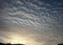 https://maltaclouds.net/wp-content/uploads/2018/09/Ac-undulatus8-1.jpg?v=1569920166
1536
2048
admin
http://maltaclouds.net/wp-content/uploads/2018/10/logo-1-300x138.png
admin2012-02-03 16:54:442018-10-30 16:57:15Ac undulatus
https://maltaclouds.net/wp-content/uploads/2018/09/Ac-undulatus8-1.jpg?v=1569920166
1536
2048
admin
http://maltaclouds.net/wp-content/uploads/2018/10/logo-1-300x138.png
admin2012-02-03 16:54:442018-10-30 16:57:15Ac undulatus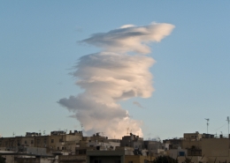 https://maltaclouds.net/wp-content/uploads/2018/09/Ac-lenticularis1-1.jpg?v=1569920200
1536
2048
admin
http://maltaclouds.net/wp-content/uploads/2018/10/logo-1-300x138.png
admin2011-12-25 16:58:222018-10-30 17:11:00Ac lenticularis
https://maltaclouds.net/wp-content/uploads/2018/09/Ac-lenticularis1-1.jpg?v=1569920200
1536
2048
admin
http://maltaclouds.net/wp-content/uploads/2018/10/logo-1-300x138.png
admin2011-12-25 16:58:222018-10-30 17:11:00Ac lenticularis https://maltaclouds.net/wp-content/uploads/2018/09/Ac-floccus3-1.jpg?v=1569920208
1536
2048
admin
http://maltaclouds.net/wp-content/uploads/2018/10/logo-1-300x138.png
admin2011-11-19 17:19:542018-10-30 17:23:01Ac floccus
https://maltaclouds.net/wp-content/uploads/2018/09/Ac-floccus3-1.jpg?v=1569920208
1536
2048
admin
http://maltaclouds.net/wp-content/uploads/2018/10/logo-1-300x138.png
admin2011-11-19 17:19:542018-10-30 17:23:01Ac floccus https://maltaclouds.net/wp-content/uploads/2018/09/Ac-undulatus6-1.jpg?v=1569920166
1536
2048
admin
http://maltaclouds.net/wp-content/uploads/2018/10/logo-1-300x138.png
admin2011-11-19 17:14:372018-10-30 17:18:20Ac perlucidus
https://maltaclouds.net/wp-content/uploads/2018/09/Ac-undulatus6-1.jpg?v=1569920166
1536
2048
admin
http://maltaclouds.net/wp-content/uploads/2018/10/logo-1-300x138.png
admin2011-11-19 17:14:372018-10-30 17:18:20Ac perlucidus https://maltaclouds.net/wp-content/uploads/2018/09/Ac-castellanustoundulatus-1.jpg?v=1569920212
1536
2048
admin
http://maltaclouds.net/wp-content/uploads/2018/10/logo-1-300x138.png
admin2011-10-28 17:27:012018-10-30 17:29:32Ac perlucidus
https://maltaclouds.net/wp-content/uploads/2018/09/Ac-castellanustoundulatus-1.jpg?v=1569920212
1536
2048
admin
http://maltaclouds.net/wp-content/uploads/2018/10/logo-1-300x138.png
admin2011-10-28 17:27:012018-10-30 17:29:32Ac perlucidus https://maltaclouds.net/wp-content/uploads/2018/09/Ac-floccus2-1.jpg?v=1569920208
1536
2048
admin
http://maltaclouds.net/wp-content/uploads/2018/10/logo-1-300x138.png
admin2011-10-08 17:30:212018-10-30 17:33:19Ac floccus
https://maltaclouds.net/wp-content/uploads/2018/09/Ac-floccus2-1.jpg?v=1569920208
1536
2048
admin
http://maltaclouds.net/wp-content/uploads/2018/10/logo-1-300x138.png
admin2011-10-08 17:30:212018-10-30 17:33:19Ac floccusAc undulatus

A beautiful and unusual cloud formation at sunset on this day with the cloud looking almost like a very large funnel. On the ground, it did not produce any precipitation or severe weather. The weather situation of the day is explained in the next photo and also there was a strong overhead jet stream. When I queried about this cloud photo online, the following answers were given: 1) Mr. Jesse Ferrel (B.Sc. in Meteorology) -> Yes I do believe it is Altocumulus perhaps two layers with the Virga above. 2) Accuweather -> Classifying clouds can often be difficult, and in cases such as this subjective — but one possible classification, and the preferred one if for no other reason than simplicity is cirrostratus undulatus. Alternatively, cirrocumulus castellanus, cirrocumulus stratiformis or even cirrostratus overlayed on altostratus could be considered. To begin with, the weather sounding taken at 12Z (14:00 CEST) showed 3 cloud layers being Stratus (actually Cumulus clouds were observed in the photo probably at the height indicated by the sounding of around 0.55km), Altocumulus covering altitudes between 1.74km and 4.33km and high-level clouds between 8.23km and 12.53km. Wind shear of the former cloud level as calculated by Jeff Haby formula was 6 units which means lots of wind shear while at high altitude where the high-level cloud was located little wind shear was present but the jet stream was a strong 130kmh. Given this detailed analysis from using the weather sounding, and that to form undulations in a cloud layer, it requires wind shear in order to make the whole air colomn rotate, I came to the conclusion that it was Altocumulus undulatus, althaugh the huge roll-like feature is very strange for an Altocumulus undulatus. It could also have been a peculiar combination of 2 different layers of clouds one altocumulus and other cirrus clouds just above it. Furthermore, a strong jet stream which was present on this day would form wind-swept high level clouds rather than rotation in the cloud layer given the lack of wind shear at that level. This cloud seemed to have been visible even from satellite imagery. The following thumbnails show another photo of the same cloud taken earlier before sunset, the weather sounding of the day and the jet stream chart. An 18Z (2000 CEST) sounding was also looked at but provided very little clouds that could have explained this unsual cloud formation for the Maltese Islands. The 850mb chart is also included in the thumbnails as the closely packed temperature lines might indicate a cold front at that level (1.5km) perhaps having triggered this cloud formation. Note: To calculate mid-level wind speed shear value, the wind values of 38 knots at 1.97km and 58 knots at 3.68km were used for calculation purposes.


Leave a Reply
Want to join the discussion?Feel free to contribute!