 https://maltaclouds.net/wp-content/uploads/2019/05/Ns-praecipitatio10.jpg?v=1569919541
2784
3712
admin
http://maltaclouds.net/wp-content/uploads/2018/10/logo-1-300x138.png
admin2019-03-27 18:55:212019-06-06 18:57:32Ns praecipitatio
 https://maltaclouds.net/wp-content/uploads/2019/05/Ns-pannus4.jpg?v=1569919523
1674
5013
admin
http://maltaclouds.net/wp-content/uploads/2018/10/logo-1-300x138.png
admin2019-01-11 18:51:592019-06-06 18:54:51Ns pannus
 https://maltaclouds.net/wp-content/uploads/2019/05/Ns-virga1.jpg?v=1569919522
2048
3072
admin
http://maltaclouds.net/wp-content/uploads/2018/10/logo-1-300x138.png
admin2019-01-10 18:47:522019-06-06 18:51:18Ns virga
 https://maltaclouds.net/wp-content/uploads/2019/05/Ns-praecipitatio9.jpg?v=1569919506
3888
5184
admin
http://maltaclouds.net/wp-content/uploads/2018/10/logo-1-300x138.png
admin2018-11-10 17:49:252019-06-17 18:24:36Ns praecipitatio
 https://maltaclouds.net/wp-content/uploads/2019/05/Ns-praecipitatio8.jpg?v=1569919500
2076
3264
admin
http://maltaclouds.net/wp-content/uploads/2018/10/logo-1-300x138.png
admin2018-10-31 17:41:412019-06-06 17:44:10Ns praecipitatio
 https://maltaclouds.net/wp-content/uploads/2019/05/Ns-pannus3.jpg?v=1569919496
1365
2048
admin
http://maltaclouds.net/wp-content/uploads/2018/10/logo-1-300x138.png
admin2018-10-13 17:39:482019-06-06 17:41:14Ns pannus
 https://maltaclouds.net/wp-content/uploads/2019/05/Ns-praecipitatio7.jpg?v=1569919446
1815
3072
admin
http://maltaclouds.net/wp-content/uploads/2018/10/logo-1-300x138.png
admin2018-02-03 17:36:572019-06-06 17:39:14Ns praecipitatio
 https://maltaclouds.net/wp-content/uploads/2018/09/Ns-praecipitatio6.jpg?v=1569919911
3166
6940
admin
http://maltaclouds.net/wp-content/uploads/2018/10/logo-1-300x138.png
admin2017-12-01 17:34:062019-06-06 17:36:15Ns praecipitatio
 https://maltaclouds.net/wp-content/uploads/2018/09/Ns-pannus2.jpg?v=1569919917
2899
4726
admin
http://maltaclouds.net/wp-content/uploads/2018/10/logo-1-300x138.png
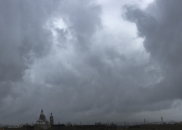
admin2017-10-05 17:30:512019-06-06 17:33:31Ns pannus
 https://maltaclouds.net/wp-content/uploads/2018/09/Ns-praecipitatio5-1.jpg?v=1569919912
1944
2592
admin
http://maltaclouds.net/wp-content/uploads/2018/10/logo-1-300x138.png
admin2015-05-18 17:10:492018-11-17 15:36:44Ns praecipitatio
 https://maltaclouds.net/wp-content/uploads/2018/09/Ns-praecipitatio4-1.jpg?v=1569919913
1536
2048
admin
http://maltaclouds.net/wp-content/uploads/2018/10/logo-1-300x138.png
admin2015-02-21 15:53:112018-10-21 14:08:57Ns praecipitatio
 https://maltaclouds.net/wp-content/uploads/2018/09/Ns-praecipitatio3-1.jpg?v=1569919913
1536
2048
admin
http://maltaclouds.net/wp-content/uploads/2018/10/logo-1-300x138.png
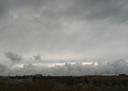
admin2014-05-03 16:13:142018-11-17 15:40:40Ns praecipitatio
 https://maltaclouds.net/wp-content/uploads/2018/09/Ns-praecipitatio2-1.jpg?v=1569919914
1536
2048
admin
http://maltaclouds.net/wp-content/uploads/2018/10/logo-1-300x138.png
admin2014-02-27 16:30:472018-10-21 14:10:48Ns praecipitatio
 https://maltaclouds.net/wp-content/uploads/2018/09/Ns-praecipitatio1-1.jpg?v=1569919915
1536
2048
admin
http://maltaclouds.net/wp-content/uploads/2018/10/logo-1-300x138.png
admin2014-02-01 16:40:162018-10-21 14:11:42Ns praecipitatio
 https://maltaclouds.net/wp-content/uploads/2018/09/Ns-praecipitatio-1.jpg?v=1569919916
3240
4320
admin
http://maltaclouds.net/wp-content/uploads/2018/10/logo-1-300x138.png
admin2014-01-06 16:45:202018-11-17 15:42:45Ns praecipitatio
 https://maltaclouds.net/wp-content/uploads/2018/09/Ns-virga-1.jpg?v=1569919909
1536
2048
admin
http://maltaclouds.net/wp-content/uploads/2018/10/logo-1-300x138.png
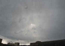
admin2014-01-05 16:51:282018-10-21 14:14:36Ns virga
 https://maltaclouds.net/wp-content/uploads/2018/09/Ns-pannus1-1.jpg?v=1569919918
1536
2048
admin
http://maltaclouds.net/wp-content/uploads/2018/10/logo-1-300x138.png
admin2011-11-17 17:03:422018-10-21 14:15:22Ns pannus
https://maltaclouds.net/wp-content/uploads/2018/09/Ns-pannus1-1.jpg?v=1569919918
1536
2048
admin
http://maltaclouds.net/wp-content/uploads/2018/10/logo-1-300x138.png
admin2011-11-17 17:03:422018-10-21 14:15:22Ns pannusNs praecipitatio
/ 0 Comments / in Low Levels, Nimbostratus
The same closed upper trough as explained here had arrived over the Maltese Islands as evidenced in the 500mb chart. However, due its arrival over Malta during the early morning whereby the air is at its most stable in late Spring due to lack of surface heating, this low pressure was only able to produce nimbostratus clouds also given the relative stability of the airmass in the weather sounding. Should it have arrived in the afternoon, the resultant cloud formation would surely have been different in the form of cumuliform clouds. This cloud had produced steady rain for around 2 hours in the morning with an accumulation of around 15mm which is more than the average monthly rainfall for May in Malta. The first thumbnail shows an unusual soggy May morning.


Leave a Reply
Want to join the discussion?Feel free to contribute!