 https://maltaclouds.net/wp-content/uploads/2019/09/Dry-microburst.jpg?v=1569918567
1365
2048
admin
http://maltaclouds.net/wp-content/uploads/2018/10/logo-1-300x138.png
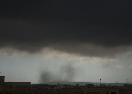
admin2019-07-15 16:10:482019-10-20 11:56:44Dry microburst
https://maltaclouds.net/wp-content/uploads/2019/09/Dry-microburst.jpg?v=1569918567
1365
2048
admin
http://maltaclouds.net/wp-content/uploads/2018/10/logo-1-300x138.png
admin2019-07-15 16:10:482019-10-20 11:56:44Dry microburst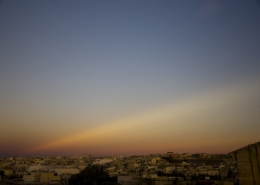 https://maltaclouds.net/wp-content/uploads/2019/09/Anticrepuscular-rays.jpg?v=1569918577
1365
2048
admin
http://maltaclouds.net/wp-content/uploads/2018/10/logo-1-300x138.png
admin2019-06-19 16:08:142019-09-03 16:16:36Anticrepuscular rays
https://maltaclouds.net/wp-content/uploads/2019/09/Anticrepuscular-rays.jpg?v=1569918577
1365
2048
admin
http://maltaclouds.net/wp-content/uploads/2018/10/logo-1-300x138.png
admin2019-06-19 16:08:142019-09-03 16:16:36Anticrepuscular rays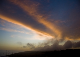 https://maltaclouds.net/wp-content/uploads/2019/09/Frontal-Zone.jpg?v=1569918566
1365
2048
admin
http://maltaclouds.net/wp-content/uploads/2018/10/logo-1-300x138.png
admin2019-05-26 15:53:542019-09-03 16:04:33Frontal Zone
https://maltaclouds.net/wp-content/uploads/2019/09/Frontal-Zone.jpg?v=1569918566
1365
2048
admin
http://maltaclouds.net/wp-content/uploads/2018/10/logo-1-300x138.png
admin2019-05-26 15:53:542019-09-03 16:04:33Frontal Zone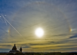 https://maltaclouds.net/wp-content/uploads/2019/09/Sundog.jpg?v=1569918563
2001
2895
admin
http://maltaclouds.net/wp-content/uploads/2018/10/logo-1-300x138.png
admin2019-05-21 15:47:142019-10-02 17:36:34Sundog
https://maltaclouds.net/wp-content/uploads/2019/09/Sundog.jpg?v=1569918563
2001
2895
admin
http://maltaclouds.net/wp-content/uploads/2018/10/logo-1-300x138.png
admin2019-05-21 15:47:142019-10-02 17:36:34Sundog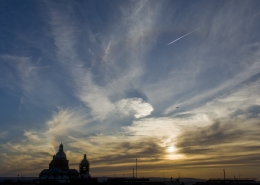 https://maltaclouds.net/wp-content/uploads/2019/09/Sun-dog.jpg?v=1569918564
2048
3072
admin
http://maltaclouds.net/wp-content/uploads/2018/10/logo-1-300x138.png
admin2019-05-07 15:44:092019-09-03 15:46:26Sun dog
https://maltaclouds.net/wp-content/uploads/2019/09/Sun-dog.jpg?v=1569918564
2048
3072
admin
http://maltaclouds.net/wp-content/uploads/2018/10/logo-1-300x138.png
admin2019-05-07 15:44:092019-09-03 15:46:26Sun dog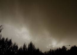 https://maltaclouds.net/wp-content/uploads/2019/05/Virga-sand.jpg?v=1569919548
2048
3072
admin
http://maltaclouds.net/wp-content/uploads/2018/10/logo-1-300x138.png
admin2019-04-22 17:26:192019-06-06 17:29:29Virga sand
https://maltaclouds.net/wp-content/uploads/2019/05/Virga-sand.jpg?v=1569919548
2048
3072
admin
http://maltaclouds.net/wp-content/uploads/2018/10/logo-1-300x138.png
admin2019-04-22 17:26:192019-06-06 17:29:29Virga sand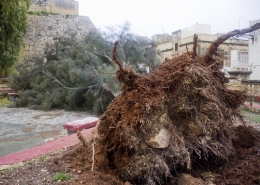 https://maltaclouds.net/wp-content/uploads/2019/05/24Feb19GregaleDamage.jpg?v=1569919536
1365
2048
admin
http://maltaclouds.net/wp-content/uploads/2018/10/logo-1-300x138.png
admin2019-02-24 17:17:592019-06-17 18:18:1424Feb19 Gregale Damage
https://maltaclouds.net/wp-content/uploads/2019/05/24Feb19GregaleDamage.jpg?v=1569919536
1365
2048
admin
http://maltaclouds.net/wp-content/uploads/2018/10/logo-1-300x138.png
admin2019-02-24 17:17:592019-06-17 18:18:1424Feb19 Gregale Damage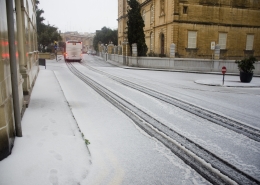 https://maltaclouds.net/wp-content/uploads/2019/05/Snow-pellets1.jpg?v=1569919536
1365
2048
admin
http://maltaclouds.net/wp-content/uploads/2018/10/logo-1-300x138.png
admin2019-02-23 17:00:512019-06-17 18:14:42Snow pellets
https://maltaclouds.net/wp-content/uploads/2019/05/Snow-pellets1.jpg?v=1569919536
1365
2048
admin
http://maltaclouds.net/wp-content/uploads/2018/10/logo-1-300x138.png
admin2019-02-23 17:00:512019-06-17 18:14:42Snow pellets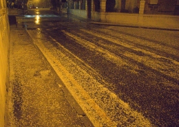 https://maltaclouds.net/wp-content/uploads/2019/05/Snow-pellets.jpg?v=1569919535
2048
2754
admin
http://maltaclouds.net/wp-content/uploads/2018/10/logo-1-300x138.png
admin2019-02-16 05:15:052019-06-06 17:00:26Snow pellets
https://maltaclouds.net/wp-content/uploads/2019/05/Snow-pellets.jpg?v=1569919535
2048
2754
admin
http://maltaclouds.net/wp-content/uploads/2018/10/logo-1-300x138.png
admin2019-02-16 05:15:052019-06-06 17:00:26Snow pellets https://maltaclouds.net/wp-content/uploads/2019/05/Mistral-Shwr.jpg?v=1569919524
2048
3072
admin
http://maltaclouds.net/wp-content/uploads/2018/10/logo-1-300x138.png
admin2019-01-14 16:53:182019-06-06 16:56:30Mistral Shower
https://maltaclouds.net/wp-content/uploads/2019/05/Mistral-Shwr.jpg?v=1569919524
2048
3072
admin
http://maltaclouds.net/wp-content/uploads/2018/10/logo-1-300x138.png
admin2019-01-14 16:53:182019-06-06 16:56:30Mistral Shower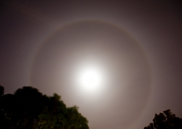 https://maltaclouds.net/wp-content/uploads/2019/05/Lunar-Halo.jpg?v=1569919511
1365
2048
admin
http://maltaclouds.net/wp-content/uploads/2018/10/logo-1-300x138.png
admin2018-11-19 16:50:512019-06-06 16:52:37Lunar Halo
https://maltaclouds.net/wp-content/uploads/2019/05/Lunar-Halo.jpg?v=1569919511
1365
2048
admin
http://maltaclouds.net/wp-content/uploads/2018/10/logo-1-300x138.png
admin2018-11-19 16:50:512019-06-06 16:52:37Lunar Halo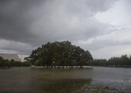 https://maltaclouds.net/wp-content/uploads/2019/05/TaQali-Floods.jpg?v=1569919505
1365
2048
admin
http://maltaclouds.net/wp-content/uploads/2018/10/logo-1-300x138.png
admin2018-11-03 16:47:252019-06-06 16:50:32TaQali Floods
https://maltaclouds.net/wp-content/uploads/2019/05/TaQali-Floods.jpg?v=1569919505
1365
2048
admin
http://maltaclouds.net/wp-content/uploads/2018/10/logo-1-300x138.png
admin2018-11-03 16:47:252019-06-06 16:50:32TaQali Floods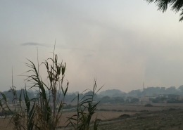 https://maltaclouds.net/wp-content/uploads/2019/05/Lithometeor.jpg?v=1569919485
2448
3264
admin
http://maltaclouds.net/wp-content/uploads/2018/10/logo-1-300x138.png
admin2018-09-02 16:44:502019-06-06 16:46:13Lithometeor
https://maltaclouds.net/wp-content/uploads/2019/05/Lithometeor.jpg?v=1569919485
2448
3264
admin
http://maltaclouds.net/wp-content/uploads/2018/10/logo-1-300x138.png
admin2018-09-02 16:44:502019-06-06 16:46:13Lithometeor https://maltaclouds.net/wp-content/uploads/2018/09/27Jul18-LunarEclipse.jpg?v=1569919787
963
1204
admin
http://maltaclouds.net/wp-content/uploads/2018/10/logo-1-300x138.png
admin2018-07-27 16:41:042019-06-06 16:43:5827Jul18 Lunar Eclipse
https://maltaclouds.net/wp-content/uploads/2018/09/27Jul18-LunarEclipse.jpg?v=1569919787
963
1204
admin
http://maltaclouds.net/wp-content/uploads/2018/10/logo-1-300x138.png
admin2018-07-27 16:41:042019-06-06 16:43:5827Jul18 Lunar Eclipse https://maltaclouds.net/wp-content/uploads/2019/05/Circumzenithal-arc.jpg?v=1569919466
2048
1365
admin
http://maltaclouds.net/wp-content/uploads/2018/10/logo-1-300x138.png
admin2018-05-18 18:30:582019-06-05 19:14:14Circumzenithal arc
https://maltaclouds.net/wp-content/uploads/2019/05/Circumzenithal-arc.jpg?v=1569919466
2048
1365
admin
http://maltaclouds.net/wp-content/uploads/2018/10/logo-1-300x138.png
admin2018-05-18 18:30:582019-06-05 19:14:14Circumzenithal arc https://maltaclouds.net/wp-content/uploads/2019/05/Horseshoe-Cloud.jpg?v=1569919463
1864
2187
admin
http://maltaclouds.net/wp-content/uploads/2018/10/logo-1-300x138.png
admin2018-05-04 13:20:532019-06-02 13:30:40Horseshoe Cloud
https://maltaclouds.net/wp-content/uploads/2019/05/Horseshoe-Cloud.jpg?v=1569919463
1864
2187
admin
http://maltaclouds.net/wp-content/uploads/2018/10/logo-1-300x138.png
admin2018-05-04 13:20:532019-06-02 13:30:40Horseshoe Cloud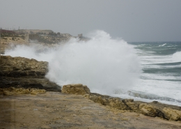 https://maltaclouds.net/wp-content/uploads/2019/05/Rough-sea5.jpg?v=1569919459
1231
1721
admin
http://maltaclouds.net/wp-content/uploads/2018/10/logo-1-300x138.png
admin2018-04-14 19:08:122019-06-05 19:10:22Rough sea
https://maltaclouds.net/wp-content/uploads/2019/05/Rough-sea5.jpg?v=1569919459
1231
1721
admin
http://maltaclouds.net/wp-content/uploads/2018/10/logo-1-300x138.png
admin2018-04-14 19:08:122019-06-05 19:10:22Rough sea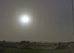 https://maltaclouds.net/wp-content/uploads/2019/05/Sand-haze3.jpg?v=1569919451
3154
4844
admin
http://maltaclouds.net/wp-content/uploads/2018/10/logo-1-300x138.png
admin2018-03-03 19:05:122019-06-05 19:07:41Sand haze
https://maltaclouds.net/wp-content/uploads/2019/05/Sand-haze3.jpg?v=1569919451
3154
4844
admin
http://maltaclouds.net/wp-content/uploads/2018/10/logo-1-300x138.png
admin2018-03-03 19:05:122019-06-05 19:07:41Sand haze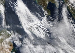 https://maltaclouds.net/wp-content/uploads/2019/05/MistralLeeWaveClouds.jpg?v=1569919434
2880
3840
admin
http://maltaclouds.net/wp-content/uploads/2018/10/logo-1-300x138.png
admin2018-01-04 19:01:002019-06-05 19:04:38Mistral Lee Wave Clouds
https://maltaclouds.net/wp-content/uploads/2019/05/MistralLeeWaveClouds.jpg?v=1569919434
2880
3840
admin
http://maltaclouds.net/wp-content/uploads/2018/10/logo-1-300x138.png
admin2018-01-04 19:01:002019-06-05 19:04:38Mistral Lee Wave Clouds https://maltaclouds.net/wp-content/uploads/2018/09/2Jan18-MistralWaves.jpg?v=1569919788
2048
3072
admin
http://maltaclouds.net/wp-content/uploads/2018/10/logo-1-300x138.png
admin2018-01-02 18:56:232019-06-05 18:59:192Jan18 MistralWaves
https://maltaclouds.net/wp-content/uploads/2018/09/2Jan18-MistralWaves.jpg?v=1569919788
2048
3072
admin
http://maltaclouds.net/wp-content/uploads/2018/10/logo-1-300x138.png
admin2018-01-02 18:56:232019-06-05 18:59:192Jan18 MistralWaves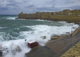 https://maltaclouds.net/wp-content/uploads/2019/05/21Dec17-Gregale.jpg?v=1569919433
2296
3264
admin
http://maltaclouds.net/wp-content/uploads/2018/10/logo-1-300x138.png
admin2017-12-21 18:51:192019-06-05 18:55:5021Dec17 Gregale
https://maltaclouds.net/wp-content/uploads/2019/05/21Dec17-Gregale.jpg?v=1569919433
2296
3264
admin
http://maltaclouds.net/wp-content/uploads/2018/10/logo-1-300x138.png
admin2017-12-21 18:51:192019-06-05 18:55:5021Dec17 Gregale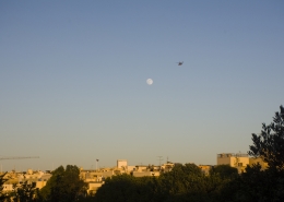 https://maltaclouds.net/wp-content/uploads/2018/09/Moonrise2.jpg?v=1569919875
3413
5120
admin
http://maltaclouds.net/wp-content/uploads/2018/10/logo-1-300x138.png
admin2017-07-07 19:51:452018-11-16 19:53:14Moon rise
https://maltaclouds.net/wp-content/uploads/2018/09/Moonrise2.jpg?v=1569919875
3413
5120
admin
http://maltaclouds.net/wp-content/uploads/2018/10/logo-1-300x138.png
admin2017-07-07 19:51:452018-11-16 19:53:14Moon rise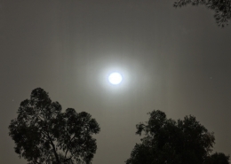 https://maltaclouds.net/wp-content/uploads/2018/09/Dusthaze.jpg?v=1569919891
1384
2048
admin
http://maltaclouds.net/wp-content/uploads/2018/10/logo-1-300x138.png
admin2017-04-29 19:56:302018-11-16 19:58:10Dust haze
https://maltaclouds.net/wp-content/uploads/2018/09/Dusthaze.jpg?v=1569919891
1384
2048
admin
http://maltaclouds.net/wp-content/uploads/2018/10/logo-1-300x138.png
admin2017-04-29 19:56:302018-11-16 19:58:10Dust haze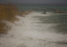 https://maltaclouds.net/wp-content/uploads/2018/09/Easterly-Gale.jpg?v=1569919889
1289
2004
admin
http://maltaclouds.net/wp-content/uploads/2018/10/logo-1-300x138.png
admin2016-12-17 20:00:152018-11-16 20:03:19Severe easterly gale
https://maltaclouds.net/wp-content/uploads/2018/09/Easterly-Gale.jpg?v=1569919889
1289
2004
admin
http://maltaclouds.net/wp-content/uploads/2018/10/logo-1-300x138.png
admin2016-12-17 20:00:152018-11-16 20:03:19Severe easterly gale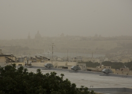 https://maltaclouds.net/wp-content/uploads/2018/09/Desert-sand-haze5.jpg?v=1569919895
1771
2451
admin
http://maltaclouds.net/wp-content/uploads/2018/10/logo-1-300x138.png
admin2016-11-08 20:26:492018-11-16 20:31:37Desert sand haze
https://maltaclouds.net/wp-content/uploads/2018/09/Desert-sand-haze5.jpg?v=1569919895
1771
2451
admin
http://maltaclouds.net/wp-content/uploads/2018/10/logo-1-300x138.png
admin2016-11-08 20:26:492018-11-16 20:31:37Desert sand haze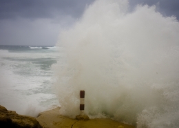 https://maltaclouds.net/wp-content/uploads/2018/09/Cyclone-Invest-90M.jpg?v=1569919900
2048
3072
admin
http://maltaclouds.net/wp-content/uploads/2018/10/logo-1-300x138.png
admin2016-10-29 20:33:112018-11-16 20:36:35Med Cyclone 'Invest 90M'
https://maltaclouds.net/wp-content/uploads/2018/09/Cyclone-Invest-90M.jpg?v=1569919900
2048
3072
admin
http://maltaclouds.net/wp-content/uploads/2018/10/logo-1-300x138.png
admin2016-10-29 20:33:112018-11-16 20:36:35Med Cyclone 'Invest 90M'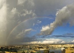 https://maltaclouds.net/wp-content/uploads/2018/09/Rainbow8.jpg?v=1569919869
2915
5649
admin
http://maltaclouds.net/wp-content/uploads/2018/10/logo-1-300x138.png
admin2016-10-11 20:37:152018-11-16 20:39:03Rainbow panorama
https://maltaclouds.net/wp-content/uploads/2018/09/Rainbow8.jpg?v=1569919869
2915
5649
admin
http://maltaclouds.net/wp-content/uploads/2018/10/logo-1-300x138.png
admin2016-10-11 20:37:152018-11-16 20:39:03Rainbow panorama https://maltaclouds.net/wp-content/uploads/2018/09/Appr.-TStrm.jpg?v=1569919905
2969
4557
admin
http://maltaclouds.net/wp-content/uploads/2018/10/logo-1-300x138.png
admin2016-09-25 20:39:222018-11-16 20:41:24Appr. Autumnal thunderstorm
https://maltaclouds.net/wp-content/uploads/2018/09/Appr.-TStrm.jpg?v=1569919905
2969
4557
admin
http://maltaclouds.net/wp-content/uploads/2018/10/logo-1-300x138.png
admin2016-09-25 20:39:222018-11-16 20:41:24Appr. Autumnal thunderstorm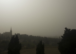 https://maltaclouds.net/wp-content/uploads/2018/09/Desert-sand-haze3.jpg?v=1569919897
1365
2048
admin
http://maltaclouds.net/wp-content/uploads/2018/10/logo-1-300x138.png
admin2016-05-11 20:44:112018-11-16 20:46:38Thick sand haze
https://maltaclouds.net/wp-content/uploads/2018/09/Desert-sand-haze3.jpg?v=1569919897
1365
2048
admin
http://maltaclouds.net/wp-content/uploads/2018/10/logo-1-300x138.png
admin2016-05-11 20:44:112018-11-16 20:46:38Thick sand haze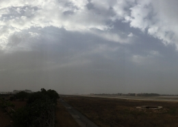 https://maltaclouds.net/wp-content/uploads/2018/09/Desert-sand-haze4.jpg?v=1569919896
3102
8740
admin
http://maltaclouds.net/wp-content/uploads/2018/10/logo-1-300x138.png
admin2016-05-11 20:41:532018-11-16 20:43:28Sand Haze
https://maltaclouds.net/wp-content/uploads/2018/09/Desert-sand-haze4.jpg?v=1569919896
3102
8740
admin
http://maltaclouds.net/wp-content/uploads/2018/10/logo-1-300x138.png
admin2016-05-11 20:41:532018-11-16 20:43:28Sand Haze https://maltaclouds.net/wp-content/uploads/2018/09/Drought16.jpg?v=1569919894
2048
3072
admin
http://maltaclouds.net/wp-content/uploads/2018/10/logo-1-300x138.png
admin2016-04-04 20:47:252018-11-16 20:49:03Winter drought conditions
https://maltaclouds.net/wp-content/uploads/2018/09/Drought16.jpg?v=1569919894
2048
3072
admin
http://maltaclouds.net/wp-content/uploads/2018/10/logo-1-300x138.png
admin2016-04-04 20:47:252018-11-16 20:49:03Winter drought conditions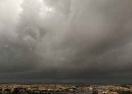 https://maltaclouds.net/wp-content/uploads/2018/09/Squall-line-1.jpg?v=1569919865
2168
2944
admin
http://maltaclouds.net/wp-content/uploads/2018/10/logo-1-300x138.png
admin2016-03-11 20:49:562018-11-16 20:52:08Squall line
https://maltaclouds.net/wp-content/uploads/2018/09/Squall-line-1.jpg?v=1569919865
2168
2944
admin
http://maltaclouds.net/wp-content/uploads/2018/10/logo-1-300x138.png
admin2016-03-11 20:49:562018-11-16 20:52:08Squall line https://maltaclouds.net/wp-content/uploads/2018/09/Sun-halo3.jpg?v=1569919862
2048
3072
admin
http://maltaclouds.net/wp-content/uploads/2018/10/logo-1-300x138.png
admin2016-02-27 20:52:482018-11-16 20:54:44Solar halo
https://maltaclouds.net/wp-content/uploads/2018/09/Sun-halo3.jpg?v=1569919862
2048
3072
admin
http://maltaclouds.net/wp-content/uploads/2018/10/logo-1-300x138.png
admin2016-02-27 20:52:482018-11-16 20:54:44Solar halo https://maltaclouds.net/wp-content/uploads/2018/11/Fog1.jpg?v=1569919576
467
938
admin
http://maltaclouds.net/wp-content/uploads/2018/10/logo-1-300x138.png
admin2016-02-23 20:55:172018-11-16 20:57:42Advection Fog
https://maltaclouds.net/wp-content/uploads/2018/11/Fog1.jpg?v=1569919576
467
938
admin
http://maltaclouds.net/wp-content/uploads/2018/10/logo-1-300x138.png
admin2016-02-23 20:55:172018-11-16 20:57:42Advection Fog https://maltaclouds.net/wp-content/uploads/2018/09/27Nov15-SeaWave.jpg?v=1569919906
1365
2048
admin
http://maltaclouds.net/wp-content/uploads/2018/10/logo-1-300x138.png
admin2015-11-27 20:58:222018-11-16 21:02:05Mistral sea wave
https://maltaclouds.net/wp-content/uploads/2018/09/27Nov15-SeaWave.jpg?v=1569919906
1365
2048
admin
http://maltaclouds.net/wp-content/uploads/2018/10/logo-1-300x138.png
admin2015-11-27 20:58:222018-11-16 21:02:05Mistral sea wave https://maltaclouds.net/wp-content/uploads/2018/09/26Nov15-SeaWave.jpg?v=1569921460
2448
3264
admin
http://maltaclouds.net/wp-content/uploads/2018/10/logo-1-300x138.png
admin2015-11-26 17:23:092018-11-17 14:51:29Mistral severe gales
https://maltaclouds.net/wp-content/uploads/2018/09/26Nov15-SeaWave.jpg?v=1569921460
2448
3264
admin
http://maltaclouds.net/wp-content/uploads/2018/10/logo-1-300x138.png
admin2015-11-26 17:23:092018-11-17 14:51:29Mistral severe gales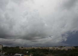 https://maltaclouds.net/wp-content/uploads/2018/09/1Nov15-ThickClouds.jpg?v=1569924255
1365
2048
admin
http://maltaclouds.net/wp-content/uploads/2018/10/logo-1-300x138.png
admin2015-11-01 21:03:032018-11-17 14:55:44Halloween Storm
https://maltaclouds.net/wp-content/uploads/2018/09/1Nov15-ThickClouds.jpg?v=1569924255
1365
2048
admin
http://maltaclouds.net/wp-content/uploads/2018/10/logo-1-300x138.png
admin2015-11-01 21:03:032018-11-17 14:55:44Halloween Storm https://maltaclouds.net/wp-content/uploads/2018/09/Moonrise1.jpg?v=1569919875
1365
2048
admin
http://maltaclouds.net/wp-content/uploads/2018/10/logo-1-300x138.png
admin2015-10-25 21:09:172018-11-16 21:11:18High-cloud moonrise
https://maltaclouds.net/wp-content/uploads/2018/09/Moonrise1.jpg?v=1569919875
1365
2048
admin
http://maltaclouds.net/wp-content/uploads/2018/10/logo-1-300x138.png
admin2015-10-25 21:09:172018-11-16 21:11:18High-cloud moonrise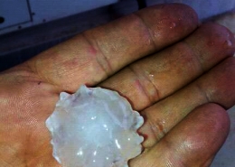 https://maltaclouds.net/wp-content/uploads/2018/09/22Oct15-HailStone.jpg?v=1569919907
720
432
admin
http://maltaclouds.net/wp-content/uploads/2018/10/logo-1-300x138.png
admin2015-10-22 21:14:522018-11-16 21:21:04Large hailstone
https://maltaclouds.net/wp-content/uploads/2018/09/22Oct15-HailStone.jpg?v=1569919907
720
432
admin
http://maltaclouds.net/wp-content/uploads/2018/10/logo-1-300x138.png
admin2015-10-22 21:14:522018-11-16 21:21:04Large hailstone https://maltaclouds.net/wp-content/uploads/2018/09/Eclipsed-moon.jpg?v=1569919888
1365
2048
admin
http://maltaclouds.net/wp-content/uploads/2018/10/logo-1-300x138.png
admin2015-09-28 21:25:462018-11-16 21:29:11Lunar eclipse
https://maltaclouds.net/wp-content/uploads/2018/09/Eclipsed-moon.jpg?v=1569919888
1365
2048
admin
http://maltaclouds.net/wp-content/uploads/2018/10/logo-1-300x138.png
admin2015-09-28 21:25:462018-11-16 21:29:11Lunar eclipse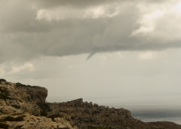 https://maltaclouds.net/wp-content/uploads/2018/09/Funnel-cloud-1.jpg?v=1569919887
1536
2048
admin
http://maltaclouds.net/wp-content/uploads/2018/10/logo-1-300x138.png
admin2015-08-12 17:54:082018-11-09 17:57:40Funnel cloud
https://maltaclouds.net/wp-content/uploads/2018/09/Funnel-cloud-1.jpg?v=1569919887
1536
2048
admin
http://maltaclouds.net/wp-content/uploads/2018/10/logo-1-300x138.png
admin2015-08-12 17:54:082018-11-09 17:57:40Funnel cloud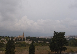 https://maltaclouds.net/wp-content/uploads/2018/09/10Aug15-Weak-MCS-1.jpg?v=1569919908
1536
2048
admin
http://maltaclouds.net/wp-content/uploads/2018/10/logo-1-300x138.png
admin2015-08-10 21:32:522018-11-16 21:35:13Weak MCS
https://maltaclouds.net/wp-content/uploads/2018/09/10Aug15-Weak-MCS-1.jpg?v=1569919908
1536
2048
admin
http://maltaclouds.net/wp-content/uploads/2018/10/logo-1-300x138.png
admin2015-08-10 21:32:522018-11-16 21:35:13Weak MCS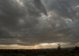 https://maltaclouds.net/wp-content/uploads/2018/09/Sun-rays1-1.jpg?v=1569919861
1536
2048
admin
http://maltaclouds.net/wp-content/uploads/2018/10/logo-1-300x138.png
admin2015-05-10 21:35:462018-11-16 21:39:07Crespecular rays
https://maltaclouds.net/wp-content/uploads/2018/09/Sun-rays1-1.jpg?v=1569919861
1536
2048
admin
http://maltaclouds.net/wp-content/uploads/2018/10/logo-1-300x138.png
admin2015-05-10 21:35:462018-11-16 21:39:07Crespecular rays https://maltaclouds.net/wp-content/uploads/2018/09/Upslope-fog-1.jpg?v=1569919857
1536
2048
admin
http://maltaclouds.net/wp-content/uploads/2018/10/logo-1-300x138.png
admin2015-03-22 18:43:462018-11-16 18:46:24Upslope fog
https://maltaclouds.net/wp-content/uploads/2018/09/Sun-rays1-1.jpg?v=1569919861
1536
2048
admin
http://maltaclouds.net/wp-content/uploads/2018/10/logo-1-300x138.png
admin2015-02-16 21:41:182018-11-16 21:45:51Sundog or Irridescence
https://maltaclouds.net/wp-content/uploads/2018/09/Upslope-fog-1.jpg?v=1569919857
1536
2048
admin
http://maltaclouds.net/wp-content/uploads/2018/10/logo-1-300x138.png
admin2015-03-22 18:43:462018-11-16 18:46:24Upslope fog
https://maltaclouds.net/wp-content/uploads/2018/09/Sun-rays1-1.jpg?v=1569919861
1536
2048
admin
http://maltaclouds.net/wp-content/uploads/2018/10/logo-1-300x138.png
admin2015-02-16 21:41:182018-11-16 21:45:51Sundog or Irridescence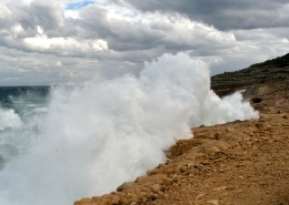 https://maltaclouds.net/wp-content/uploads/2018/11/Furious-sea-1.jpg?v=1569919574
2681
3785
admin
http://maltaclouds.net/wp-content/uploads/2018/10/logo-1-300x138.png
admin2015-02-09 21:51:152018-11-16 21:54:14Gregale sea-wave
https://maltaclouds.net/wp-content/uploads/2018/11/Furious-sea-1.jpg?v=1569919574
2681
3785
admin
http://maltaclouds.net/wp-content/uploads/2018/10/logo-1-300x138.png
admin2015-02-09 21:51:152018-11-16 21:54:14Gregale sea-wave https://maltaclouds.net/wp-content/uploads/2018/09/Graupel-shower-picture.jpg?v=1569920884
1944
2592
admin
http://maltaclouds.net/wp-content/uploads/2018/10/logo-1-300x138.png
admin2014-12-31 21:57:432018-11-17 14:47:21Graupel shower
https://maltaclouds.net/wp-content/uploads/2018/09/Graupel-shower-picture.jpg?v=1569920884
1944
2592
admin
http://maltaclouds.net/wp-content/uploads/2018/10/logo-1-300x138.png
admin2014-12-31 21:57:432018-11-17 14:47:21Graupel shower https://maltaclouds.net/wp-content/uploads/2018/09/Dusk-1.jpg?v=1569919893
1536
2048
admin
http://maltaclouds.net/wp-content/uploads/2018/10/logo-1-300x138.png
admin2014-12-06 21:59:332018-11-16 22:01:45Late Autumn dusk
https://maltaclouds.net/wp-content/uploads/2018/09/Dusk-1.jpg?v=1569919893
1536
2048
admin
http://maltaclouds.net/wp-content/uploads/2018/10/logo-1-300x138.png
admin2014-12-06 21:59:332018-11-16 22:01:45Late Autumn dusk https://maltaclouds.net/wp-content/uploads/2018/09/Cyclone-cumuliform-1.jpg?v=1569919901
1944
2592
admin
http://maltaclouds.net/wp-content/uploads/2018/10/logo-1-300x138.png
admin2014-11-07 22:02:182018-11-16 22:05:38Med Cyclone cumuliform
https://maltaclouds.net/wp-content/uploads/2018/09/Cyclone-cumuliform-1.jpg?v=1569919901
1944
2592
admin
http://maltaclouds.net/wp-content/uploads/2018/10/logo-1-300x138.png
admin2014-11-07 22:02:182018-11-16 22:05:38Med Cyclone cumuliform https://maltaclouds.net/wp-content/uploads/2018/09/Hazy-day-1.jpg?v=1569919882
1944
2592
admin
http://maltaclouds.net/wp-content/uploads/2018/10/logo-1-300x138.png
admin2014-11-06 22:06:172018-11-16 22:08:19Hazy atmosphere
https://maltaclouds.net/wp-content/uploads/2018/09/Hazy-day-1.jpg?v=1569919882
1944
2592
admin
http://maltaclouds.net/wp-content/uploads/2018/10/logo-1-300x138.png
admin2014-11-06 22:06:172018-11-16 22:08:19Hazy atmosphere https://maltaclouds.net/wp-content/uploads/2018/09/Damaging-wind-1.jpg?v=1569919899
1944
2592
admin
http://maltaclouds.net/wp-content/uploads/2018/10/logo-1-300x138.png
admin2014-10-22 22:08:452018-11-16 22:10:48Damaging wind
https://maltaclouds.net/wp-content/uploads/2018/09/Damaging-wind-1.jpg?v=1569919899
1944
2592
admin
http://maltaclouds.net/wp-content/uploads/2018/10/logo-1-300x138.png
admin2014-10-22 22:08:452018-11-16 22:10:48Damaging wind https://maltaclouds.net/wp-content/uploads/2018/09/Kelvin-Helmholtz-1.jpg?v=1569919877
1536
2048
admin
http://maltaclouds.net/wp-content/uploads/2018/10/logo-1-300x138.png
admin2014-10-04 22:11:422018-11-16 22:14:00Kelvin-Helmholtz instability
https://maltaclouds.net/wp-content/uploads/2018/09/Kelvin-Helmholtz-1.jpg?v=1569919877
1536
2048
admin
http://maltaclouds.net/wp-content/uploads/2018/10/logo-1-300x138.png
admin2014-10-04 22:11:422018-11-16 22:14:00Kelvin-Helmholtz instability https://maltaclouds.net/wp-content/uploads/2018/09/Sun-rays-1.jpg?v=1569919861
1536
2048
admin
http://maltaclouds.net/wp-content/uploads/2018/10/logo-1-300x138.png
admin2014-07-09 22:14:432018-11-16 22:16:10Sun Rays
https://maltaclouds.net/wp-content/uploads/2018/09/Sun-rays-1.jpg?v=1569919861
1536
2048
admin
http://maltaclouds.net/wp-content/uploads/2018/10/logo-1-300x138.png
admin2014-07-09 22:14:432018-11-16 22:16:10Sun Rays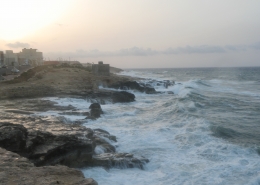 https://maltaclouds.net/wp-content/uploads/2018/11/Gregale-1.jpg?v=1569919573
3000
4000
admin
http://maltaclouds.net/wp-content/uploads/2018/10/logo-1-300x138.png
admin2014-06-02 22:16:382018-11-16 22:21:11Gregale seas
https://maltaclouds.net/wp-content/uploads/2018/11/Gregale-1.jpg?v=1569919573
3000
4000
admin
http://maltaclouds.net/wp-content/uploads/2018/10/logo-1-300x138.png
admin2014-06-02 22:16:382018-11-16 22:21:11Gregale seas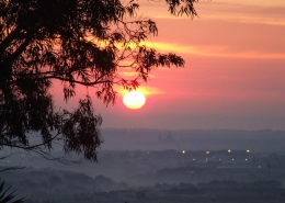 https://maltaclouds.net/wp-content/uploads/2018/09/Morning-mist-1.jpg?v=1569919874
720
960
admin
http://maltaclouds.net/wp-content/uploads/2018/10/logo-1-300x138.png
admin2014-05-09 22:21:442018-11-16 22:22:51Morning Mist
https://maltaclouds.net/wp-content/uploads/2018/09/Morning-mist-1.jpg?v=1569919874
720
960
admin
http://maltaclouds.net/wp-content/uploads/2018/10/logo-1-300x138.png
admin2014-05-09 22:21:442018-11-16 22:22:51Morning Mist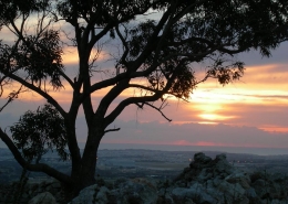 https://maltaclouds.net/wp-content/uploads/2018/09/Sunrise2-1.jpg?v=1569919858
720
960
admin
http://maltaclouds.net/wp-content/uploads/2018/10/logo-1-300x138.png
admin2014-04-19 22:23:132018-11-16 22:24:24Sunrise
https://maltaclouds.net/wp-content/uploads/2018/09/Sunrise2-1.jpg?v=1569919858
720
960
admin
http://maltaclouds.net/wp-content/uploads/2018/10/logo-1-300x138.png
admin2014-04-13 22:24:522018-11-16 22:25:44Various cloud layers
https://maltaclouds.net/wp-content/uploads/2018/09/Sunrise2-1.jpg?v=1569919858
720
960
admin
http://maltaclouds.net/wp-content/uploads/2018/10/logo-1-300x138.png
admin2014-04-19 22:23:132018-11-16 22:24:24Sunrise
https://maltaclouds.net/wp-content/uploads/2018/09/Sunrise2-1.jpg?v=1569919858
720
960
admin
http://maltaclouds.net/wp-content/uploads/2018/10/logo-1-300x138.png
admin2014-04-13 22:24:522018-11-16 22:25:44Various cloud layers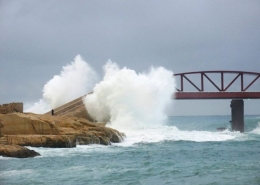 https://maltaclouds.net/wp-content/uploads/2018/09/Valletta-rough-sea-1.jpeg?v=1569919856
480
640
admin
http://maltaclouds.net/wp-content/uploads/2018/10/logo-1-300x138.png
admin2014-02-02 22:26:122018-11-16 22:31:35Valletta rough sea
https://maltaclouds.net/wp-content/uploads/2018/09/Valletta-rough-sea-1.jpeg?v=1569919856
480
640
admin
http://maltaclouds.net/wp-content/uploads/2018/10/logo-1-300x138.png
admin2014-02-02 22:26:122018-11-16 22:31:35Valletta rough sea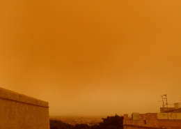 https://maltaclouds.net/wp-content/uploads/2018/09/sand-haze2-1.jpg?v=1569919866
3240
4320
admin
http://maltaclouds.net/wp-content/uploads/2018/10/logo-1-300x138.png
admin2014-01-31 22:28:302018-11-16 22:32:03Yellowish desert sand haze
https://maltaclouds.net/wp-content/uploads/2018/09/sand-haze2-1.jpg?v=1569919866
3240
4320
admin
http://maltaclouds.net/wp-content/uploads/2018/10/logo-1-300x138.png
admin2014-01-31 22:28:302018-11-16 22:32:03Yellowish desert sand haze https://maltaclouds.net/wp-content/uploads/2018/09/Rough-sea3-1.jpg?v=1569919868
1536
2048
admin
http://maltaclouds.net/wp-content/uploads/2018/10/logo-1-300x138.png
admin2014-01-19 22:33:502018-11-16 22:35:40Sirocco swells
https://maltaclouds.net/wp-content/uploads/2018/09/Rough-sea3-1.jpg?v=1569919868
1536
2048
admin
http://maltaclouds.net/wp-content/uploads/2018/10/logo-1-300x138.png
admin2014-01-19 22:33:502018-11-16 22:35:40Sirocco swells https://maltaclouds.net/wp-content/uploads/2018/09/Cloud-rays-1.jpg?v=1569919902
3240
4320
admin
http://maltaclouds.net/wp-content/uploads/2018/10/logo-1-300x138.png
admin2014-01-15 22:36:172018-11-16 22:38:11Cloud rays
https://maltaclouds.net/wp-content/uploads/2018/09/Cloud-rays-1.jpg?v=1569919902
3240
4320
admin
http://maltaclouds.net/wp-content/uploads/2018/10/logo-1-300x138.png
admin2014-01-15 22:36:172018-11-16 22:38:11Cloud rays https://maltaclouds.net/wp-content/uploads/2018/09/Moved-sea-1.jpg?v=1569919873
1536
2048
admin
http://maltaclouds.net/wp-content/uploads/2018/10/logo-1-300x138.png
admin2013-12-26 22:39:062018-11-16 22:40:31Agitated sea
https://maltaclouds.net/wp-content/uploads/2018/09/Moved-sea-1.jpg?v=1569919873
1536
2048
admin
http://maltaclouds.net/wp-content/uploads/2018/10/logo-1-300x138.png
admin2013-12-26 22:39:062018-11-16 22:40:31Agitated sea https://maltaclouds.net/wp-content/uploads/2018/09/Sunrise1-1.jpg?v=1569919859
2448
3264
admin
http://maltaclouds.net/wp-content/uploads/2018/10/logo-1-300x138.png
admin2013-11-17 13:53:402018-11-17 13:54:48Red sunrise
https://maltaclouds.net/wp-content/uploads/2018/09/Sunrise1-1.jpg?v=1569919859
2448
3264
admin
http://maltaclouds.net/wp-content/uploads/2018/10/logo-1-300x138.png
admin2013-11-17 13:53:402018-11-17 13:54:48Red sunrise https://maltaclouds.net/wp-content/uploads/2018/09/rainbow7-1.jpg?v=1569919870
3240
4320
admin
http://maltaclouds.net/wp-content/uploads/2018/10/logo-1-300x138.png
admin2013-11-15 22:42:102018-11-16 22:43:00Low-lying rainbow
https://maltaclouds.net/wp-content/uploads/2018/09/rainbow7-1.jpg?v=1569919870
3240
4320
admin
http://maltaclouds.net/wp-content/uploads/2018/10/logo-1-300x138.png
admin2013-11-15 22:42:102018-11-16 22:43:00Low-lying rainbow https://maltaclouds.net/wp-content/uploads/2018/09/rainbow6-1.jpg?v=1569919871
3240
4320
admin
http://maltaclouds.net/wp-content/uploads/2018/10/logo-1-300x138.png
admin2013-11-12 22:44:432018-11-16 22:45:22Precipitation-shaft rainbow
https://maltaclouds.net/wp-content/uploads/2018/09/rainbow6-1.jpg?v=1569919871
3240
4320
admin
http://maltaclouds.net/wp-content/uploads/2018/10/logo-1-300x138.png
admin2013-10-07 22:46:382018-11-16 22:48:03Multiple lightning strikes
https://maltaclouds.net/wp-content/uploads/2018/09/rainbow6-1.jpg?v=1569919871
3240
4320
admin
http://maltaclouds.net/wp-content/uploads/2018/10/logo-1-300x138.png
admin2013-11-12 22:44:432018-11-16 22:45:22Precipitation-shaft rainbow
https://maltaclouds.net/wp-content/uploads/2018/09/rainbow6-1.jpg?v=1569919871
3240
4320
admin
http://maltaclouds.net/wp-content/uploads/2018/10/logo-1-300x138.png
admin2013-10-07 22:46:382018-11-16 22:48:03Multiple lightning strikes https://maltaclouds.net/wp-content/uploads/2018/09/After-main-supercell.jpg?v=1569921078
1536
2048
admin
http://maltaclouds.net/wp-content/uploads/2018/10/logo-1-300x138.png
admin2013-09-05 22:48:572018-11-16 22:50:51Micro-burst winds
https://maltaclouds.net/wp-content/uploads/2018/09/After-main-supercell.jpg?v=1569921078
1536
2048
admin
http://maltaclouds.net/wp-content/uploads/2018/10/logo-1-300x138.png
admin2013-09-05 22:48:572018-11-16 22:50:51Micro-burst winds https://maltaclouds.net/wp-content/uploads/2018/09/Pos-Morning-Glory-1.jpg?v=1569919871
1536
2048
admin
http://maltaclouds.net/wp-content/uploads/2018/10/logo-1-300x138.png
admin2013-08-27 22:52:332018-11-16 22:54:18Possible morning glory
https://maltaclouds.net/wp-content/uploads/2018/09/Pos-Morning-Glory-1.jpg?v=1569919871
1536
2048
admin
http://maltaclouds.net/wp-content/uploads/2018/10/logo-1-300x138.png
admin2013-08-27 22:52:332018-11-16 22:54:18Possible morning glory https://maltaclouds.net/wp-content/uploads/2018/11/Heavy-rainfall-event.jpg?v=1569919571
1536
2048
admin
http://maltaclouds.net/wp-content/uploads/2018/10/logo-1-300x138.png
admin2013-08-21 23:00:492018-11-16 23:01:43Local heavy flooding
https://maltaclouds.net/wp-content/uploads/2018/11/Heavy-rainfall-event.jpg?v=1569919571
1536
2048
admin
http://maltaclouds.net/wp-content/uploads/2018/10/logo-1-300x138.png
admin2013-08-21 23:00:492018-11-16 23:01:43Local heavy flooding https://maltaclouds.net/wp-content/uploads/2018/09/Lightning-1.jpg?v=1569919876
800
1280
admin
http://maltaclouds.net/wp-content/uploads/2018/10/logo-1-300x138.png
admin2013-08-21 22:57:572018-11-16 22:58:14Lightning strike
https://maltaclouds.net/wp-content/uploads/2018/09/Lightning-1.jpg?v=1569919876
800
1280
admin
http://maltaclouds.net/wp-content/uploads/2018/10/logo-1-300x138.png
admin2013-08-21 22:57:572018-11-16 22:58:14Lightning strike https://maltaclouds.net/wp-content/uploads/2018/09/Circumhorizontal-Arc1-1.jpg?v=1569919903
1536
2048
admin
http://maltaclouds.net/wp-content/uploads/2018/10/logo-1-300x138.png
admin2013-08-21 22:55:042018-11-16 22:56:19Circumhorizontal arc
https://maltaclouds.net/wp-content/uploads/2018/09/Circumhorizontal-Arc1-1.jpg?v=1569919903
1536
2048
admin
http://maltaclouds.net/wp-content/uploads/2018/10/logo-1-300x138.png
admin2013-08-21 22:55:042018-11-16 22:56:19Circumhorizontal arc https://maltaclouds.net/wp-content/uploads/2018/09/Sun-halo1-1.jpg?v=1569919864
1536
2048
admin
http://maltaclouds.net/wp-content/uploads/2018/10/logo-1-300x138.png
admin2013-05-28 23:22:482018-11-16 23:25:53Solar halo
https://maltaclouds.net/wp-content/uploads/2018/09/Sun-halo1-1.jpg?v=1569919864
1536
2048
admin
http://maltaclouds.net/wp-content/uploads/2018/10/logo-1-300x138.png
admin2013-05-28 23:22:482018-11-16 23:25:53Solar halo https://maltaclouds.net/wp-content/uploads/2018/11/dust-storm-1.jpg?v=1569919569
3000
4000
admin
http://maltaclouds.net/wp-content/uploads/2018/10/logo-1-300x138.png
admin2013-05-22 23:05:212018-11-16 23:06:40Desert sand storm effects
https://maltaclouds.net/wp-content/uploads/2018/11/dust-storm-1.jpg?v=1569919569
3000
4000
admin
http://maltaclouds.net/wp-content/uploads/2018/10/logo-1-300x138.png
admin2013-05-22 23:05:212018-11-16 23:06:40Desert sand storm effects https://maltaclouds.net/wp-content/uploads/2018/09/Sun-halo2-1.jpg?v=1569919863
1536
2048
admin
http://maltaclouds.net/wp-content/uploads/2018/10/logo-1-300x138.png
admin2013-05-18 23:07:542018-11-16 23:09:11Ring around the sun
https://maltaclouds.net/wp-content/uploads/2018/09/Sun-halo2-1.jpg?v=1569919863
1536
2048
admin
http://maltaclouds.net/wp-content/uploads/2018/10/logo-1-300x138.png
admin2013-05-18 23:07:542018-11-16 23:09:11Ring around the sun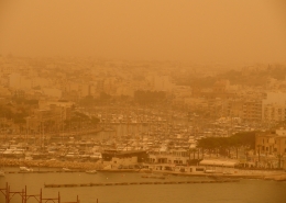 https://maltaclouds.net/wp-content/uploads/2018/09/Desert-sand-haze1-1.jpg?v=1569919897
1536
2048
admin
http://maltaclouds.net/wp-content/uploads/2018/10/logo-1-300x138.png
admin2013-05-16 23:11:212018-11-16 23:13:05Thick desert sand haze
https://maltaclouds.net/wp-content/uploads/2018/09/Desert-sand-haze1-1.jpg?v=1569919897
1536
2048
admin
http://maltaclouds.net/wp-content/uploads/2018/10/logo-1-300x138.png
admin2013-05-16 23:11:212018-11-16 23:13:05Thick desert sand haze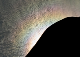 https://maltaclouds.net/wp-content/uploads/2018/09/Irridescent-cloud1-1.jpg?v=1569919878
1536
2048
admin
http://maltaclouds.net/wp-content/uploads/2018/10/logo-1-300x138.png
admin2013-05-11 23:14:122018-11-16 23:17:01Irridescent clouds
https://maltaclouds.net/wp-content/uploads/2018/09/Irridescent-cloud1-1.jpg?v=1569919878
1536
2048
admin
http://maltaclouds.net/wp-content/uploads/2018/10/logo-1-300x138.png
admin2013-05-11 23:14:122018-11-16 23:17:01Irridescent clouds https://maltaclouds.net/wp-content/uploads/2018/09/Dry-countryside-1.jpg?v=1569919893
1536
2048
admin
http://maltaclouds.net/wp-content/uploads/2018/10/logo-1-300x138.png
admin2013-04-21 23:21:132018-11-16 23:21:51Drought in the countryside
https://maltaclouds.net/wp-content/uploads/2018/09/Dry-countryside-1.jpg?v=1569919893
1536
2048
admin
http://maltaclouds.net/wp-content/uploads/2018/10/logo-1-300x138.png
admin2013-04-21 23:21:132018-11-16 23:21:51Drought in the countryside https://maltaclouds.net/wp-content/uploads/2018/09/Sun-halo.jpg?v=1569920321
1536
2048
admin
http://maltaclouds.net/wp-content/uploads/2018/10/logo-1-300x138.png
admin2013-04-21 23:17:372018-11-16 23:19:37Solar halo
https://maltaclouds.net/wp-content/uploads/2018/09/Sun-halo.jpg?v=1569920321
1536
2048
admin
http://maltaclouds.net/wp-content/uploads/2018/10/logo-1-300x138.png
admin2013-04-21 23:17:372018-11-16 23:19:37Solar halo https://maltaclouds.net/wp-content/uploads/2018/09/rough_sea1.jpg?v=1569920841
300
540
admin
http://maltaclouds.net/wp-content/uploads/2018/10/logo-1-300x138.png
admin2013-03-15 23:37:492018-11-17 15:21:53Mistral severe gale
https://maltaclouds.net/wp-content/uploads/2018/09/rough_sea1.jpg?v=1569920841
300
540
admin
http://maltaclouds.net/wp-content/uploads/2018/10/logo-1-300x138.png
admin2013-03-15 23:37:492018-11-17 15:21:53Mistral severe gale https://maltaclouds.net/wp-content/uploads/2018/09/Hail-shower-1.jpg?v=1569919628
1536
2048
admin
http://maltaclouds.net/wp-content/uploads/2018/10/logo-1-300x138.png
admin2013-03-15 23:33:152018-11-17 15:24:16Very blustery hail shower
https://maltaclouds.net/wp-content/uploads/2018/09/Hail-shower-1.jpg?v=1569919628
1536
2048
admin
http://maltaclouds.net/wp-content/uploads/2018/10/logo-1-300x138.png
admin2013-03-15 23:33:152018-11-17 15:24:16Very blustery hail shower https://maltaclouds.net/wp-content/uploads/2018/09/Rough-sea1-1.jpg?v=1569919868
1536
2048
admin
http://maltaclouds.net/wp-content/uploads/2018/10/logo-1-300x138.png
admin2013-03-15 23:30:532018-11-17 15:07:55Mistral rough sea
https://maltaclouds.net/wp-content/uploads/2018/09/Rough-sea1-1.jpg?v=1569919868
1536
2048
admin
http://maltaclouds.net/wp-content/uploads/2018/10/logo-1-300x138.png
admin2013-03-15 23:30:532018-11-17 15:07:55Mistral rough sea https://maltaclouds.net/wp-content/uploads/2018/09/Sand-haze1-1.jpg?v=1569919867
1536
2048
admin
http://maltaclouds.net/wp-content/uploads/2018/10/logo-1-300x138.png
admin2013-03-07 13:47:582018-11-17 13:50:30Desert sand haze
https://maltaclouds.net/wp-content/uploads/2018/09/Sand-haze1-1.jpg?v=1569919867
1536
2048
admin
http://maltaclouds.net/wp-content/uploads/2018/10/logo-1-300x138.png
admin2013-03-07 13:47:582018-11-17 13:50:30Desert sand haze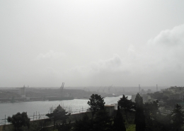 https://maltaclouds.net/wp-content/uploads/2018/09/Desert-sand-haze-1.jpg?v=1569919898
2448
3264
admin
http://maltaclouds.net/wp-content/uploads/2018/10/logo-1-300x138.png
admin2013-02-21 13:50:502018-11-17 13:52:50Desert sand haze
https://maltaclouds.net/wp-content/uploads/2018/09/Desert-sand-haze-1.jpg?v=1569919898
2448
3264
admin
http://maltaclouds.net/wp-content/uploads/2018/10/logo-1-300x138.png
admin2013-02-21 13:50:502018-11-17 13:52:50Desert sand haze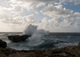 https://maltaclouds.net/wp-content/uploads/2018/09/Dwejra_Rough-Sea-1.jpg?v=1569919890
1536
2048
admin
http://maltaclouds.net/wp-content/uploads/2018/10/logo-1-300x138.png
admin2012-12-28 13:56:332018-11-17 13:58:03Rough sea in Dwejra
https://maltaclouds.net/wp-content/uploads/2018/09/Dwejra_Rough-Sea-1.jpg?v=1569919890
1536
2048
admin
http://maltaclouds.net/wp-content/uploads/2018/10/logo-1-300x138.png
admin2012-12-28 13:56:332018-11-17 13:58:03Rough sea in Dwejra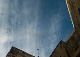 https://maltaclouds.net/wp-content/uploads/2018/09/Circumhorizontal-arc-1.jpg?v=1569919904
1536
2048
admin
http://maltaclouds.net/wp-content/uploads/2018/10/logo-1-300x138.png
admin2012-12-26 13:58:312018-11-17 14:00:16Circumhorizontal arc
https://maltaclouds.net/wp-content/uploads/2018/09/Circumhorizontal-arc-1.jpg?v=1569919904
1536
2048
admin
http://maltaclouds.net/wp-content/uploads/2018/10/logo-1-300x138.png
admin2012-12-26 13:58:312018-11-17 14:00:16Circumhorizontal arc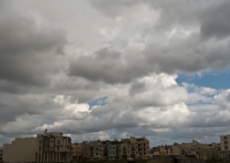 https://maltaclouds.net/wp-content/uploads/2018/09/8Dec12_CuCong.jpg?v=1569922991
1536
2048
admin
http://maltaclouds.net/wp-content/uploads/2018/10/logo-1-300x138.png
admin2012-12-08 14:03:262018-11-17 15:28:41Cold front very strong wind gusts
https://maltaclouds.net/wp-content/uploads/2018/09/8Dec12_CuCong.jpg?v=1569922991
1536
2048
admin
http://maltaclouds.net/wp-content/uploads/2018/10/logo-1-300x138.png
admin2012-12-08 14:03:262018-11-17 15:28:41Cold front very strong wind gusts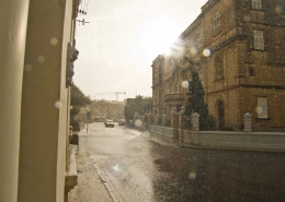 https://maltaclouds.net/wp-content/uploads/2018/09/sun_heavy_rain-1.jpg?v=1569919860
1536
2048
admin
http://maltaclouds.net/wp-content/uploads/2018/10/logo-1-300x138.png
admin2012-09-03 14:08:162018-11-17 14:11:18Heavy sun shower
https://maltaclouds.net/wp-content/uploads/2018/09/sun_heavy_rain-1.jpg?v=1569919860
1536
2048
admin
http://maltaclouds.net/wp-content/uploads/2018/10/logo-1-300x138.png
admin2012-09-03 14:08:162018-11-17 14:11:18Heavy sun shower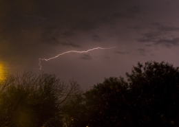 https://maltaclouds.net/wp-content/uploads/2018/09/AirtoAir_Lightning-1.jpg?v=1569919906
1536
2048
admin
http://maltaclouds.net/wp-content/uploads/2018/10/logo-1-300x138.png
admin2012-09-02 14:11:442018-11-17 15:30:52Air to Air Lightning
https://maltaclouds.net/wp-content/uploads/2018/09/AirtoAir_Lightning-1.jpg?v=1569919906
1536
2048
admin
http://maltaclouds.net/wp-content/uploads/2018/10/logo-1-300x138.png
admin2012-09-02 14:11:442018-11-17 15:30:52Air to Air Lightning https://maltaclouds.net/wp-content/uploads/2018/09/Heavysea_swell-1.jpg?v=1569919880
1536
2048
admin
http://maltaclouds.net/wp-content/uploads/2018/10/logo-1-300x138.png
admin2012-03-11 14:25:282018-11-17 14:31:29Heavy sea swell
https://maltaclouds.net/wp-content/uploads/2018/09/Heavysea_swell-1.jpg?v=1569919880
1536
2048
admin
http://maltaclouds.net/wp-content/uploads/2018/10/logo-1-300x138.png
admin2012-03-11 14:25:282018-11-17 14:31:29Heavy sea swell https://maltaclouds.net/wp-content/uploads/2018/09/heavy_bloodrain-1.jpg?v=1569919881
1788
1255
admin
http://maltaclouds.net/wp-content/uploads/2018/10/logo-1-300x138.png
admin2012-03-10 14:32:372018-11-17 14:33:59Heavy blood rain
https://maltaclouds.net/wp-content/uploads/2018/09/heavy_bloodrain-1.jpg?v=1569919881
1788
1255
admin
http://maltaclouds.net/wp-content/uploads/2018/10/logo-1-300x138.png
admin2012-03-10 14:32:372018-11-17 14:33:59Heavy blood rain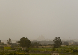 https://maltaclouds.net/wp-content/uploads/2018/09/thick_desertsandhaze-1.jpg?v=1569919857
1536
2048
admin
http://maltaclouds.net/wp-content/uploads/2018/10/logo-1-300x138.png
admin2012-03-10 14:28:262018-11-17 14:30:08Thick desert sand haze
https://maltaclouds.net/wp-content/uploads/2018/09/thick_desertsandhaze-1.jpg?v=1569919857
1536
2048
admin
http://maltaclouds.net/wp-content/uploads/2018/10/logo-1-300x138.png
admin2012-03-10 14:28:262018-11-17 14:30:08Thick desert sand haze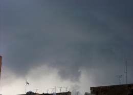 https://maltaclouds.net/wp-content/uploads/2018/09/funnel_cloud-1.jpg?v=1569919886
1536
2048
admin
http://maltaclouds.net/wp-content/uploads/2018/10/logo-1-300x138.png
admin2012-03-05 14:35:052018-11-17 14:37:27Funnel cloud??
https://maltaclouds.net/wp-content/uploads/2018/09/funnel_cloud-1.jpg?v=1569919886
1536
2048
admin
http://maltaclouds.net/wp-content/uploads/2018/10/logo-1-300x138.png
admin2012-03-05 14:35:052018-11-17 14:37:27Funnel cloud?? https://maltaclouds.net/wp-content/uploads/2018/09/Hailstorm-1.jpg?v=1569919883
720
960
admin
http://maltaclouds.net/wp-content/uploads/2018/10/logo-1-300x138.png
admin2012-02-14 14:37:502018-11-17 14:39:32Hail storm
https://maltaclouds.net/wp-content/uploads/2018/09/Hailstorm-1.jpg?v=1569919883
720
960
admin
http://maltaclouds.net/wp-content/uploads/2018/10/logo-1-300x138.png
admin2012-02-14 14:37:502018-11-17 14:39:32Hail storm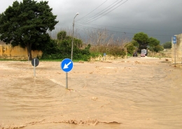 https://maltaclouds.net/wp-content/uploads/2018/09/Gozo_heavy_rain-1.jpg?v=1569919885
720
960
admin
http://maltaclouds.net/wp-content/uploads/2018/10/logo-1-300x138.png
admin2011-11-29 14:40:072018-11-17 14:42:00Gozo heavy rain
https://maltaclouds.net/wp-content/uploads/2018/09/Gozo_heavy_rain-1.jpg?v=1569919885
720
960
admin
http://maltaclouds.net/wp-content/uploads/2018/10/logo-1-300x138.png
admin2011-11-29 14:40:072018-11-17 14:42:00Gozo heavy rain https://maltaclouds.net/wp-content/uploads/2018/09/intra-cloudlightning-1.jpg?v=1569919879
640
480
admin
http://maltaclouds.net/wp-content/uploads/2018/10/logo-1-300x138.png
admin2011-11-19 14:42:502018-11-17 14:43:58Intra-cloud lightning
https://maltaclouds.net/wp-content/uploads/2018/09/intra-cloudlightning-1.jpg?v=1569919879
640
480
admin
http://maltaclouds.net/wp-content/uploads/2018/10/logo-1-300x138.png
admin2011-11-19 14:42:502018-11-17 14:43:58Intra-cloud lightningSand haze
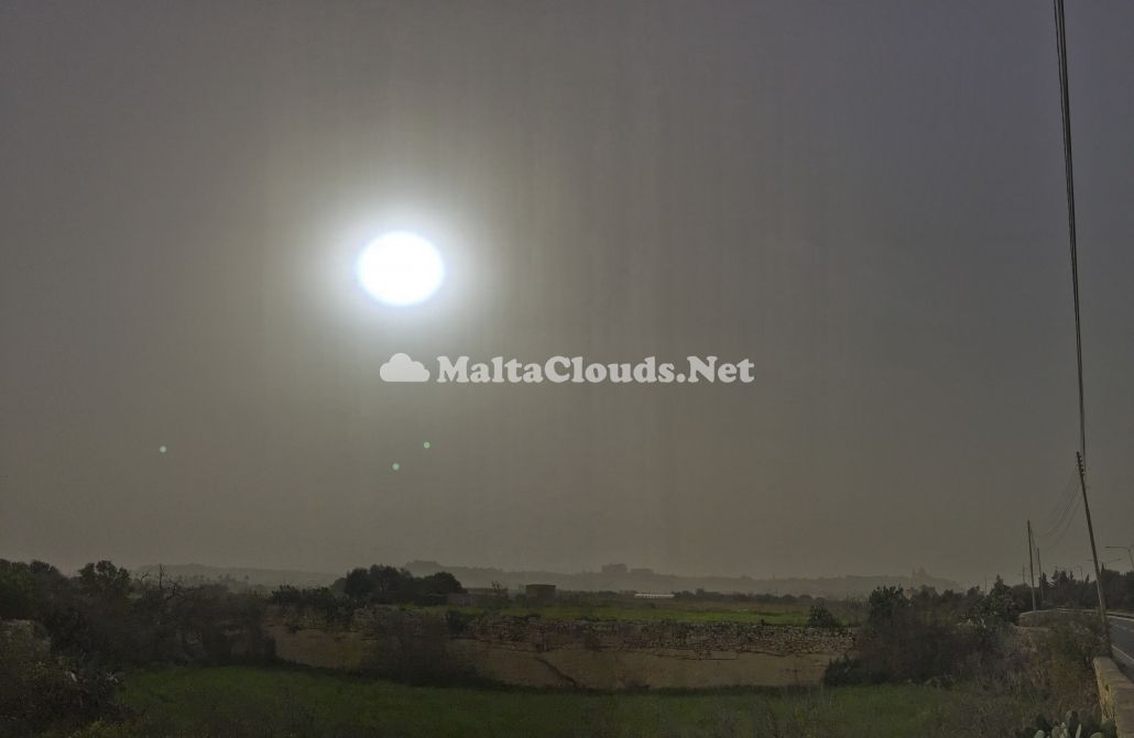
This photo shows ‘Lithometeors’ which the World Meteorological Organisation defines as suspension of dry particles in the atmosphere, in this case a sand haze because the extremely fine sand particles are individually invisible to the naked eye. However, being present in very huge quantities, these sand particles gave this photo an opalescent appearance. The larger sand particles are precipitated from the atmosphere well before reaching the Maltese Islands as the distance from North Africa is in the order of 450km from the Gulf of Gabes from where the dusty wind comes and is not able to pick up any more dust particles. The first thumbnail is a view of the dust haze against the sun from Rabat with the brownish appearance very clear to see. This dust haze was brought about by very extensive areas of low pressure extending from the UK all the way down to the Sahara desert via SW wind coming from the northern edge of the Sahara desert as per surface wind chart of the fourth thumbnail. The weather sounding shows the air profile over the Maltese Islands with a radiation inversion as the warm airmass travelled over a cooler sea making it more stable hence trapping the fine dust in the lowest layers of the atmosphere whilst the visible satellite image on the third thumbnail depicts the dust haze in the southern Mediterranean along with some high clouds.


Leave a Reply
Want to join the discussion?Feel free to contribute!