 https://maltaclouds.net/wp-content/uploads/2019/09/Cb-altocumulogenitus1.jpg?v=1569918576
3908
5868
admin
http://maltaclouds.net/wp-content/uploads/2018/10/logo-1-300x138.png
admin2019-06-15 17:58:532019-10-02 17:47:02Cb altocumulogenitus
https://maltaclouds.net/wp-content/uploads/2019/09/Cb-altocumulogenitus1.jpg?v=1569918576
3908
5868
admin
http://maltaclouds.net/wp-content/uploads/2018/10/logo-1-300x138.png
admin2019-06-15 17:58:532019-10-02 17:47:02Cb altocumulogenitus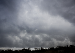 https://maltaclouds.net/wp-content/uploads/2019/09/Cb-arcus8.jpg?v=1569918575
2048
3072
admin
http://maltaclouds.net/wp-content/uploads/2018/10/logo-1-300x138.png
admin2019-05-16 17:49:122019-09-02 18:05:14Cb arcus
https://maltaclouds.net/wp-content/uploads/2019/09/Cb-arcus8.jpg?v=1569918575
2048
3072
admin
http://maltaclouds.net/wp-content/uploads/2018/10/logo-1-300x138.png
admin2019-05-16 17:49:122019-09-02 18:05:14Cb arcus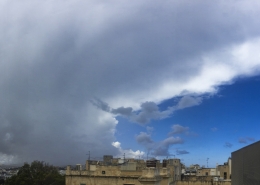 https://maltaclouds.net/wp-content/uploads/2019/09/Cb-incus49.jpg?v=1569918574
2879
5845
admin
http://maltaclouds.net/wp-content/uploads/2018/10/logo-1-300x138.png
admin2019-05-14 17:33:112019-09-06 15:45:37Cb incus
https://maltaclouds.net/wp-content/uploads/2019/09/Cb-incus49.jpg?v=1569918574
2879
5845
admin
http://maltaclouds.net/wp-content/uploads/2018/10/logo-1-300x138.png
admin2019-05-14 17:33:112019-09-06 15:45:37Cb incus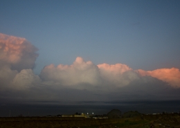 https://maltaclouds.net/wp-content/uploads/2019/05/Cb-calvus21.jpg?v=1569919540
1579
3035
admin
http://maltaclouds.net/wp-content/uploads/2018/10/logo-1-300x138.png
admin2019-03-21 18:35:212019-06-05 18:39:53Cb calvus
https://maltaclouds.net/wp-content/uploads/2019/05/Cb-calvus21.jpg?v=1569919540
1579
3035
admin
http://maltaclouds.net/wp-content/uploads/2018/10/logo-1-300x138.png
admin2019-03-21 18:35:212019-06-05 18:39:53Cb calvus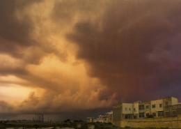 https://maltaclouds.net/wp-content/uploads/2019/05/Cb-cauda.jpg?v=1569919539
3110
7930
admin
http://maltaclouds.net/wp-content/uploads/2018/10/logo-1-300x138.png
admin2019-02-27 18:31:132019-06-05 18:34:52Cb cauda
https://maltaclouds.net/wp-content/uploads/2019/05/Cb-cauda.jpg?v=1569919539
3110
7930
admin
http://maltaclouds.net/wp-content/uploads/2018/10/logo-1-300x138.png
admin2019-02-27 18:31:132019-06-05 18:34:52Cb cauda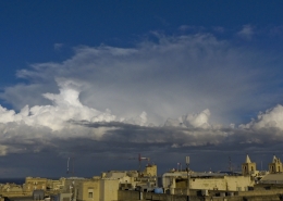 https://maltaclouds.net/wp-content/uploads/2019/05/Cb-capillatus19.jpg?v=1569919534
1965
3706
admin
http://maltaclouds.net/wp-content/uploads/2018/10/logo-1-300x138.png
admin2019-02-12 18:22:542019-06-05 18:30:42Cb capillatus
https://maltaclouds.net/wp-content/uploads/2019/05/Cb-capillatus19.jpg?v=1569919534
1965
3706
admin
http://maltaclouds.net/wp-content/uploads/2018/10/logo-1-300x138.png
admin2019-02-12 18:22:542019-06-05 18:30:42Cb capillatus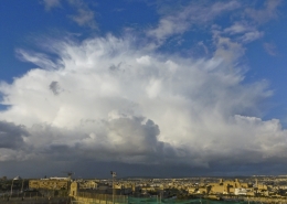 https://maltaclouds.net/wp-content/uploads/2019/05/Cb-capillatus18.jpg?v=1569919529
2274
3706
admin
http://maltaclouds.net/wp-content/uploads/2018/10/logo-1-300x138.png
admin2019-01-29 08:19:502019-06-05 18:22:06Cb capillatus
https://maltaclouds.net/wp-content/uploads/2019/05/Cb-capillatus18.jpg?v=1569919529
2274
3706
admin
http://maltaclouds.net/wp-content/uploads/2018/10/logo-1-300x138.png
admin2019-01-29 08:19:502019-06-05 18:22:06Cb capillatus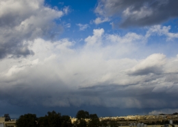 https://maltaclouds.net/wp-content/uploads/2019/05/Cb-calvus20.jpg?v=1569919521
1829
3046
admin
http://maltaclouds.net/wp-content/uploads/2018/10/logo-1-300x138.png
admin2019-01-04 18:15:202019-06-05 18:19:27Cb calvus
https://maltaclouds.net/wp-content/uploads/2019/05/Cb-calvus20.jpg?v=1569919521
1829
3046
admin
http://maltaclouds.net/wp-content/uploads/2018/10/logo-1-300x138.png
admin2019-01-04 18:15:202019-06-05 18:19:27Cb calvus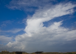 https://maltaclouds.net/wp-content/uploads/2019/05/Cb-capillatus17.jpg?v=1569919508
1365
2048
admin
http://maltaclouds.net/wp-content/uploads/2018/10/logo-1-300x138.png
admin2018-11-11 18:12:562019-06-05 18:14:54Cb capillatus
https://maltaclouds.net/wp-content/uploads/2019/05/Cb-capillatus17.jpg?v=1569919508
1365
2048
admin
http://maltaclouds.net/wp-content/uploads/2018/10/logo-1-300x138.png
admin2018-11-11 18:12:562019-06-05 18:14:54Cb capillatus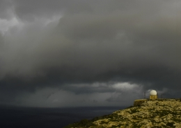 https://maltaclouds.net/wp-content/uploads/2019/05/Cb-arcus7.jpg?v=1569919507
1808
7356
admin
http://maltaclouds.net/wp-content/uploads/2018/10/logo-1-300x138.png
admin2018-11-10 18:07:422019-06-05 18:12:35Cb arcus
https://maltaclouds.net/wp-content/uploads/2019/05/Cb-arcus7.jpg?v=1569919507
1808
7356
admin
http://maltaclouds.net/wp-content/uploads/2018/10/logo-1-300x138.png
admin2018-11-10 18:07:422019-06-05 18:12:35Cb arcus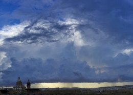 https://maltaclouds.net/wp-content/uploads/2019/05/Cb-capillatus16.jpg?v=1569919498
2436
7904
admin
http://maltaclouds.net/wp-content/uploads/2018/10/logo-1-300x138.png
admin2018-10-23 18:04:272019-06-05 18:07:20Cb capillatus
https://maltaclouds.net/wp-content/uploads/2019/05/Cb-capillatus16.jpg?v=1569919498
2436
7904
admin
http://maltaclouds.net/wp-content/uploads/2018/10/logo-1-300x138.png
admin2018-10-23 18:04:272019-06-05 18:07:20Cb capillatus https://maltaclouds.net/wp-content/uploads/2019/05/Cb-capillatus15.jpg?v=1569919495
3246
5061
admin
http://maltaclouds.net/wp-content/uploads/2018/10/logo-1-300x138.png
admin2018-10-09 17:57:212019-06-05 18:03:57Cb capillatus
https://maltaclouds.net/wp-content/uploads/2019/05/Cb-capillatus15.jpg?v=1569919495
3246
5061
admin
http://maltaclouds.net/wp-content/uploads/2018/10/logo-1-300x138.png
admin2018-10-09 17:57:212019-06-05 18:03:57Cb capillatus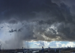 https://maltaclouds.net/wp-content/uploads/2019/05/Cb-praecipitatio6.jpg?v=1569919494
2943
5745
admin
http://maltaclouds.net/wp-content/uploads/2018/10/logo-1-300x138.png
admin2018-10-08 16:48:582019-06-05 16:51:39Cb praecipitatio
https://maltaclouds.net/wp-content/uploads/2019/05/Cb-praecipitatio6.jpg?v=1569919494
2943
5745
admin
http://maltaclouds.net/wp-content/uploads/2018/10/logo-1-300x138.png
admin2018-10-08 16:48:582019-06-05 16:51:39Cb praecipitatio https://maltaclouds.net/wp-content/uploads/2019/05/Cb-incus48.jpg?v=1569919493
1715
4955
admin
http://maltaclouds.net/wp-content/uploads/2018/10/logo-1-300x138.png
admin2018-10-03 16:45:192019-06-05 16:48:32Cb incus
https://maltaclouds.net/wp-content/uploads/2019/05/Cb-incus48.jpg?v=1569919493
1715
4955
admin
http://maltaclouds.net/wp-content/uploads/2018/10/logo-1-300x138.png
admin2018-10-03 16:45:192019-06-05 16:48:32Cb incus https://maltaclouds.net/wp-content/uploads/2019/05/Cb-arcus6.jpg?v=1569919491
3888
5184
admin
http://maltaclouds.net/wp-content/uploads/2018/10/logo-1-300x138.png
admin2018-10-02 16:23:252019-06-05 16:44:29Cb arcus
https://maltaclouds.net/wp-content/uploads/2019/05/Cb-arcus6.jpg?v=1569919491
3888
5184
admin
http://maltaclouds.net/wp-content/uploads/2018/10/logo-1-300x138.png
admin2018-10-02 16:23:252019-06-05 16:44:29Cb arcus https://maltaclouds.net/wp-content/uploads/2019/05/Cb-murus.jpg?v=1569919482
1365
2048
admin
http://maltaclouds.net/wp-content/uploads/2018/10/logo-1-300x138.png
admin2018-08-22 16:19:382019-06-05 16:22:26Cb murus
https://maltaclouds.net/wp-content/uploads/2019/05/Cb-murus.jpg?v=1569919482
1365
2048
admin
http://maltaclouds.net/wp-content/uploads/2018/10/logo-1-300x138.png
admin2018-08-22 16:19:382019-06-05 16:22:26Cb murus https://maltaclouds.net/wp-content/uploads/2019/05/Cb-incus47.jpg?v=1569919482
2936
6389
admin
http://maltaclouds.net/wp-content/uploads/2018/10/logo-1-300x138.png
admin2018-08-19 16:15:572019-06-05 16:19:07Cb incus
https://maltaclouds.net/wp-content/uploads/2019/05/Cb-incus47.jpg?v=1569919482
2936
6389
admin
http://maltaclouds.net/wp-content/uploads/2018/10/logo-1-300x138.png
admin2018-08-19 16:15:572019-06-05 16:19:07Cb incus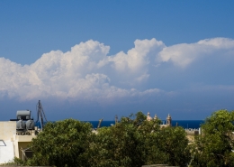 https://maltaclouds.net/wp-content/uploads/2018/09/Cb-incus46.jpg?v=1569919728
1204
2926
admin
http://maltaclouds.net/wp-content/uploads/2018/10/logo-1-300x138.png
admin2018-08-17 16:11:172019-06-05 16:13:52Cb incus
https://maltaclouds.net/wp-content/uploads/2018/09/Cb-incus46.jpg?v=1569919728
1204
2926
admin
http://maltaclouds.net/wp-content/uploads/2018/10/logo-1-300x138.png
admin2018-08-17 16:11:172019-06-05 16:13:52Cb incus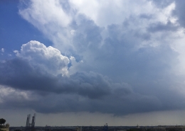 https://maltaclouds.net/wp-content/uploads/2019/05/Cb-capillatus14.jpg?v=1569919479
2448
3264
admin
http://maltaclouds.net/wp-content/uploads/2018/10/logo-1-300x138.png
admin2018-08-14 16:07:332019-06-05 16:10:40Cb capillatus
https://maltaclouds.net/wp-content/uploads/2019/05/Cb-capillatus14.jpg?v=1569919479
2448
3264
admin
http://maltaclouds.net/wp-content/uploads/2018/10/logo-1-300x138.png
admin2018-08-14 16:07:332019-06-05 16:10:40Cb capillatus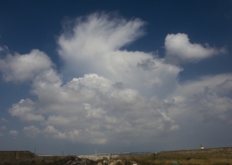 https://maltaclouds.net/wp-content/uploads/2019/05/Cb-capillatus13.jpg?v=1569919477
1174
2010
admin
http://maltaclouds.net/wp-content/uploads/2018/10/logo-1-300x138.png
admin2018-08-05 16:03:242019-06-05 16:06:52Cb capillatus
https://maltaclouds.net/wp-content/uploads/2019/05/Cb-capillatus13.jpg?v=1569919477
1174
2010
admin
http://maltaclouds.net/wp-content/uploads/2018/10/logo-1-300x138.png
admin2018-08-05 16:03:242019-06-05 16:06:52Cb capillatus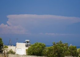 https://maltaclouds.net/wp-content/uploads/2019/05/Cb-capillatus12.jpg?v=1569919475
862
1804
admin
http://maltaclouds.net/wp-content/uploads/2018/10/logo-1-300x138.png
admin2018-07-10 16:01:072019-06-05 16:03:02Cb capillatus
https://maltaclouds.net/wp-content/uploads/2019/05/Cb-capillatus12.jpg?v=1569919475
862
1804
admin
http://maltaclouds.net/wp-content/uploads/2018/10/logo-1-300x138.png
admin2018-07-10 16:01:072019-06-05 16:03:02Cb capillatus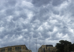 https://maltaclouds.net/wp-content/uploads/2019/05/Cb-mammatus12.jpg?v=1569919473
3070
7250
admin
http://maltaclouds.net/wp-content/uploads/2018/10/logo-1-300x138.png
admin2018-06-25 15:58:372019-06-05 16:00:41Cb mammatus
https://maltaclouds.net/wp-content/uploads/2019/05/Cb-mammatus12.jpg?v=1569919473
3070
7250
admin
http://maltaclouds.net/wp-content/uploads/2018/10/logo-1-300x138.png
admin2018-06-25 15:58:372019-06-05 16:00:41Cb mammatus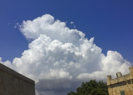 https://maltaclouds.net/wp-content/uploads/2019/05/Cb-capillatus11.jpg?v=1569919471
2448
3264
admin
http://maltaclouds.net/wp-content/uploads/2018/10/logo-1-300x138.png
admin2018-06-21 15:54:332019-06-05 15:58:08Cb capillatus
https://maltaclouds.net/wp-content/uploads/2019/05/Cb-capillatus11.jpg?v=1569919471
2448
3264
admin
http://maltaclouds.net/wp-content/uploads/2018/10/logo-1-300x138.png
admin2018-06-21 15:54:332019-06-05 15:58:08Cb capillatus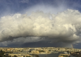 https://maltaclouds.net/wp-content/uploads/2019/05/Cb-incus45.jpg?v=1569919455
2905
6212
admin
http://maltaclouds.net/wp-content/uploads/2018/10/logo-1-300x138.png
admin2018-03-26 07:51:252019-06-05 15:53:48Cb incus
https://maltaclouds.net/wp-content/uploads/2019/05/Cb-incus45.jpg?v=1569919455
2905
6212
admin
http://maltaclouds.net/wp-content/uploads/2018/10/logo-1-300x138.png
admin2018-03-26 07:51:252019-06-05 15:53:48Cb incus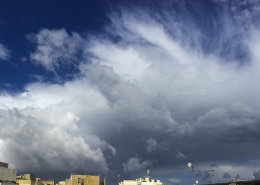 https://maltaclouds.net/wp-content/uploads/2018/09/Cb-incus44.jpg?v=1569919729
3061
5416
admin
http://maltaclouds.net/wp-content/uploads/2018/10/logo-1-300x138.png
admin2018-02-26 15:48:342019-06-05 15:51:00Cb incus
https://maltaclouds.net/wp-content/uploads/2018/09/Cb-incus44.jpg?v=1569919729
3061
5416
admin
http://maltaclouds.net/wp-content/uploads/2018/10/logo-1-300x138.png
admin2018-02-26 15:48:342019-06-05 15:51:00Cb incus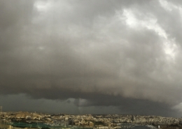 https://maltaclouds.net/wp-content/uploads/2019/05/Cb-arcus5.jpg?v=1569919449
2792
5251
admin
http://maltaclouds.net/wp-content/uploads/2018/10/logo-1-300x138.png
admin2018-02-23 15:45:122019-06-05 15:47:59Cb arcus
https://maltaclouds.net/wp-content/uploads/2019/05/Cb-arcus5.jpg?v=1569919449
2792
5251
admin
http://maltaclouds.net/wp-content/uploads/2018/10/logo-1-300x138.png
admin2018-02-23 15:45:122019-06-05 15:47:59Cb arcus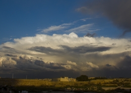 https://maltaclouds.net/wp-content/uploads/2019/05/Cb-incus43.jpg?v=1569919562
1227
2550
admin
http://maltaclouds.net/wp-content/uploads/2018/10/logo-1-300x138.png
admin2017-11-15 15:40:372019-06-05 15:44:41Cb incus
https://maltaclouds.net/wp-content/uploads/2019/05/Cb-incus43.jpg?v=1569919562
1227
2550
admin
http://maltaclouds.net/wp-content/uploads/2018/10/logo-1-300x138.png
admin2017-11-15 15:40:372019-06-05 15:44:41Cb incus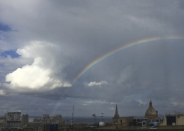 https://maltaclouds.net/wp-content/uploads/2019/05/Cb-incus42.jpg?v=1569919560
2551
3894
admin
http://maltaclouds.net/wp-content/uploads/2018/10/logo-1-300x138.png
admin2017-11-13 19:17:232019-06-04 19:21:55Cb incus
https://maltaclouds.net/wp-content/uploads/2019/05/Cb-incus42.jpg?v=1569919560
2551
3894
admin
http://maltaclouds.net/wp-content/uploads/2018/10/logo-1-300x138.png
admin2017-11-13 19:17:232019-06-04 19:21:55Cb incus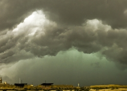 https://maltaclouds.net/wp-content/uploads/2019/05/Cb-arcus4.jpg?v=1569919560
3090
5724
admin
http://maltaclouds.net/wp-content/uploads/2018/10/logo-1-300x138.png
admin2017-11-10 19:08:112019-06-04 19:16:29Cb arcus
https://maltaclouds.net/wp-content/uploads/2019/05/Cb-arcus4.jpg?v=1569919560
3090
5724
admin
http://maltaclouds.net/wp-content/uploads/2018/10/logo-1-300x138.png
admin2017-11-10 19:08:112019-06-04 19:16:29Cb arcus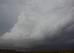 https://maltaclouds.net/wp-content/uploads/2019/05/Cb-calvus19.jpg?v=1569919559
2048
3072
admin
http://maltaclouds.net/wp-content/uploads/2018/10/logo-1-300x138.png
admin2017-11-10 19:01:542019-06-04 19:14:23Cb calvus
https://maltaclouds.net/wp-content/uploads/2019/05/Cb-calvus19.jpg?v=1569919559
2048
3072
admin
http://maltaclouds.net/wp-content/uploads/2018/10/logo-1-300x138.png
admin2017-11-10 19:01:542019-06-04 19:14:23Cb calvus https://maltaclouds.net/wp-content/uploads/2019/01/Cb-incus41.jpg?v=1569919564
1606
3072
maltaclouds
http://maltaclouds.net/wp-content/uploads/2018/10/logo-1-300x138.png
maltaclouds2017-10-03 14:47:302019-01-19 15:04:33Cb Incus
https://maltaclouds.net/wp-content/uploads/2019/01/Cb-incus41.jpg?v=1569919564
1606
3072
maltaclouds
http://maltaclouds.net/wp-content/uploads/2018/10/logo-1-300x138.png
maltaclouds2017-10-03 14:47:302019-01-19 15:04:33Cb Incus https://maltaclouds.net/wp-content/uploads/2018/09/Cb-altocumulogenitus.jpg?v=1569920045
1811
3072
admin
http://maltaclouds.net/wp-content/uploads/2018/10/logo-1-300x138.png
admin2017-04-16 19:14:492018-11-08 19:17:40Cb altocumulogenitus
https://maltaclouds.net/wp-content/uploads/2018/09/Cb-altocumulogenitus.jpg?v=1569920045
1811
3072
admin
http://maltaclouds.net/wp-content/uploads/2018/10/logo-1-300x138.png
admin2017-04-16 19:14:492018-11-08 19:17:40Cb altocumulogenitus https://maltaclouds.net/wp-content/uploads/2018/09/Cb-capillatus10.jpg?v=1569920023
2152
4353
admin
http://maltaclouds.net/wp-content/uploads/2018/10/logo-1-300x138.png
admin2017-04-04 19:19:432018-11-08 19:23:01Cb capillatus
https://maltaclouds.net/wp-content/uploads/2018/09/Cb-capillatus10.jpg?v=1569920023
2152
4353
admin
http://maltaclouds.net/wp-content/uploads/2018/10/logo-1-300x138.png
admin2017-04-04 19:19:432018-11-08 19:23:01Cb capillatus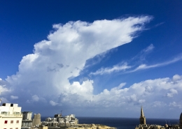 https://maltaclouds.net/wp-content/uploads/2018/09/Cb-capillatus9.jpg?v=1569920024
2016
3188
admin
http://maltaclouds.net/wp-content/uploads/2018/10/logo-1-300x138.png
admin2017-03-07 19:30:072018-11-09 16:37:45Cb capillatus
https://maltaclouds.net/wp-content/uploads/2018/09/Cb-capillatus9.jpg?v=1569920024
2016
3188
admin
http://maltaclouds.net/wp-content/uploads/2018/10/logo-1-300x138.png
admin2017-03-07 19:30:072018-11-09 16:37:45Cb capillatus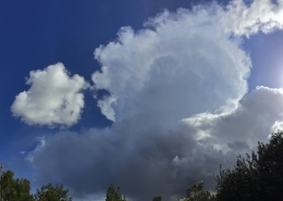 https://maltaclouds.net/wp-content/uploads/2018/09/Cb-incus40.jpg?v=1569920001
3130
5054
admin
http://maltaclouds.net/wp-content/uploads/2018/10/logo-1-300x138.png
admin2017-01-25 16:38:372018-11-09 16:41:27Cb incus
https://maltaclouds.net/wp-content/uploads/2018/09/Cb-incus40.jpg?v=1569920001
3130
5054
admin
http://maltaclouds.net/wp-content/uploads/2018/10/logo-1-300x138.png
admin2017-01-25 16:38:372018-11-09 16:41:27Cb incus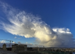 https://maltaclouds.net/wp-content/uploads/2018/09/Cb-mammatus11.jpg?v=1569919993
2839
4852
admin
http://maltaclouds.net/wp-content/uploads/2018/10/logo-1-300x138.png
admin2017-01-16 16:42:002018-11-09 16:44:17Cb mammatus
https://maltaclouds.net/wp-content/uploads/2018/09/Cb-mammatus11.jpg?v=1569919993
2839
4852
admin
http://maltaclouds.net/wp-content/uploads/2018/10/logo-1-300x138.png
admin2017-01-16 16:42:002018-11-09 16:44:17Cb mammatus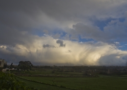 https://maltaclouds.net/wp-content/uploads/2018/09/Cb-praecipitatio5.jpg?v=1569919720
1365
2048
admin
http://maltaclouds.net/wp-content/uploads/2018/10/logo-1-300x138.png
admin2017-01-06 18:54:132019-06-04 19:01:32Cb praecipitatio
https://maltaclouds.net/wp-content/uploads/2018/09/Cb-praecipitatio5.jpg?v=1569919720
1365
2048
admin
http://maltaclouds.net/wp-content/uploads/2018/10/logo-1-300x138.png
admin2017-01-06 18:54:132019-06-04 19:01:32Cb praecipitatio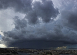 https://maltaclouds.net/wp-content/uploads/2018/09/Cb-praecipitatio4.jpg?v=1569919991
2886
5752
admin
http://maltaclouds.net/wp-content/uploads/2018/10/logo-1-300x138.png
admin2016-11-28 16:47:542018-11-09 16:50:25Cb praecipitatio
https://maltaclouds.net/wp-content/uploads/2018/09/Cb-praecipitatio4.jpg?v=1569919991
2886
5752
admin
http://maltaclouds.net/wp-content/uploads/2018/10/logo-1-300x138.png
admin2016-11-28 16:47:542018-11-09 16:50:25Cb praecipitatio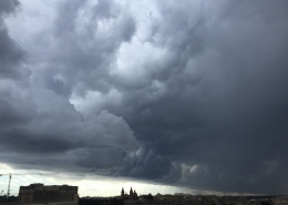 https://maltaclouds.net/wp-content/uploads/2018/09/Cb-arcus3.jpg?v=1569920041
2448
3264
admin
http://maltaclouds.net/wp-content/uploads/2018/10/logo-1-300x138.png
admin2016-11-28 16:44:422018-11-09 16:46:57Cb arcus
https://maltaclouds.net/wp-content/uploads/2018/09/Cb-arcus3.jpg?v=1569920041
2448
3264
admin
http://maltaclouds.net/wp-content/uploads/2018/10/logo-1-300x138.png
admin2016-11-28 16:44:422018-11-09 16:46:57Cb arcus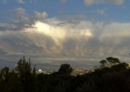 https://maltaclouds.net/wp-content/uploads/2018/09/Cb-mammatus10.jpg?v=1569919994
1572
2989
admin
http://maltaclouds.net/wp-content/uploads/2018/10/logo-1-300x138.png
admin2016-10-27 16:50:512018-11-09 16:52:59Cb mammatus
https://maltaclouds.net/wp-content/uploads/2018/09/Cb-mammatus10.jpg?v=1569919994
1572
2989
admin
http://maltaclouds.net/wp-content/uploads/2018/10/logo-1-300x138.png
admin2016-10-27 16:50:512018-11-09 16:52:59Cb mammatus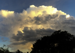 https://maltaclouds.net/wp-content/uploads/2018/09/Cb-capillatus8.jpg?v=1569920025
2974
7104
admin
http://maltaclouds.net/wp-content/uploads/2018/10/logo-1-300x138.png
admin2016-10-20 16:53:522019-10-02 17:58:46Cb capillatus
https://maltaclouds.net/wp-content/uploads/2018/09/Cb-capillatus8.jpg?v=1569920025
2974
7104
admin
http://maltaclouds.net/wp-content/uploads/2018/10/logo-1-300x138.png
admin2016-10-20 16:53:522019-10-02 17:58:46Cb capillatus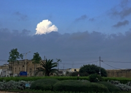 https://maltaclouds.net/wp-content/uploads/2018/09/Cb-calvus18.jpg?v=1569920030
1724
2660
admin
http://maltaclouds.net/wp-content/uploads/2018/10/logo-1-300x138.png
admin2016-06-24 16:57:112018-11-09 16:59:20Cb calvus
https://maltaclouds.net/wp-content/uploads/2018/09/Cb-calvus18.jpg?v=1569920030
1724
2660
admin
http://maltaclouds.net/wp-content/uploads/2018/10/logo-1-300x138.png
admin2016-06-24 16:57:112018-11-09 16:59:20Cb calvus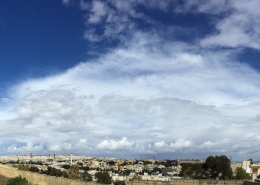 https://maltaclouds.net/wp-content/uploads/2018/09/Cb-incus38.jpg?v=1569920002
2873
7764
admin
http://maltaclouds.net/wp-content/uploads/2018/10/logo-1-300x138.png
admin2016-03-13 16:59:512018-11-09 17:02:24Cb incus
https://maltaclouds.net/wp-content/uploads/2018/09/Cb-incus38.jpg?v=1569920002
2873
7764
admin
http://maltaclouds.net/wp-content/uploads/2018/10/logo-1-300x138.png
admin2016-03-13 16:59:512018-11-09 17:02:24Cb incus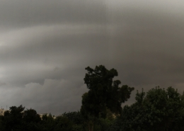 https://maltaclouds.net/wp-content/uploads/2018/09/Shelf-cloud1.jpg?v=1569919989
2471
5329
admin
http://maltaclouds.net/wp-content/uploads/2018/10/logo-1-300x138.png
admin2016-02-18 17:03:022018-11-09 17:05:26Cb arcus
https://maltaclouds.net/wp-content/uploads/2018/09/Shelf-cloud1.jpg?v=1569919989
2471
5329
admin
http://maltaclouds.net/wp-content/uploads/2018/10/logo-1-300x138.png
admin2016-02-18 17:03:022018-11-09 17:05:26Cb arcus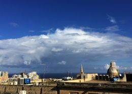 https://maltaclouds.net/wp-content/uploads/2018/09/Cb-Incus36.jpg?v=1569920003
1820
3264
admin
http://maltaclouds.net/wp-content/uploads/2018/10/logo-1-300x138.png
admin2015-12-21 17:05:522018-11-09 17:10:05Cb incus
https://maltaclouds.net/wp-content/uploads/2018/09/Cb-Incus36.jpg?v=1569920003
1820
3264
admin
http://maltaclouds.net/wp-content/uploads/2018/10/logo-1-300x138.png
admin2015-12-21 17:05:522018-11-09 17:10:05Cb incus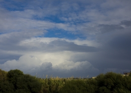 https://maltaclouds.net/wp-content/uploads/2018/09/Cb-incus35.jpg?v=1569920003
1365
2048
admin
http://maltaclouds.net/wp-content/uploads/2018/10/logo-1-300x138.png
admin2015-11-26 17:10:322018-11-09 17:28:55Cb incus
https://maltaclouds.net/wp-content/uploads/2018/09/Cb-incus35.jpg?v=1569920003
1365
2048
admin
http://maltaclouds.net/wp-content/uploads/2018/10/logo-1-300x138.png
admin2015-11-26 17:10:322018-11-09 17:28:55Cb incus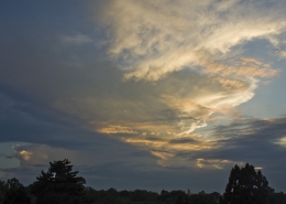 https://maltaclouds.net/wp-content/uploads/2018/09/Cb-incus34.jpg?v=1569920004
1365
2048
admin
http://maltaclouds.net/wp-content/uploads/2018/10/logo-1-300x138.png
admin2015-11-06 17:30:252018-11-09 17:33:06Cb incus
https://maltaclouds.net/wp-content/uploads/2018/09/Cb-incus34.jpg?v=1569920004
1365
2048
admin
http://maltaclouds.net/wp-content/uploads/2018/10/logo-1-300x138.png
admin2015-11-06 17:30:252018-11-09 17:33:06Cb incus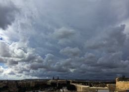 https://maltaclouds.net/wp-content/uploads/2018/09/Cb-Incus33.jpg?v=1569920005
2448
3264
admin
http://maltaclouds.net/wp-content/uploads/2018/10/logo-1-300x138.png
admin2015-10-22 17:33:222018-11-16 21:24:24Cb incus
https://maltaclouds.net/wp-content/uploads/2018/09/Cb-Incus33.jpg?v=1569920005
2448
3264
admin
http://maltaclouds.net/wp-content/uploads/2018/10/logo-1-300x138.png
admin2015-10-22 17:33:222018-11-16 21:24:24Cb incus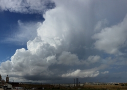 https://maltaclouds.net/wp-content/uploads/2018/09/Cb-capillatus7.jpg?v=1569920026
1339
2500
admin
http://maltaclouds.net/wp-content/uploads/2018/10/logo-1-300x138.png
admin2015-10-03 17:39:592018-11-09 17:49:41Cb capillatus
https://maltaclouds.net/wp-content/uploads/2018/09/Cb-capillatus7.jpg?v=1569920026
1339
2500
admin
http://maltaclouds.net/wp-content/uploads/2018/10/logo-1-300x138.png
admin2015-10-03 17:39:592018-11-09 17:49:41Cb capillatus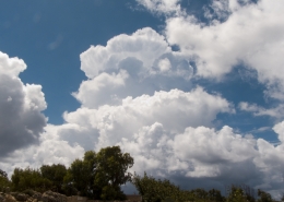 https://maltaclouds.net/wp-content/uploads/2018/09/Cb-calvus17-1.jpg?v=1569920031
1536
2048
admin
http://maltaclouds.net/wp-content/uploads/2018/10/logo-1-300x138.png
admin2015-08-12 17:50:442018-11-09 18:01:53Cb calvus
https://maltaclouds.net/wp-content/uploads/2018/09/Cb-calvus17-1.jpg?v=1569920031
1536
2048
admin
http://maltaclouds.net/wp-content/uploads/2018/10/logo-1-300x138.png
admin2015-08-12 17:50:442018-11-09 18:01:53Cb calvus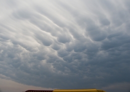 https://maltaclouds.net/wp-content/uploads/2018/09/Cb-mammatus9-1.jpg?v=1569919995
1536
2048
admin
http://maltaclouds.net/wp-content/uploads/2018/10/logo-1-300x138.png
admin2015-08-08 18:07:572018-11-09 19:22:12Cb mammatus
https://maltaclouds.net/wp-content/uploads/2018/09/Cb-mammatus9-1.jpg?v=1569919995
1536
2048
admin
http://maltaclouds.net/wp-content/uploads/2018/10/logo-1-300x138.png
admin2015-08-08 18:07:572018-11-09 19:22:12Cb mammatus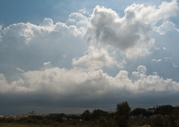 https://maltaclouds.net/wp-content/uploads/2018/09/Cb-calvus16-1.jpg?v=1569920032
1536
2048
admin
http://maltaclouds.net/wp-content/uploads/2018/10/logo-1-300x138.png
admin2015-08-08 18:03:252018-11-09 19:27:45Cb calvus
https://maltaclouds.net/wp-content/uploads/2018/09/Cb-calvus16-1.jpg?v=1569920032
1536
2048
admin
http://maltaclouds.net/wp-content/uploads/2018/10/logo-1-300x138.png
admin2015-08-08 18:03:252018-11-09 19:27:45Cb calvus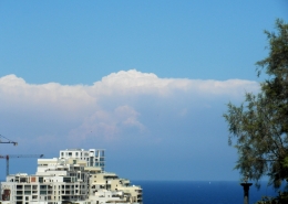 https://maltaclouds.net/wp-content/uploads/2018/09/Cb-calvus15-1.jpg?v=1569920033
1860
2538
admin
http://maltaclouds.net/wp-content/uploads/2018/10/logo-1-300x138.png
admin2015-07-24 19:32:082018-11-09 19:36:25Cb calvus
https://maltaclouds.net/wp-content/uploads/2018/09/Cb-calvus15-1.jpg?v=1569920033
1860
2538
admin
http://maltaclouds.net/wp-content/uploads/2018/10/logo-1-300x138.png
admin2015-07-24 19:32:082018-11-09 19:36:25Cb calvus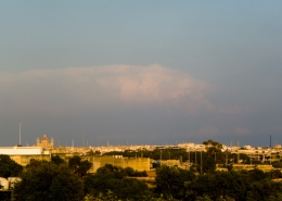 https://maltaclouds.net/wp-content/uploads/2018/09/Cb-incus32-1.jpg?v=1569920006
1536
2048
admin
http://maltaclouds.net/wp-content/uploads/2018/10/logo-1-300x138.png
admin2015-06-08 19:37:392018-11-09 19:40:54Cb incus
https://maltaclouds.net/wp-content/uploads/2018/09/Cb-incus32-1.jpg?v=1569920006
1536
2048
admin
http://maltaclouds.net/wp-content/uploads/2018/10/logo-1-300x138.png
admin2015-06-08 19:37:392018-11-09 19:40:54Cb incus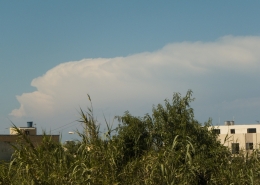 https://maltaclouds.net/wp-content/uploads/2018/09/Cb-incus31-1.jpg?v=1569920007
1536
2048
admin
http://maltaclouds.net/wp-content/uploads/2018/10/logo-1-300x138.png
admin2015-05-10 19:46:382018-11-09 19:49:45Cb incus
https://maltaclouds.net/wp-content/uploads/2018/09/Cb-incus31-1.jpg?v=1569920007
1536
2048
admin
http://maltaclouds.net/wp-content/uploads/2018/10/logo-1-300x138.png
admin2015-05-10 19:46:382018-11-09 19:49:45Cb incus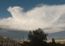 https://maltaclouds.net/wp-content/uploads/2018/09/Cb-mammatus8-1.jpg?v=1569919996
1536
2048
admin
http://maltaclouds.net/wp-content/uploads/2018/10/logo-1-300x138.png
admin2015-05-10 19:43:562018-11-09 19:51:08Cb mammatus
https://maltaclouds.net/wp-content/uploads/2018/09/Cb-mammatus8-1.jpg?v=1569919996
1536
2048
admin
http://maltaclouds.net/wp-content/uploads/2018/10/logo-1-300x138.png
admin2015-05-10 19:43:562018-11-09 19:51:08Cb mammatus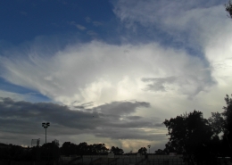 https://maltaclouds.net/wp-content/uploads/2018/09/Cb-incus29-1.jpg?v=1569920008
1792
2482
admin
http://maltaclouds.net/wp-content/uploads/2018/10/logo-1-300x138.png
admin2015-02-27 19:53:352018-11-09 19:55:22Cb incus
https://maltaclouds.net/wp-content/uploads/2018/09/Cb-incus29-1.jpg?v=1569920008
1792
2482
admin
http://maltaclouds.net/wp-content/uploads/2018/10/logo-1-300x138.png
admin2015-02-27 19:53:352018-11-09 19:55:22Cb incus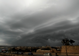 https://maltaclouds.net/wp-content/uploads/2018/09/Shelf-cloud-1.jpg?v=1569919990
1944
2592
admin
http://maltaclouds.net/wp-content/uploads/2018/10/logo-1-300x138.png
admin2015-02-24 19:57:492018-11-09 20:01:37Shelf cloud
https://maltaclouds.net/wp-content/uploads/2018/09/Shelf-cloud-1.jpg?v=1569919990
1944
2592
admin
http://maltaclouds.net/wp-content/uploads/2018/10/logo-1-300x138.png
admin2015-02-24 19:57:492018-11-09 20:01:37Shelf cloud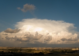 https://maltaclouds.net/wp-content/uploads/2018/09/Cb-incus28-1.jpg?v=1569920009
1536
2048
admin
http://maltaclouds.net/wp-content/uploads/2018/10/logo-1-300x138.png
admin2014-10-31 20:08:572018-11-09 20:11:39Cb incus
https://maltaclouds.net/wp-content/uploads/2018/09/Cb-incus28-1.jpg?v=1569920009
1536
2048
admin
http://maltaclouds.net/wp-content/uploads/2018/10/logo-1-300x138.png
admin2014-10-31 20:08:572018-11-09 20:11:39Cb incus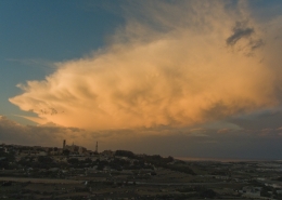 https://maltaclouds.net/wp-content/uploads/2018/09/Cb-mammatus5-1.jpg?v=1569919996
1536
2048
admin
http://maltaclouds.net/wp-content/uploads/2018/10/logo-1-300x138.png
admin2014-10-31 20:03:272018-11-09 20:13:05Cb mammatus
https://maltaclouds.net/wp-content/uploads/2018/09/Cb-mammatus5-1.jpg?v=1569919996
1536
2048
admin
http://maltaclouds.net/wp-content/uploads/2018/10/logo-1-300x138.png
admin2014-10-31 20:03:272018-11-09 20:13:05Cb mammatus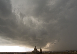 https://maltaclouds.net/wp-content/uploads/2018/09/Isol-TStorm-1.jpg?v=1569919991
1536
2048
admin
http://maltaclouds.net/wp-content/uploads/2018/10/logo-1-300x138.png
admin2014-10-28 20:14:232018-11-09 20:16:52Cb praecipitatio
https://maltaclouds.net/wp-content/uploads/2018/09/Isol-TStorm-1.jpg?v=1569919991
1536
2048
admin
http://maltaclouds.net/wp-content/uploads/2018/10/logo-1-300x138.png
admin2014-10-28 20:14:232018-11-09 20:16:52Cb praecipitatio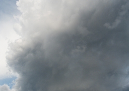 https://maltaclouds.net/wp-content/uploads/2018/09/Cb-arcus2-1.jpg?v=1569920042
2048
1536
admin
http://maltaclouds.net/wp-content/uploads/2018/10/logo-1-300x138.png
admin2014-10-28 16:59:512018-11-10 17:02:14Cb arcus
https://maltaclouds.net/wp-content/uploads/2018/09/Cb-arcus2-1.jpg?v=1569920042
2048
1536
admin
http://maltaclouds.net/wp-content/uploads/2018/10/logo-1-300x138.png
admin2014-10-28 16:59:512018-11-10 17:02:14Cb arcus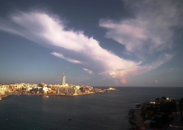 https://maltaclouds.net/wp-content/uploads/2018/09/Cb-incus27-1.jpg?v=1569920010
480
640
admin
http://maltaclouds.net/wp-content/uploads/2018/10/logo-1-300x138.png
admin2014-10-07 17:02:382018-11-10 17:03:54Cb incus
https://maltaclouds.net/wp-content/uploads/2018/09/Cb-incus27-1.jpg?v=1569920010
480
640
admin
http://maltaclouds.net/wp-content/uploads/2018/10/logo-1-300x138.png
admin2014-10-07 17:02:382018-11-10 17:03:54Cb incus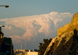 https://maltaclouds.net/wp-content/uploads/2018/09/Cb-incus26-1.jpg?v=1569920011
1319
1956
admin
http://maltaclouds.net/wp-content/uploads/2018/10/logo-1-300x138.png
admin2014-10-06 17:04:092018-11-10 17:06:07Cb incus
https://maltaclouds.net/wp-content/uploads/2018/09/Cb-incus26-1.jpg?v=1569920011
1319
1956
admin
http://maltaclouds.net/wp-content/uploads/2018/10/logo-1-300x138.png
admin2014-10-06 17:04:092018-11-10 17:06:07Cb incus https://maltaclouds.net/wp-content/uploads/2014/10/Cb-arcus1-1.jpg?v=1569919583
3000
4000
admin
http://maltaclouds.net/wp-content/uploads/2018/10/logo-1-300x138.png
admin2014-10-05 17:10:112018-11-10 17:13:46Cb arcus
https://maltaclouds.net/wp-content/uploads/2014/10/Cb-arcus1-1.jpg?v=1569919583
3000
4000
admin
http://maltaclouds.net/wp-content/uploads/2018/10/logo-1-300x138.png
admin2014-10-05 17:10:112018-11-10 17:13:46Cb arcus https://maltaclouds.net/wp-content/uploads/2018/09/Cb-mammatus4-1.jpg?v=1569919997
1536
2048
admin
http://maltaclouds.net/wp-content/uploads/2018/10/logo-1-300x138.png
admin2014-10-05 17:06:282018-11-10 17:09:48Cb mammatus
https://maltaclouds.net/wp-content/uploads/2018/09/Cb-mammatus4-1.jpg?v=1569919997
1536
2048
admin
http://maltaclouds.net/wp-content/uploads/2018/10/logo-1-300x138.png
admin2014-10-05 17:06:282018-11-10 17:09:48Cb mammatus https://maltaclouds.net/wp-content/uploads/2018/09/Cb-incus25-1.jpg?v=1569920011
1944
2592
admin
http://maltaclouds.net/wp-content/uploads/2018/10/logo-1-300x138.png
admin2014-09-25 17:14:102018-11-10 17:19:42Cb incus
https://maltaclouds.net/wp-content/uploads/2018/09/Cb-incus25-1.jpg?v=1569920011
1944
2592
admin
http://maltaclouds.net/wp-content/uploads/2018/10/logo-1-300x138.png
admin2014-09-25 17:14:102018-11-10 17:19:42Cb incus https://maltaclouds.net/wp-content/uploads/2018/09/Cb-calvus14-1.jpg?v=1569920033
1536
2048
admin
http://maltaclouds.net/wp-content/uploads/2018/10/logo-1-300x138.png
admin2014-06-17 17:16:022018-11-10 17:18:55Cb calvus
https://maltaclouds.net/wp-content/uploads/2018/09/Cb-calvus14-1.jpg?v=1569920033
1536
2048
admin
http://maltaclouds.net/wp-content/uploads/2018/10/logo-1-300x138.png
admin2014-06-17 17:16:022018-11-10 17:18:55Cb calvus https://maltaclouds.net/wp-content/uploads/2018/09/Cb-base3-1.jpg?v=1569920040
1536
2048
admin
http://maltaclouds.net/wp-content/uploads/2018/10/logo-1-300x138.png
admin2014-04-18 17:21:202018-11-10 17:23:50Cb cloud base
https://maltaclouds.net/wp-content/uploads/2018/09/Cb-base3-1.jpg?v=1569920040
1536
2048
admin
http://maltaclouds.net/wp-content/uploads/2018/10/logo-1-300x138.png
admin2014-04-18 17:21:202018-11-10 17:23:50Cb cloud base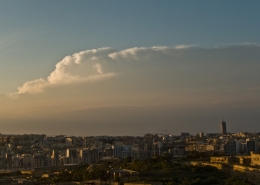 https://maltaclouds.net/wp-content/uploads/2018/09/Cb-Incus24-1.jpg?v=1569920012
1536
2048
admin
http://maltaclouds.net/wp-content/uploads/2018/10/logo-1-300x138.png
admin2014-03-09 17:24:212018-11-10 17:26:00Cb incus
https://maltaclouds.net/wp-content/uploads/2018/09/Cb-Incus24-1.jpg?v=1569920012
1536
2048
admin
http://maltaclouds.net/wp-content/uploads/2018/10/logo-1-300x138.png
admin2014-03-09 17:24:212018-11-10 17:26:00Cb incus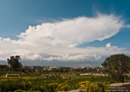 https://maltaclouds.net/wp-content/uploads/2018/09/Cb-Incus23-1.jpg?v=1569920013
1536
2048
admin
http://maltaclouds.net/wp-content/uploads/2018/10/logo-1-300x138.png
admin2014-03-08 17:26:262018-11-10 17:28:02Cb incus
https://maltaclouds.net/wp-content/uploads/2018/09/Cb-Incus23-1.jpg?v=1569920013
1536
2048
admin
http://maltaclouds.net/wp-content/uploads/2018/10/logo-1-300x138.png
admin2014-03-08 17:26:262018-11-10 17:28:02Cb incus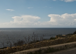 https://maltaclouds.net/wp-content/uploads/2018/09/Cb-Incus21-1.jpg?v=1569920014
919
2048
admin
http://maltaclouds.net/wp-content/uploads/2018/10/logo-1-300x138.png
admin2014-01-28 17:28:182018-11-10 17:42:42Cb incus
https://maltaclouds.net/wp-content/uploads/2018/09/Cb-Incus21-1.jpg?v=1569920014
919
2048
admin
http://maltaclouds.net/wp-content/uploads/2018/10/logo-1-300x138.png
admin2014-01-28 17:28:182018-11-10 17:42:42Cb incus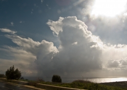 https://maltaclouds.net/wp-content/uploads/2018/09/Cb-Incus19-1.jpg?v=1569920015
1536
2048
admin
http://maltaclouds.net/wp-content/uploads/2018/10/logo-1-300x138.png
admin2014-01-25 17:47:142018-11-10 17:49:03Cb incus
https://maltaclouds.net/wp-content/uploads/2018/09/Cb-Incus19-1.jpg?v=1569920015
1536
2048
admin
http://maltaclouds.net/wp-content/uploads/2018/10/logo-1-300x138.png
admin2014-01-25 17:47:142018-11-10 17:49:03Cb incus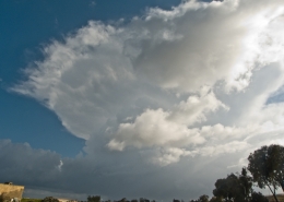 https://maltaclouds.net/wp-content/uploads/2018/09/Cb-Incus20-1.jpg?v=1569920014
1536
2048
admin
http://maltaclouds.net/wp-content/uploads/2018/10/logo-1-300x138.png
admin2014-01-25 17:44:182018-11-10 17:46:37Cb incus
https://maltaclouds.net/wp-content/uploads/2018/09/Cb-Incus20-1.jpg?v=1569920014
1536
2048
admin
http://maltaclouds.net/wp-content/uploads/2018/10/logo-1-300x138.png
admin2014-01-25 17:44:182018-11-10 17:46:37Cb incus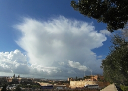 https://maltaclouds.net/wp-content/uploads/2018/09/Cb-incus18-1.jpg?v=1569920016
3240
4320
admin
http://maltaclouds.net/wp-content/uploads/2018/10/logo-1-300x138.png
admin2014-01-06 17:49:152018-11-10 17:51:24Cb incus
https://maltaclouds.net/wp-content/uploads/2018/09/Cb-incus18-1.jpg?v=1569920016
3240
4320
admin
http://maltaclouds.net/wp-content/uploads/2018/10/logo-1-300x138.png
admin2014-01-06 17:49:152018-11-10 17:51:24Cb incus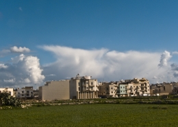 https://maltaclouds.net/wp-content/uploads/2018/09/Cb-Incus17-1.jpg?v=1569920017
1536
2048
admin
http://maltaclouds.net/wp-content/uploads/2018/10/logo-1-300x138.png
admin2013-12-31 17:52:472018-11-10 17:54:34Cb incus
https://maltaclouds.net/wp-content/uploads/2018/09/Cb-Incus17-1.jpg?v=1569920017
1536
2048
admin
http://maltaclouds.net/wp-content/uploads/2018/10/logo-1-300x138.png
admin2013-12-31 17:52:472018-11-10 17:54:34Cb incus https://maltaclouds.net/wp-content/uploads/2018/09/Cb-incus16-1.jpg?v=1569920017
1536
2048
admin
http://maltaclouds.net/wp-content/uploads/2018/10/logo-1-300x138.png
admin2013-12-21 17:54:482018-11-10 17:56:23Cb incus
https://maltaclouds.net/wp-content/uploads/2018/09/Cb-incus16-1.jpg?v=1569920017
1536
2048
admin
http://maltaclouds.net/wp-content/uploads/2018/10/logo-1-300x138.png
admin2013-11-25 17:56:372018-11-10 17:57:54Cb incus
https://maltaclouds.net/wp-content/uploads/2018/09/Cb-incus16-1.jpg?v=1569920017
1536
2048
admin
http://maltaclouds.net/wp-content/uploads/2018/10/logo-1-300x138.png
admin2013-12-21 17:54:482018-11-10 17:56:23Cb incus
https://maltaclouds.net/wp-content/uploads/2018/09/Cb-incus16-1.jpg?v=1569920017
1536
2048
admin
http://maltaclouds.net/wp-content/uploads/2018/10/logo-1-300x138.png
admin2013-11-25 17:56:372018-11-10 17:57:54Cb incus https://maltaclouds.net/wp-content/uploads/2018/09/Cb-Incus14-1.jpg?v=1569920019
3240
4320
admin
http://maltaclouds.net/wp-content/uploads/2018/10/logo-1-300x138.png
admin2013-11-15 17:58:082018-11-10 18:14:43Cb incus
https://maltaclouds.net/wp-content/uploads/2018/09/Cb-Incus14-1.jpg?v=1569920019
3240
4320
admin
http://maltaclouds.net/wp-content/uploads/2018/10/logo-1-300x138.png
admin2013-11-15 17:58:082018-11-10 18:14:43Cb incus https://maltaclouds.net/wp-content/uploads/2018/09/Cb-calvus13-1.jpg?v=1569920034
3240
4320
admin
http://maltaclouds.net/wp-content/uploads/2018/10/logo-1-300x138.png
admin2013-11-13 18:15:112018-11-10 18:29:46Cb calvus
https://maltaclouds.net/wp-content/uploads/2018/09/Cb-calvus13-1.jpg?v=1569920034
3240
4320
admin
http://maltaclouds.net/wp-content/uploads/2018/10/logo-1-300x138.png
admin2013-11-13 18:15:112018-11-10 18:29:46Cb calvus https://maltaclouds.net/wp-content/uploads/2018/09/Cb-calvus12-1.jpg?v=1569920035
3240
4320
admin
http://maltaclouds.net/wp-content/uploads/2018/10/logo-1-300x138.png
admin2013-11-12 18:30:252018-11-10 18:32:06Cb calvus
https://maltaclouds.net/wp-content/uploads/2018/09/Cb-calvus12-1.jpg?v=1569920035
3240
4320
admin
http://maltaclouds.net/wp-content/uploads/2018/10/logo-1-300x138.png
admin2013-11-12 18:30:252018-11-10 18:32:06Cb calvus https://maltaclouds.net/wp-content/uploads/2018/09/Cb-mammatus3-1.jpg?v=1569919998
1536
2048
admin
http://maltaclouds.net/wp-content/uploads/2018/10/logo-1-300x138.png
admin2013-11-02 18:32:232018-11-10 18:35:56Cb mammatus
https://maltaclouds.net/wp-content/uploads/2018/09/Cb-mammatus3-1.jpg?v=1569919998
1536
2048
admin
http://maltaclouds.net/wp-content/uploads/2018/10/logo-1-300x138.png
admin2013-11-02 18:32:232018-11-10 18:35:56Cb mammatus https://maltaclouds.net/wp-content/uploads/2018/09/Cb-calvus10-1.jpg?v=1569920037
1536
2048
admin
http://maltaclouds.net/wp-content/uploads/2018/10/logo-1-300x138.png
admin2013-11-01 18:43:252018-11-10 18:48:02Cb calvus
https://maltaclouds.net/wp-content/uploads/2018/09/Cb-calvus10-1.jpg?v=1569920037
1536
2048
admin
http://maltaclouds.net/wp-content/uploads/2018/10/logo-1-300x138.png
admin2013-11-01 18:43:252018-11-10 18:48:02Cb calvus https://maltaclouds.net/wp-content/uploads/2018/09/Cb-mammatus2-1.jpg?v=1569919999
1536
2048
admin
http://maltaclouds.net/wp-content/uploads/2018/10/logo-1-300x138.png
admin2013-11-01 18:36:382018-11-10 18:42:00Cb mammatus
https://maltaclouds.net/wp-content/uploads/2018/09/Cb-mammatus2-1.jpg?v=1569919999
1536
2048
admin
http://maltaclouds.net/wp-content/uploads/2018/10/logo-1-300x138.png
admin2013-11-01 18:36:382018-11-10 18:42:00Cb mammatus https://maltaclouds.net/wp-content/uploads/2018/09/Cb-calvus11-1.jpg?v=1569920036
3240
4320
admin
http://maltaclouds.net/wp-content/uploads/2018/10/logo-1-300x138.png
admin2013-10-31 18:53:062018-11-10 18:56:39Cb calvus
https://maltaclouds.net/wp-content/uploads/2018/09/Cb-calvus11-1.jpg?v=1569920036
3240
4320
admin
http://maltaclouds.net/wp-content/uploads/2018/10/logo-1-300x138.png
admin2013-10-31 18:53:062018-11-10 18:56:39Cb calvus https://maltaclouds.net/wp-content/uploads/2018/09/Cb-mammatus1-1.jpg?v=1569920000
1536
2048
admin
http://maltaclouds.net/wp-content/uploads/2018/10/logo-1-300x138.png
admin2013-09-22 18:58:322018-11-11 16:11:28Cb mammatus
https://maltaclouds.net/wp-content/uploads/2018/09/Cb-mammatus1-1.jpg?v=1569920000
1536
2048
admin
http://maltaclouds.net/wp-content/uploads/2018/10/logo-1-300x138.png
admin2013-09-22 18:58:322018-11-11 16:11:28Cb mammatus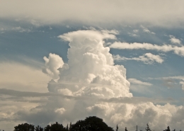 https://maltaclouds.net/wp-content/uploads/2018/09/Cb-pileus-1.jpg?v=1569919992
1536
2048
admin
http://maltaclouds.net/wp-content/uploads/2018/10/logo-1-300x138.png
admin2013-09-22 15:57:462018-11-11 16:07:46Cb pileus
https://maltaclouds.net/wp-content/uploads/2018/09/Cb-pileus-1.jpg?v=1569919992
1536
2048
admin
http://maltaclouds.net/wp-content/uploads/2018/10/logo-1-300x138.png
admin2013-09-22 15:57:462018-11-11 16:07:46Cb pileus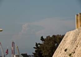 https://maltaclouds.net/wp-content/uploads/2018/09/Cb-incus12-1.jpg?v=1569920020
1536
2048
admin
http://maltaclouds.net/wp-content/uploads/2018/10/logo-1-300x138.png
admin2013-07-08 16:28:122018-11-11 16:30:10Cb incus
https://maltaclouds.net/wp-content/uploads/2018/09/Cb-incus12-1.jpg?v=1569920020
1536
2048
admin
http://maltaclouds.net/wp-content/uploads/2018/10/logo-1-300x138.png
admin2013-07-08 16:28:122018-11-11 16:30:10Cb incus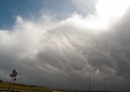 https://maltaclouds.net/wp-content/uploads/2018/09/Cb-mammatus.jpg?v=1569920457
1536
2048
admin
http://maltaclouds.net/wp-content/uploads/2018/10/logo-1-300x138.png
admin2013-03-15 16:30:462018-11-11 16:37:24Cb mammatus
https://maltaclouds.net/wp-content/uploads/2018/09/Cb-mammatus.jpg?v=1569920457
1536
2048
admin
http://maltaclouds.net/wp-content/uploads/2018/10/logo-1-300x138.png
admin2013-03-15 16:30:462018-11-11 16:37:24Cb mammatus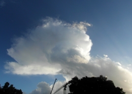 https://maltaclouds.net/wp-content/uploads/2018/09/Cb-capillatus6-1.jpg?v=1569920027
2448
3264
admin
http://maltaclouds.net/wp-content/uploads/2018/10/logo-1-300x138.png
admin2013-02-13 16:39:332018-11-11 16:41:18Cb capillatus
https://maltaclouds.net/wp-content/uploads/2018/09/Cb-capillatus6-1.jpg?v=1569920027
2448
3264
admin
http://maltaclouds.net/wp-content/uploads/2018/10/logo-1-300x138.png
admin2013-02-13 16:39:332018-11-11 16:41:18Cb capillatus https://maltaclouds.net/wp-content/uploads/2018/09/Cb-incus11-1.jpg?v=1569920021
2448
3264
admin
http://maltaclouds.net/wp-content/uploads/2018/10/logo-1-300x138.png
admin2013-02-10 16:42:162018-11-11 16:43:48Cb incus
https://maltaclouds.net/wp-content/uploads/2018/09/Cb-incus11-1.jpg?v=1569920021
2448
3264
admin
http://maltaclouds.net/wp-content/uploads/2018/10/logo-1-300x138.png
admin2013-02-10 16:42:162018-11-11 16:43:48Cb incus https://maltaclouds.net/wp-content/uploads/2018/09/Cb-incus10-1.jpg?v=1569920022
1536
2048
admin
http://maltaclouds.net/wp-content/uploads/2018/10/logo-1-300x138.png
admin2013-01-26 16:44:102018-11-11 16:45:42Cb incus
https://maltaclouds.net/wp-content/uploads/2018/09/Cb-incus10-1.jpg?v=1569920022
1536
2048
admin
http://maltaclouds.net/wp-content/uploads/2018/10/logo-1-300x138.png
admin2013-01-26 16:44:102018-11-11 16:45:42Cb incus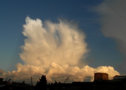 https://maltaclouds.net/wp-content/uploads/2018/09/Cb-capillatus5-1.jpg?v=1569920027
1944
2592
admin
http://maltaclouds.net/wp-content/uploads/2018/10/logo-1-300x138.png
admin2012-11-20 16:46:092019-10-02 17:53:43Cb capillatus
https://maltaclouds.net/wp-content/uploads/2018/09/Cb-capillatus5-1.jpg?v=1569920027
1944
2592
admin
http://maltaclouds.net/wp-content/uploads/2018/10/logo-1-300x138.png
admin2012-11-20 16:46:092019-10-02 17:53:43Cb capillatus https://maltaclouds.net/wp-content/uploads/2018/09/Cb-arcus.jpg?v=1569920570
1944
2592
admin
http://maltaclouds.net/wp-content/uploads/2018/10/logo-1-300x138.png
admin2012-11-19 16:49:262019-05-07 16:14:10Cb arcus
https://maltaclouds.net/wp-content/uploads/2018/09/Cb-arcus.jpg?v=1569920570
1944
2592
admin
http://maltaclouds.net/wp-content/uploads/2018/10/logo-1-300x138.png
admin2012-11-19 16:49:262019-05-07 16:14:10Cb arcus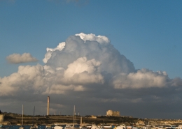 https://maltaclouds.net/wp-content/uploads/2018/09/Cb-capillatus4-1.jpg?v=1569920028
1536
2048
admin
http://maltaclouds.net/wp-content/uploads/2018/10/logo-1-300x138.png
admin2012-05-23 16:52:112018-11-11 16:54:09Cb capillatus
https://maltaclouds.net/wp-content/uploads/2018/09/Cb-capillatus4-1.jpg?v=1569920028
1536
2048
admin
http://maltaclouds.net/wp-content/uploads/2018/10/logo-1-300x138.png
admin2012-05-23 16:52:112018-11-11 16:54:09Cb capillatus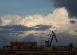 https://maltaclouds.net/wp-content/uploads/2018/09/Cb-incus9-1.jpg?v=1569920023
1134
2048
admin
http://maltaclouds.net/wp-content/uploads/2018/10/logo-1-300x138.png
admin2012-04-17 16:54:442018-11-11 16:56:01Cb incus
https://maltaclouds.net/wp-content/uploads/2018/09/Cb-incus9-1.jpg?v=1569920023
1134
2048
admin
http://maltaclouds.net/wp-content/uploads/2018/10/logo-1-300x138.png
admin2012-04-17 16:54:442018-11-11 16:56:01Cb incus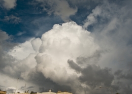 https://maltaclouds.net/wp-content/uploads/2018/09/Cb-calvus9-1.jpg?v=1569920038
1536
2048
admin
http://maltaclouds.net/wp-content/uploads/2018/10/logo-1-300x138.png
admin2011-12-29 16:56:222018-11-11 16:57:47Cb calvus
https://maltaclouds.net/wp-content/uploads/2018/09/Cb-calvus9-1.jpg?v=1569920038
1536
2048
admin
http://maltaclouds.net/wp-content/uploads/2018/10/logo-1-300x138.png
admin2011-12-29 16:56:222018-11-11 16:57:47Cb calvus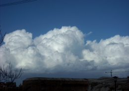 https://maltaclouds.net/wp-content/uploads/2018/09/Cb-calvus8-1.jpg?v=1569920039
1536
2048
admin
http://maltaclouds.net/wp-content/uploads/2018/10/logo-1-300x138.png
admin2011-12-19 16:58:062018-11-11 16:59:43Cb calvus
https://maltaclouds.net/wp-content/uploads/2018/09/Cb-calvus8-1.jpg?v=1569920039
1536
2048
admin
http://maltaclouds.net/wp-content/uploads/2018/10/logo-1-300x138.png
admin2011-12-19 16:58:062018-11-11 16:59:43Cb calvus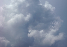 https://maltaclouds.net/wp-content/uploads/2018/09/Cb-calvus7-1.jpg?v=1569920040
2048
1536
admin
http://maltaclouds.net/wp-content/uploads/2018/10/logo-1-300x138.png
admin2011-10-06 16:59:562018-11-11 17:01:14Cb calvus
https://maltaclouds.net/wp-content/uploads/2018/09/Cb-calvus7-1.jpg?v=1569920040
2048
1536
admin
http://maltaclouds.net/wp-content/uploads/2018/10/logo-1-300x138.png
admin2011-10-06 16:59:562018-11-11 17:01:14Cb calvus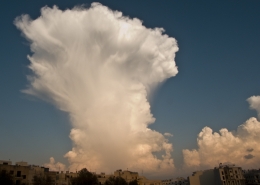 https://maltaclouds.net/wp-content/uploads/2018/09/Cb-capillatus3.jpg?v=1569920546
1404
1748
admin
http://maltaclouds.net/wp-content/uploads/2018/10/logo-1-300x138.png
admin2011-10-03 17:30:222018-11-11 14:32:40Cb capillatus
https://maltaclouds.net/wp-content/uploads/2018/09/Cb-capillatus3.jpg?v=1569920546
1404
1748
admin
http://maltaclouds.net/wp-content/uploads/2018/10/logo-1-300x138.png
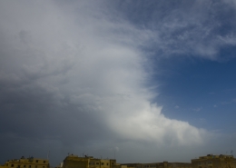
admin2011-10-03 17:30:222018-11-11 14:32:40Cb capillatusCb capillatus
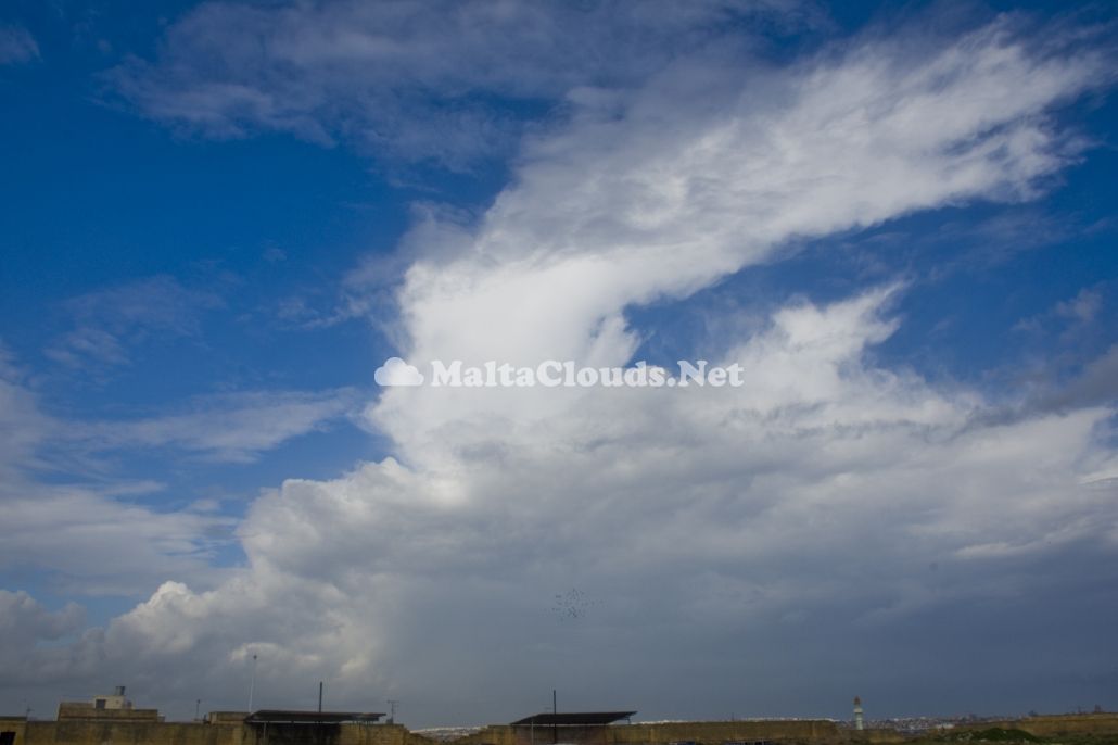
Cumulonimbus cloud formation of the species capillatus due to its fibrous structure with a clear anvil shearing off to the east upon reaching the stable layer estimated at 9km above sea level. Some left over cirrus spissatus from other Cbs could be seen on the left hand side of the photo hence the suffix ‘cumulonibogenitus’. This cloud had later produced rain showers but no thunderstorms. The first thumbnail is another photo taken at sunset showing cumuliform cloud bubbles piercing out from stratocumulus clouds in the background as ‘Thermals’ manage to break through a stable layer in the atmosphere. The second thumbnail is a wide panoramic shot of sunset taken at the same time as the first showing the whole cloud on the horizon. These clouds as confirmed by both the visible satellite and surface pressure images on the fourth and fifth thumbnails respectively were all associated with a low pressure system to the north of Libya churning out isolated cumulonimbus clouds towards the Maltese Islands. The weather sounding on the third thumbnail indicated a modestly unstable airmass with a rather steep lapse and ENE currents throughout the whole atmosphere aiding in the photographed cloud formations.


Leave a Reply
Want to join the discussion?Feel free to contribute!